Oddities in Reull Vallis on Mars

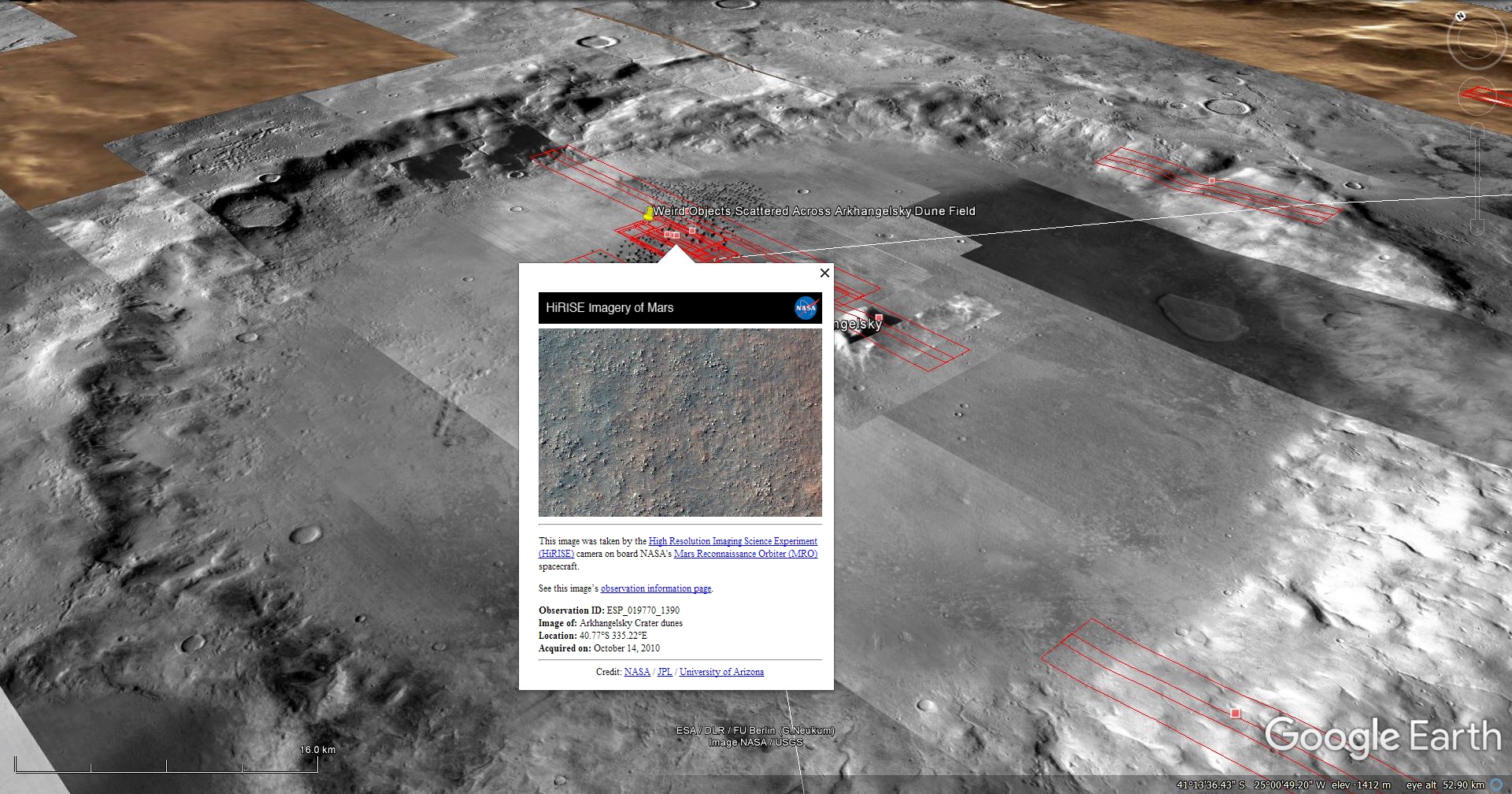
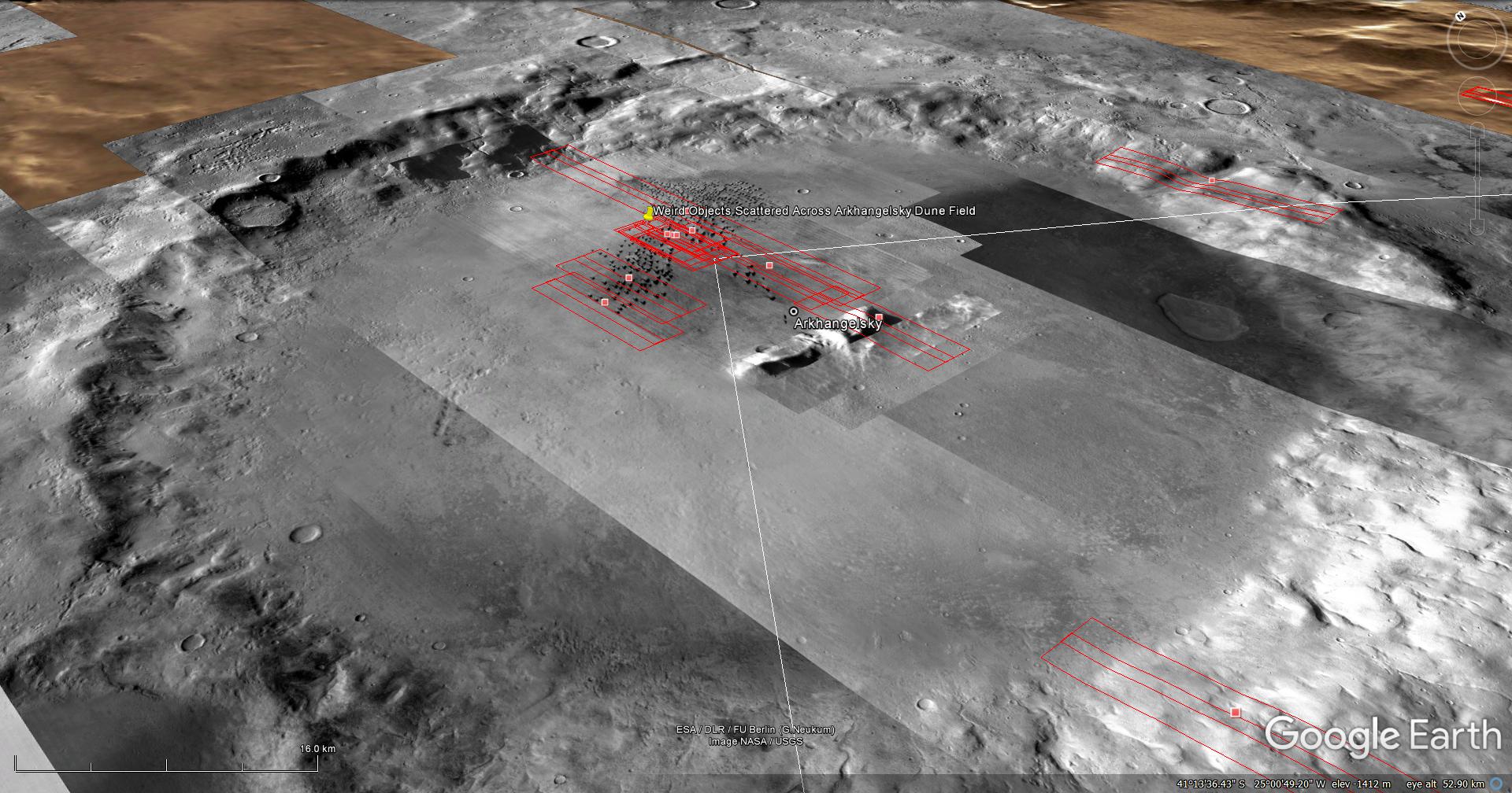
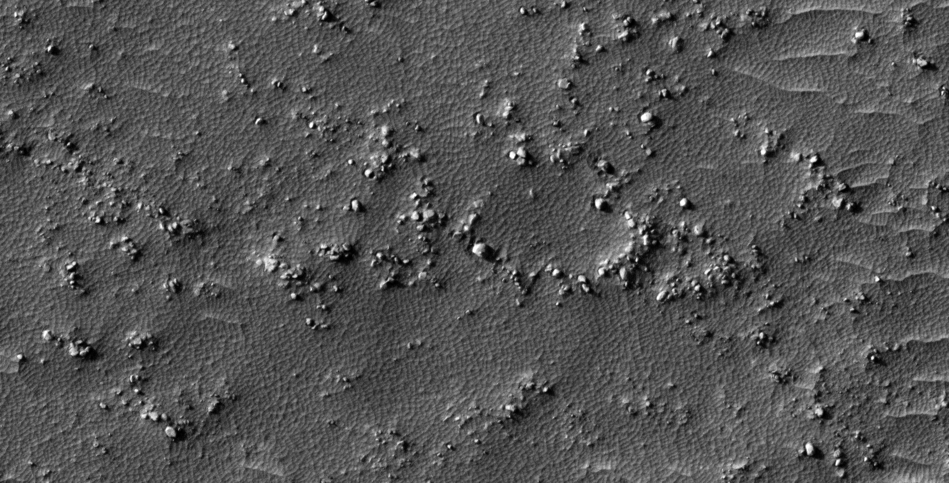
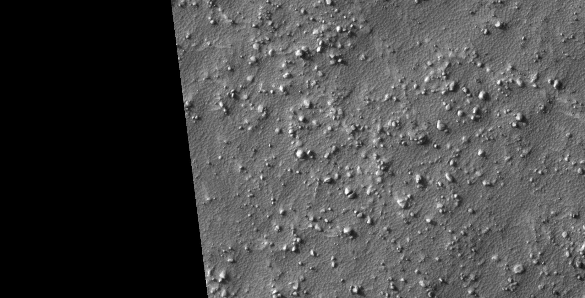
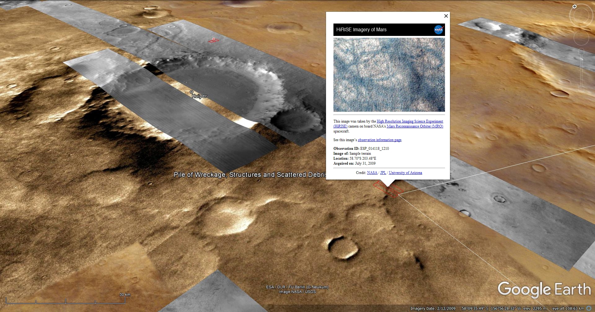
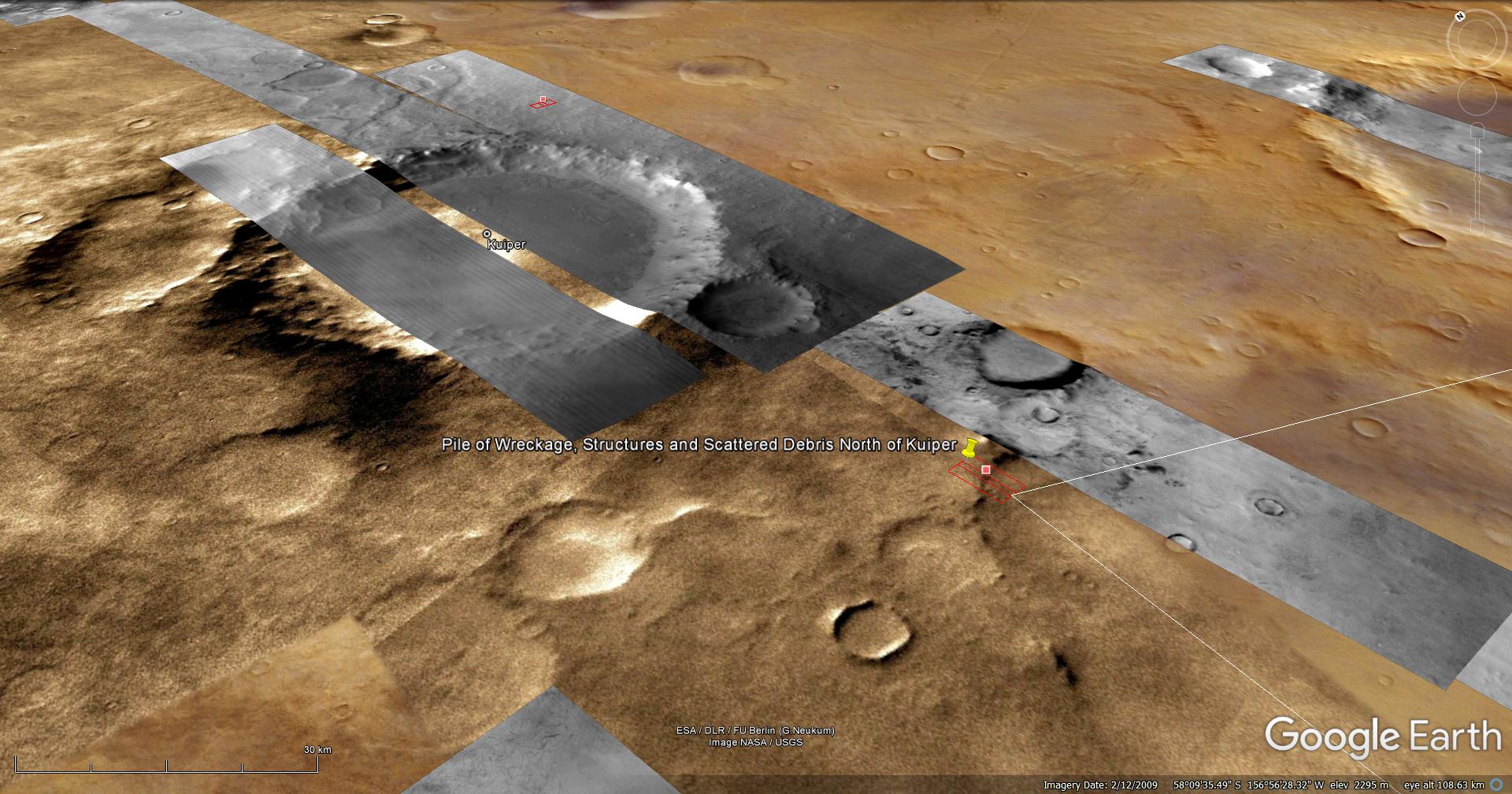
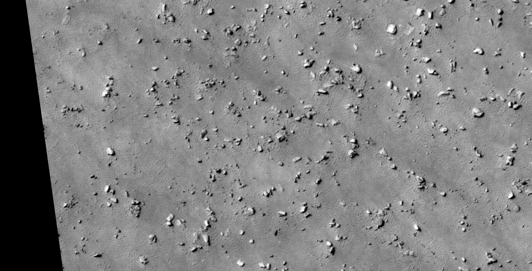
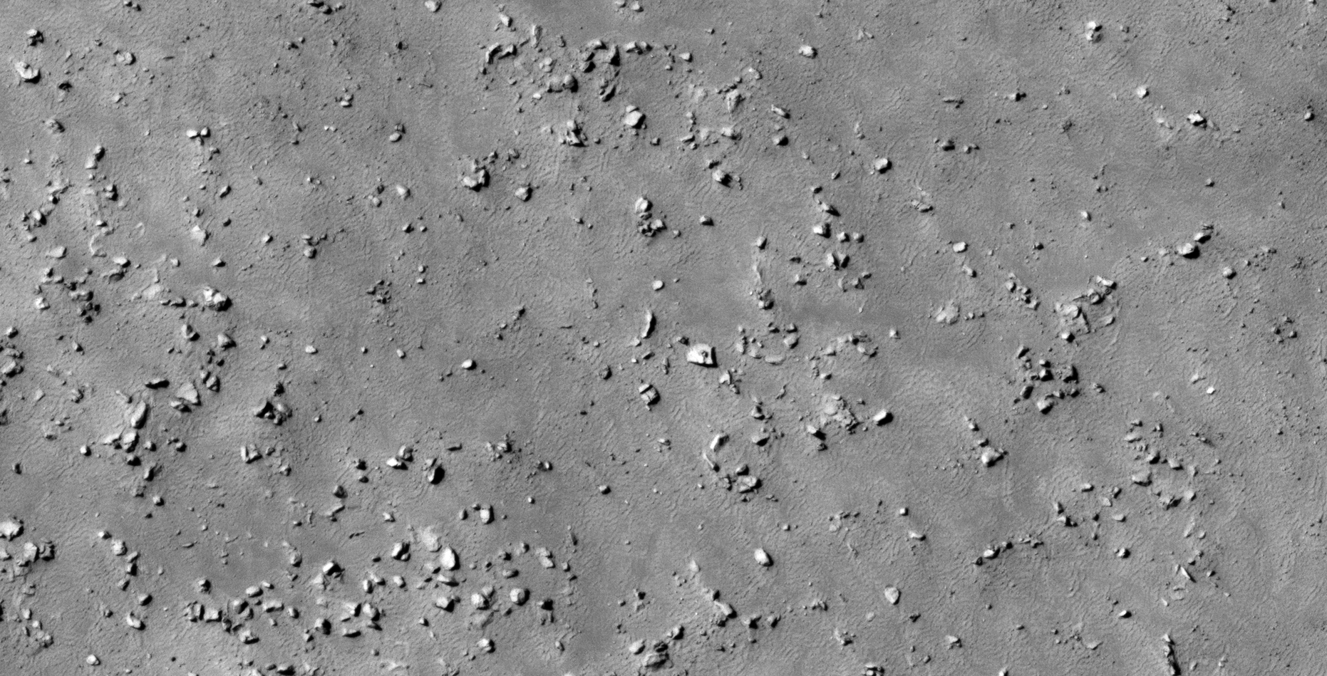
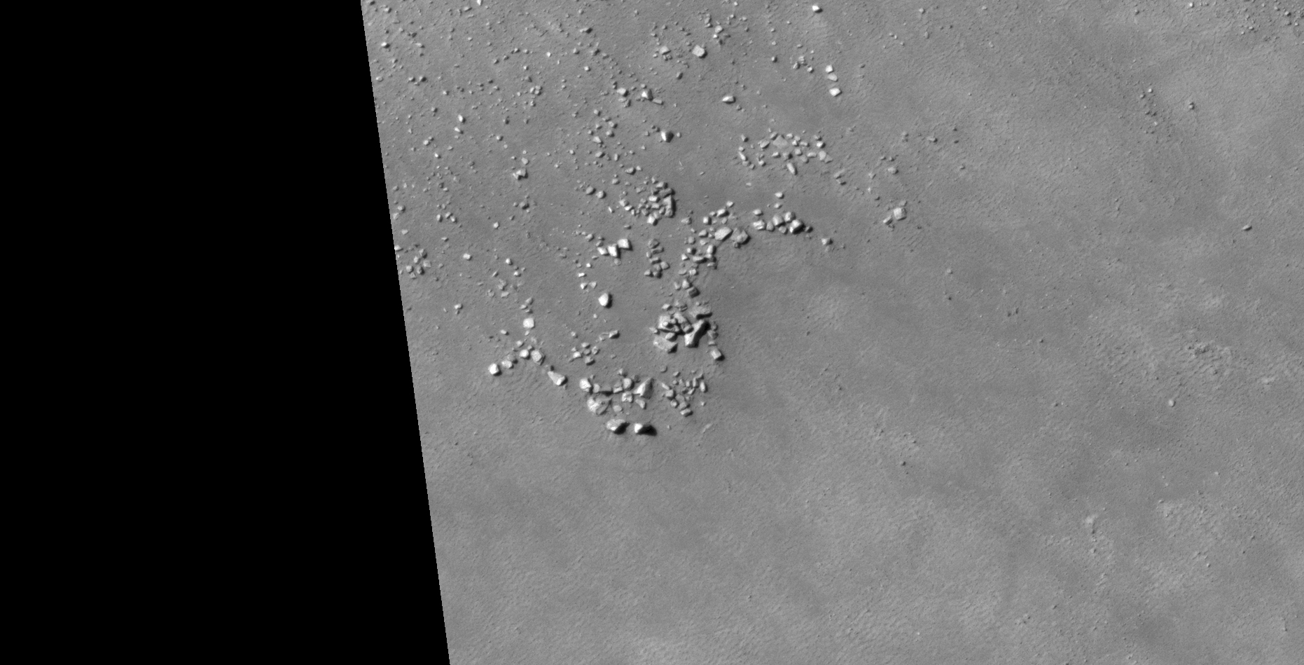
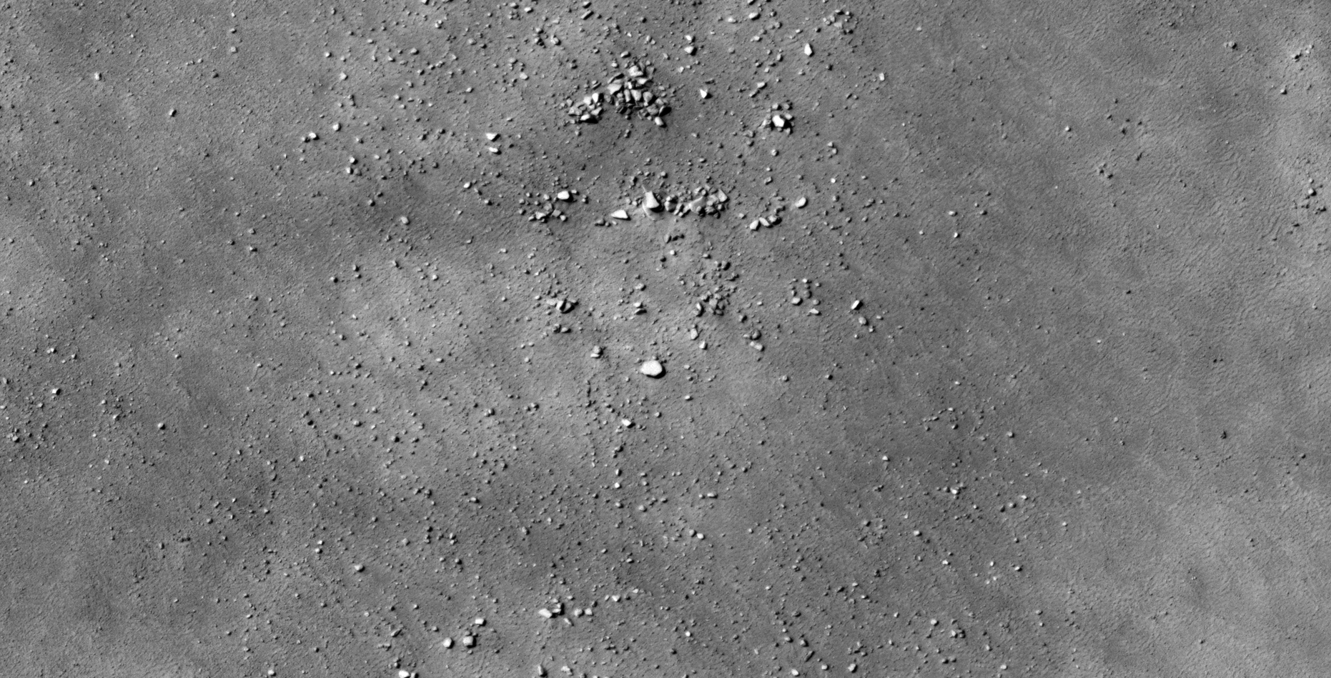
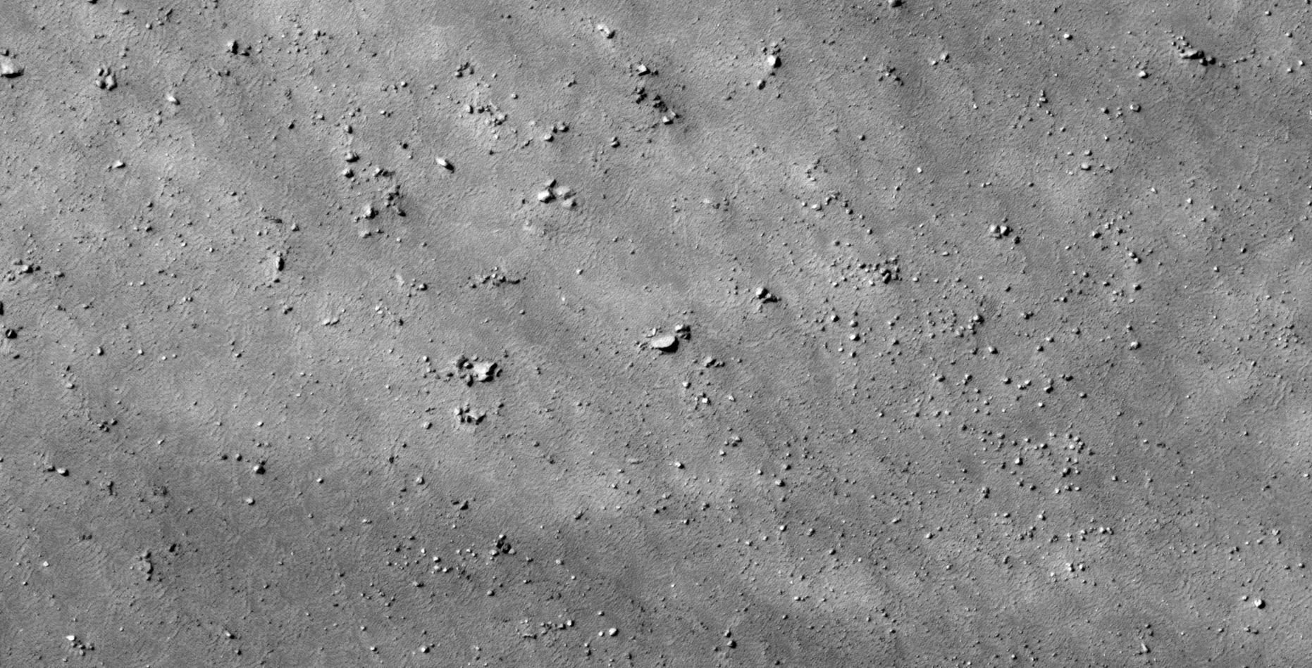
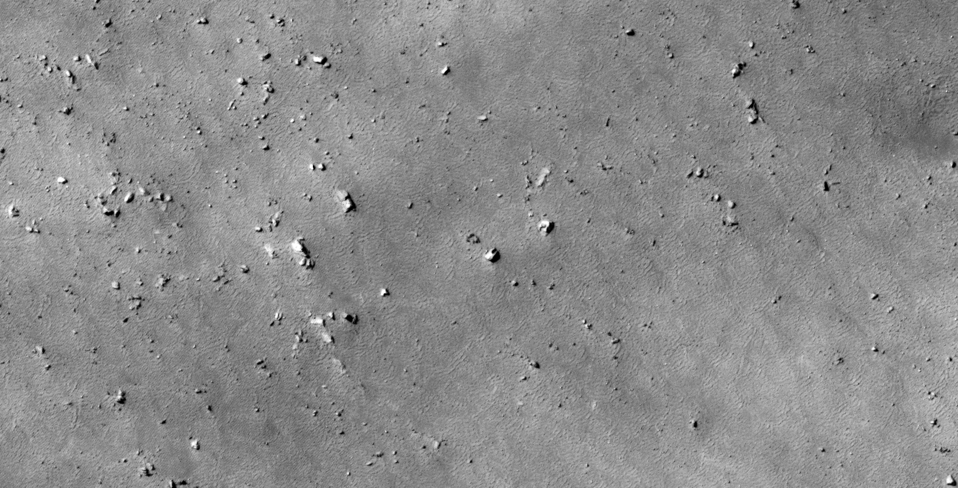
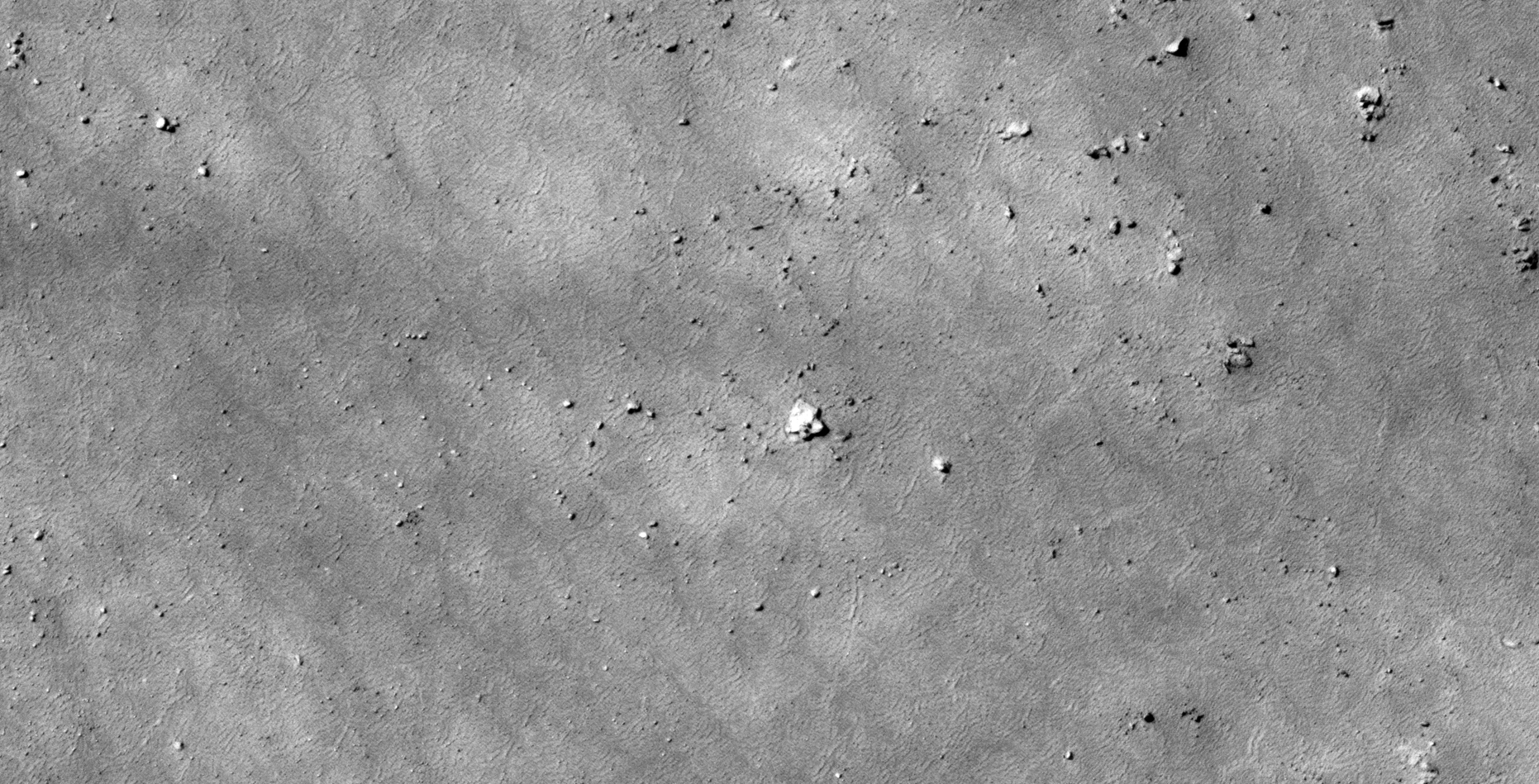
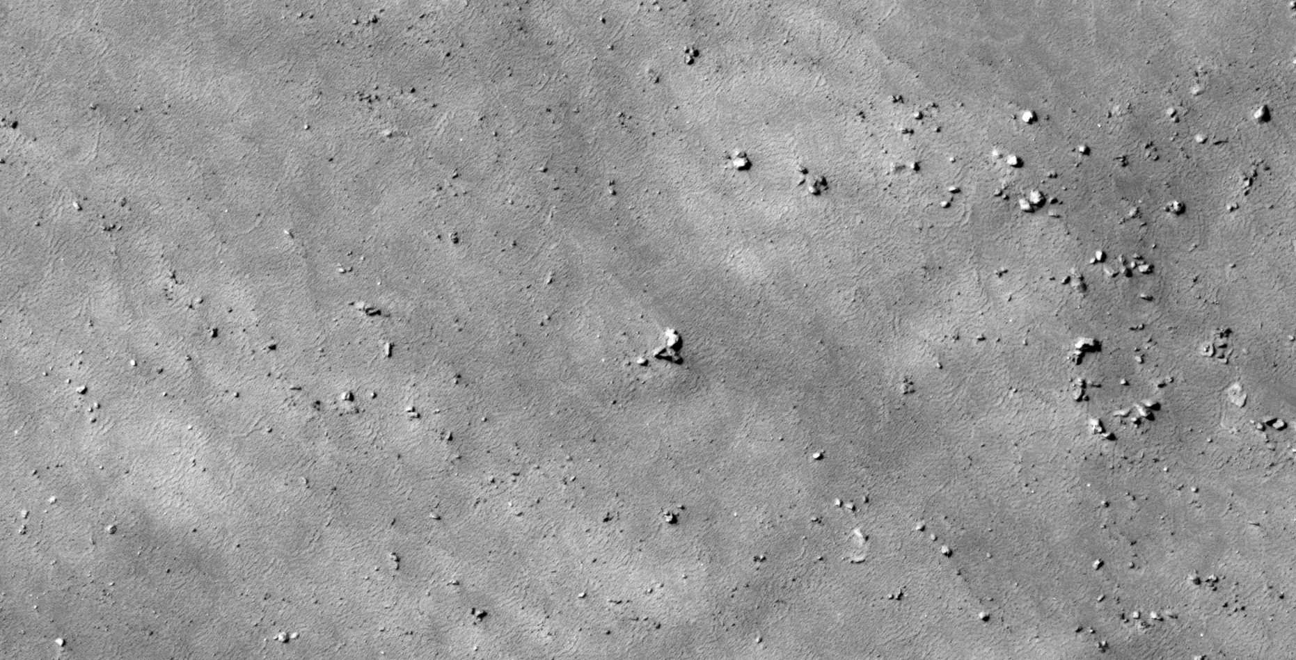
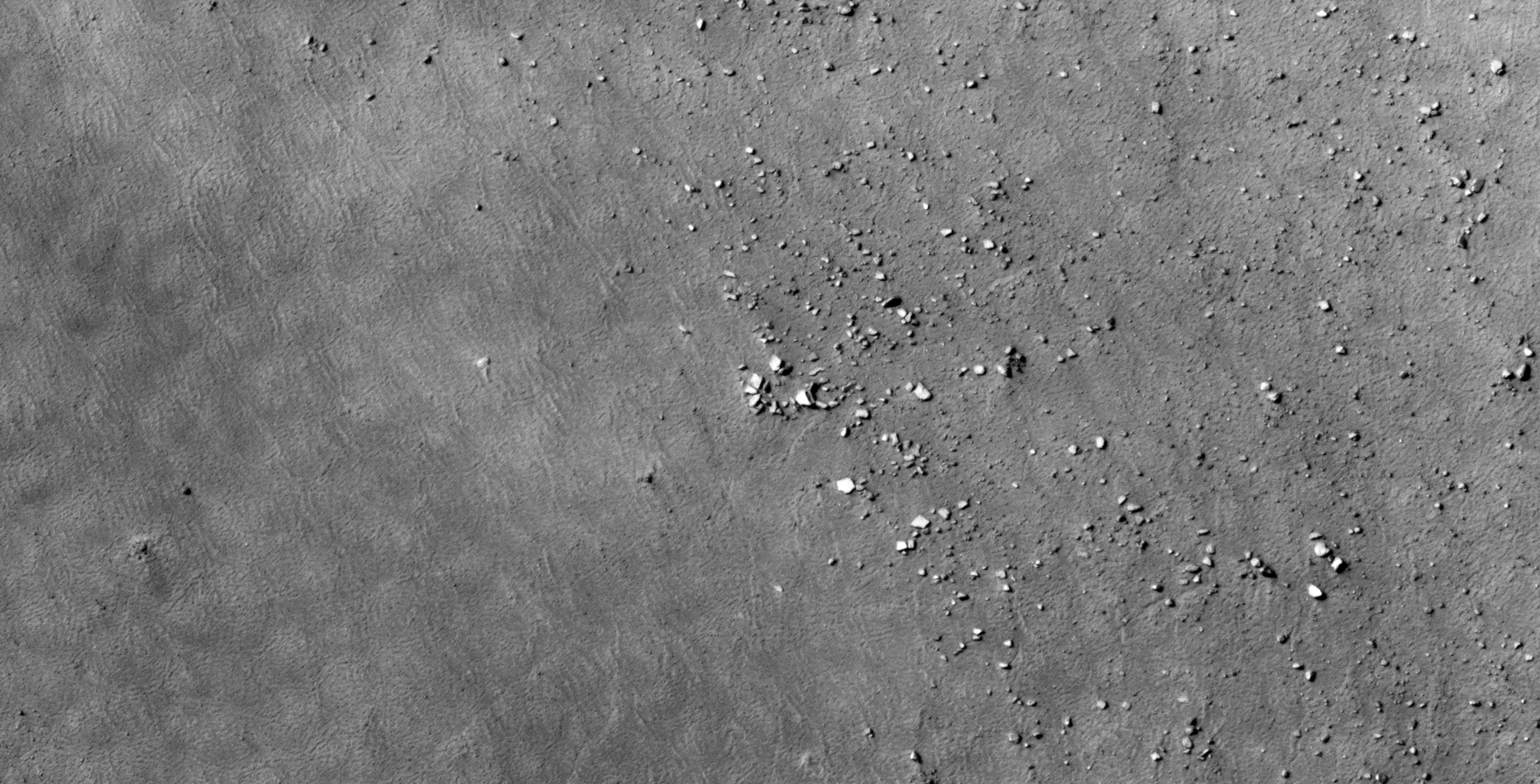
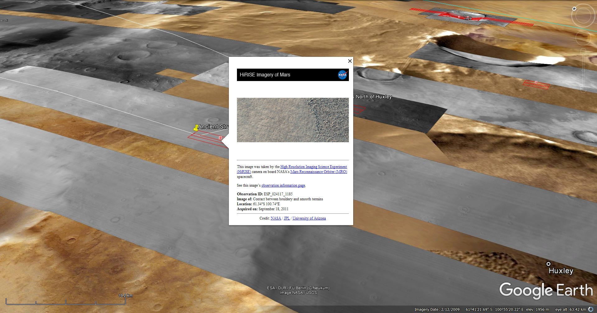
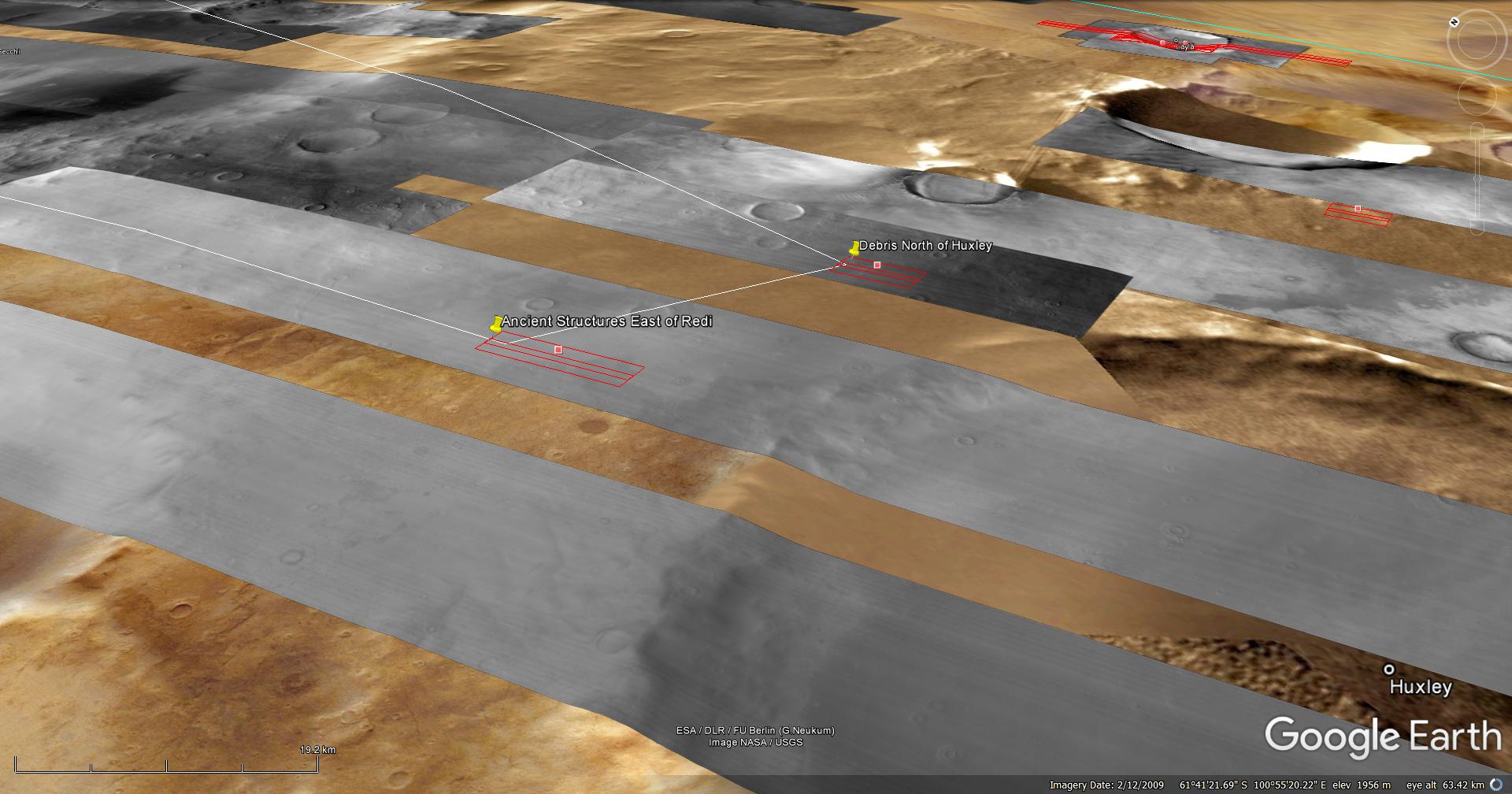
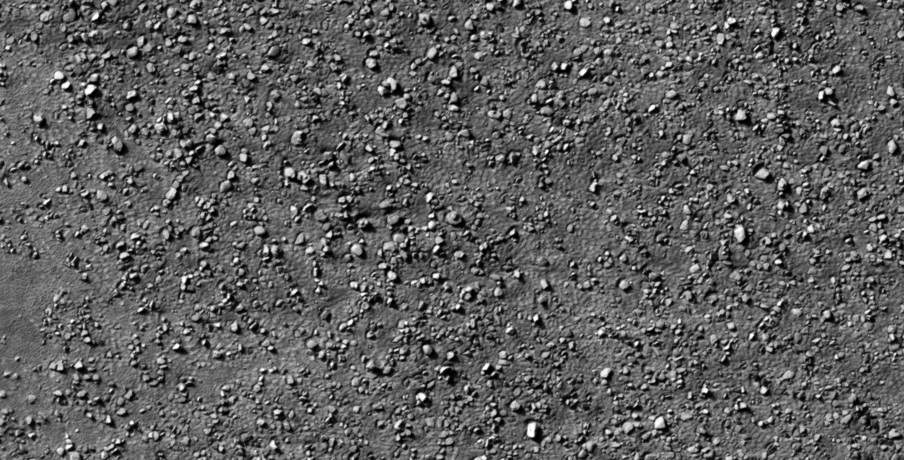
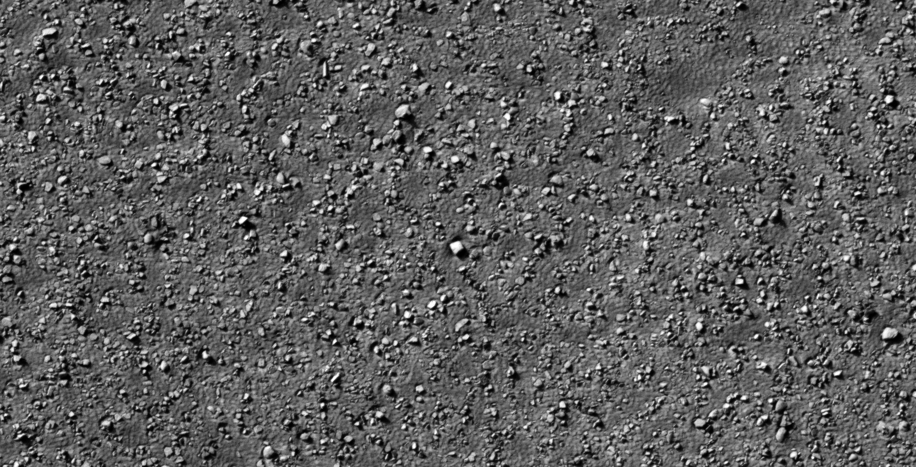
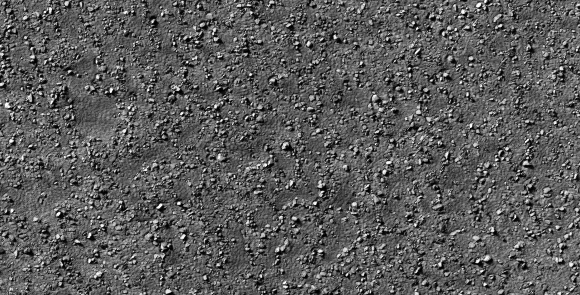
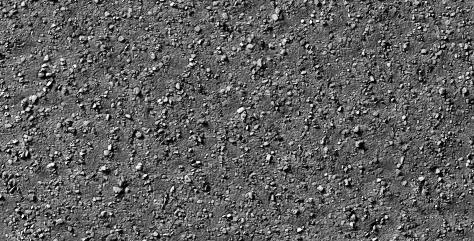
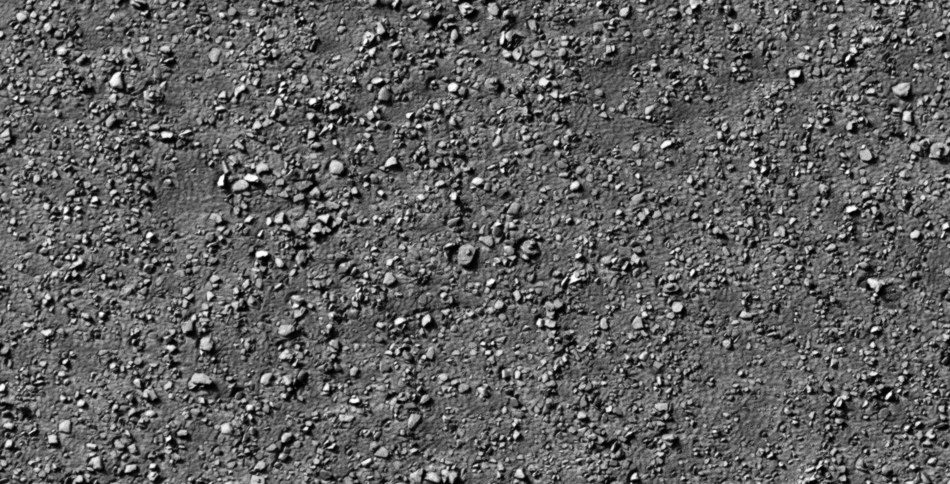
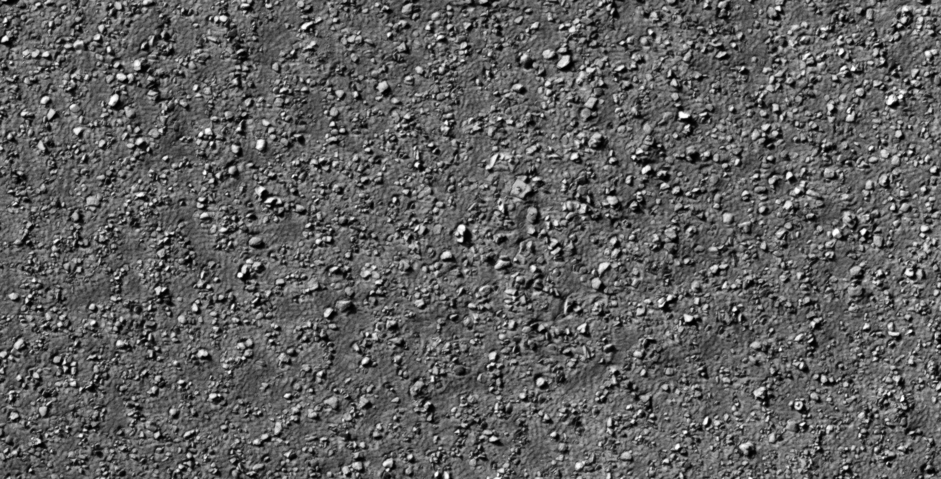
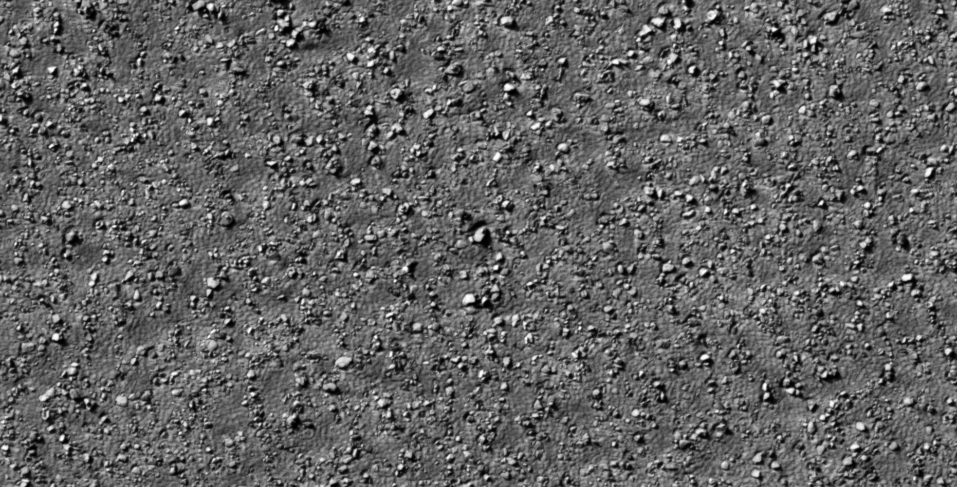
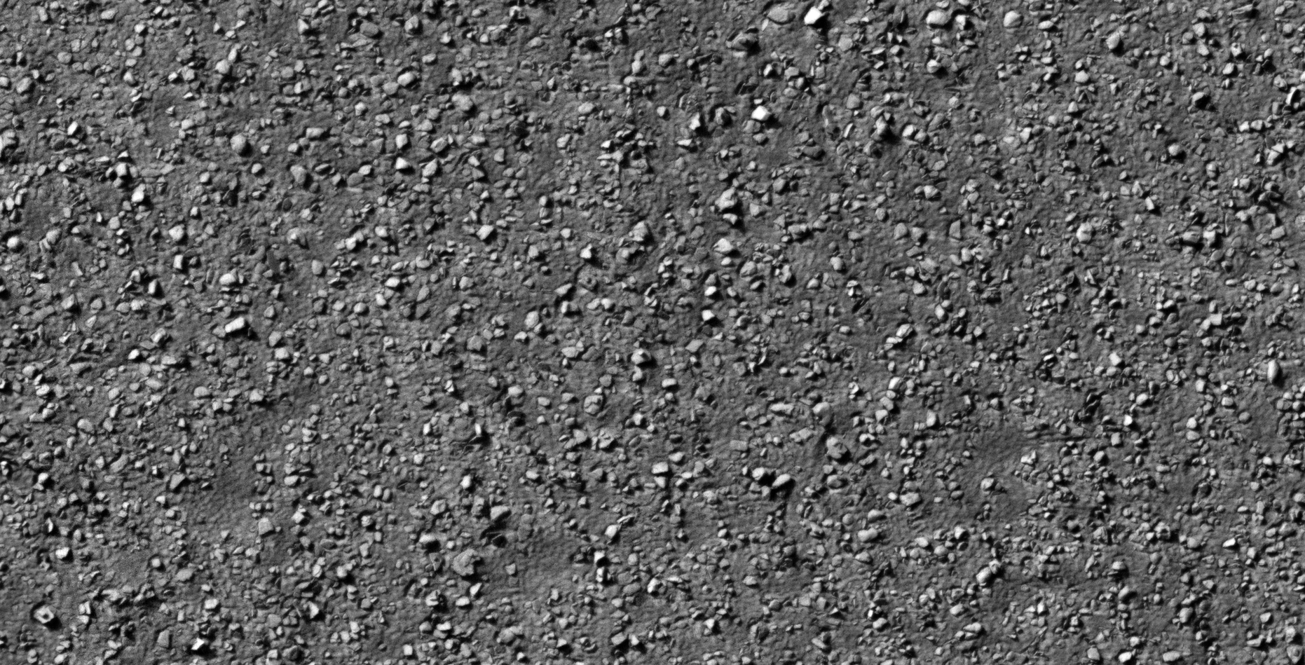
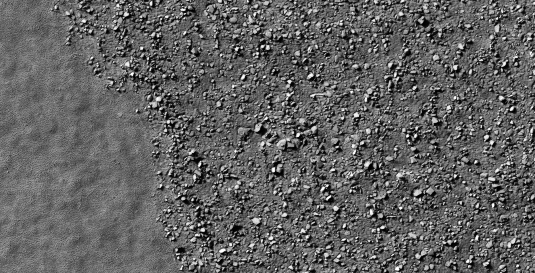
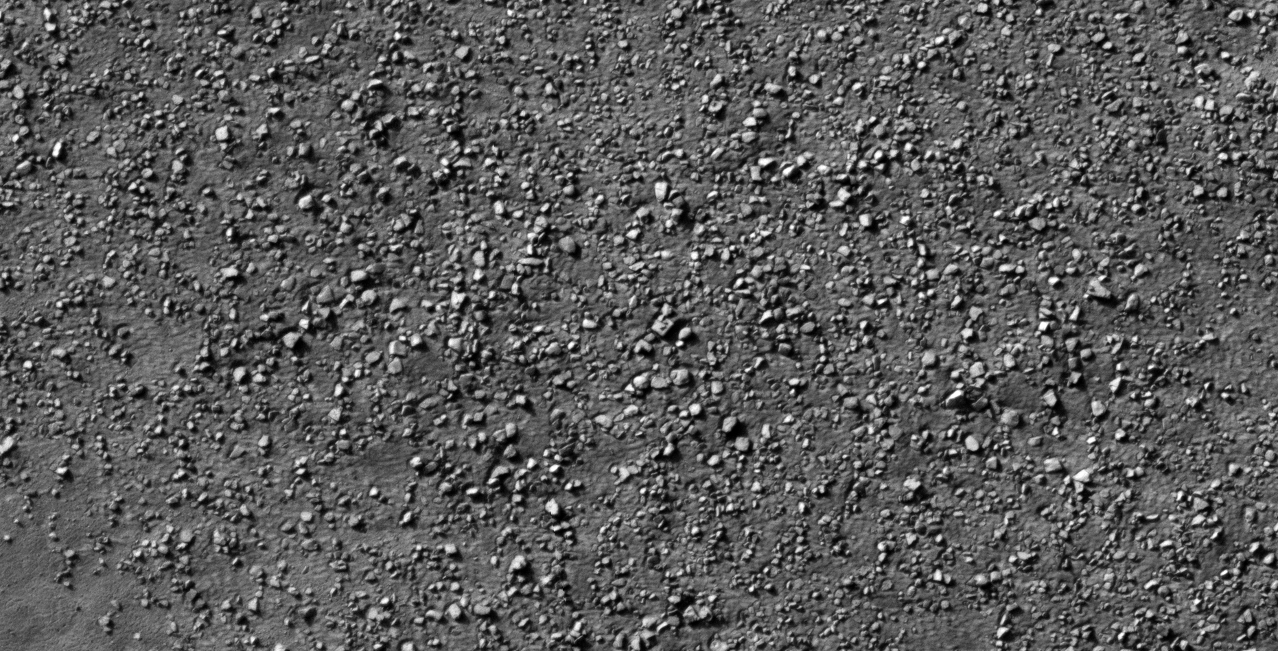
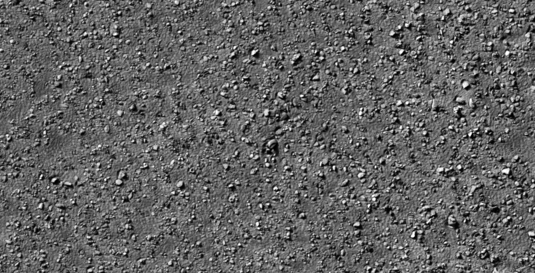
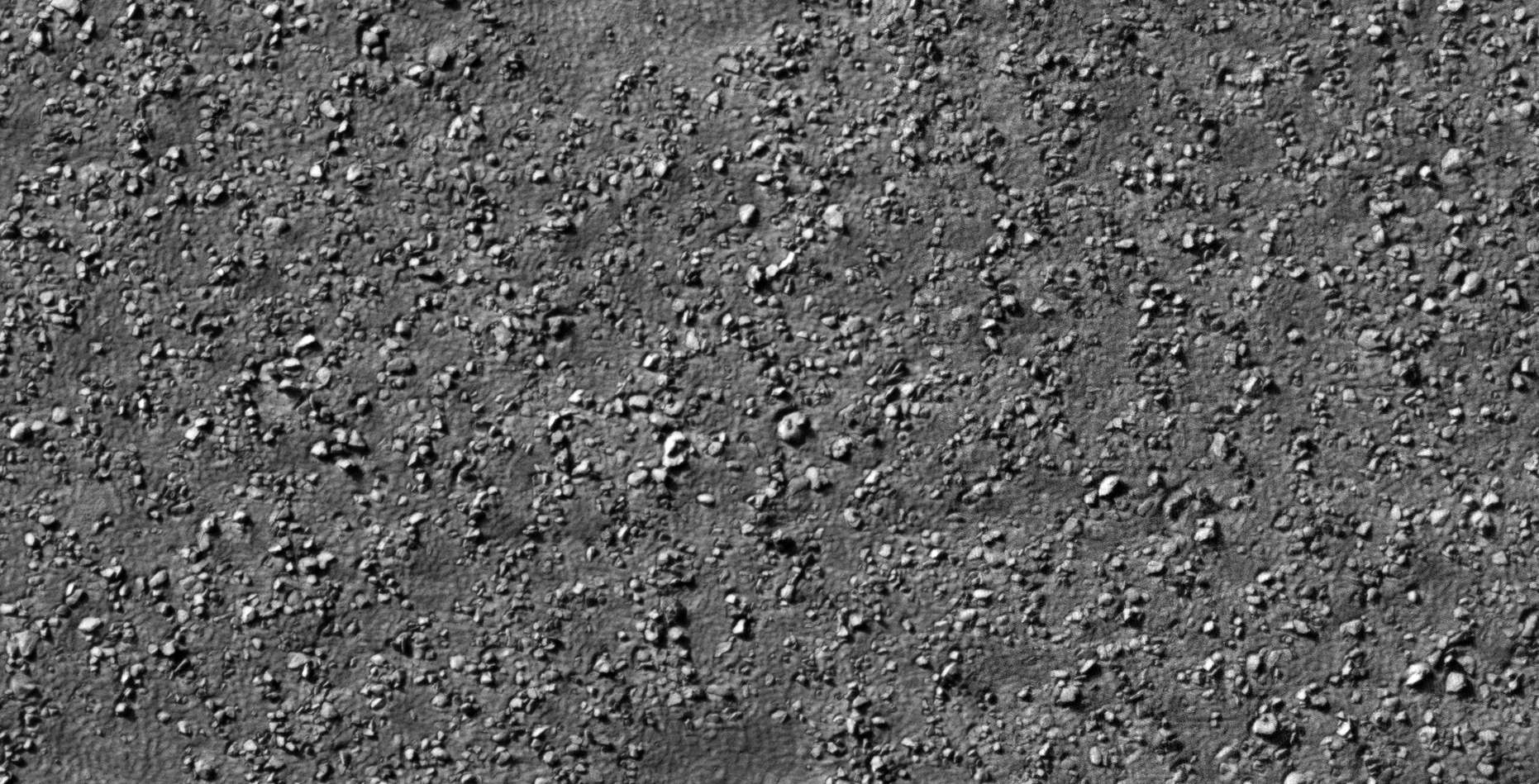
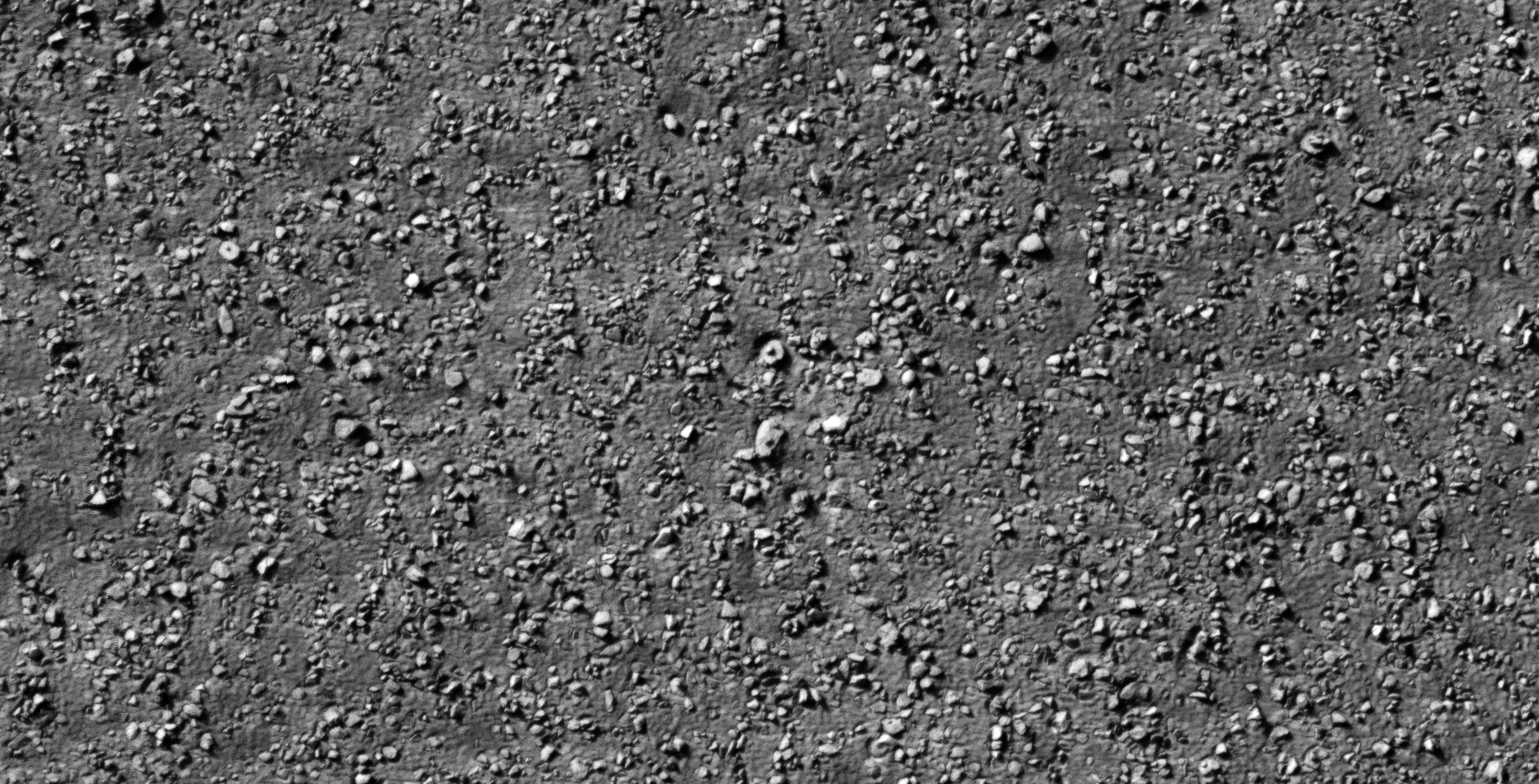
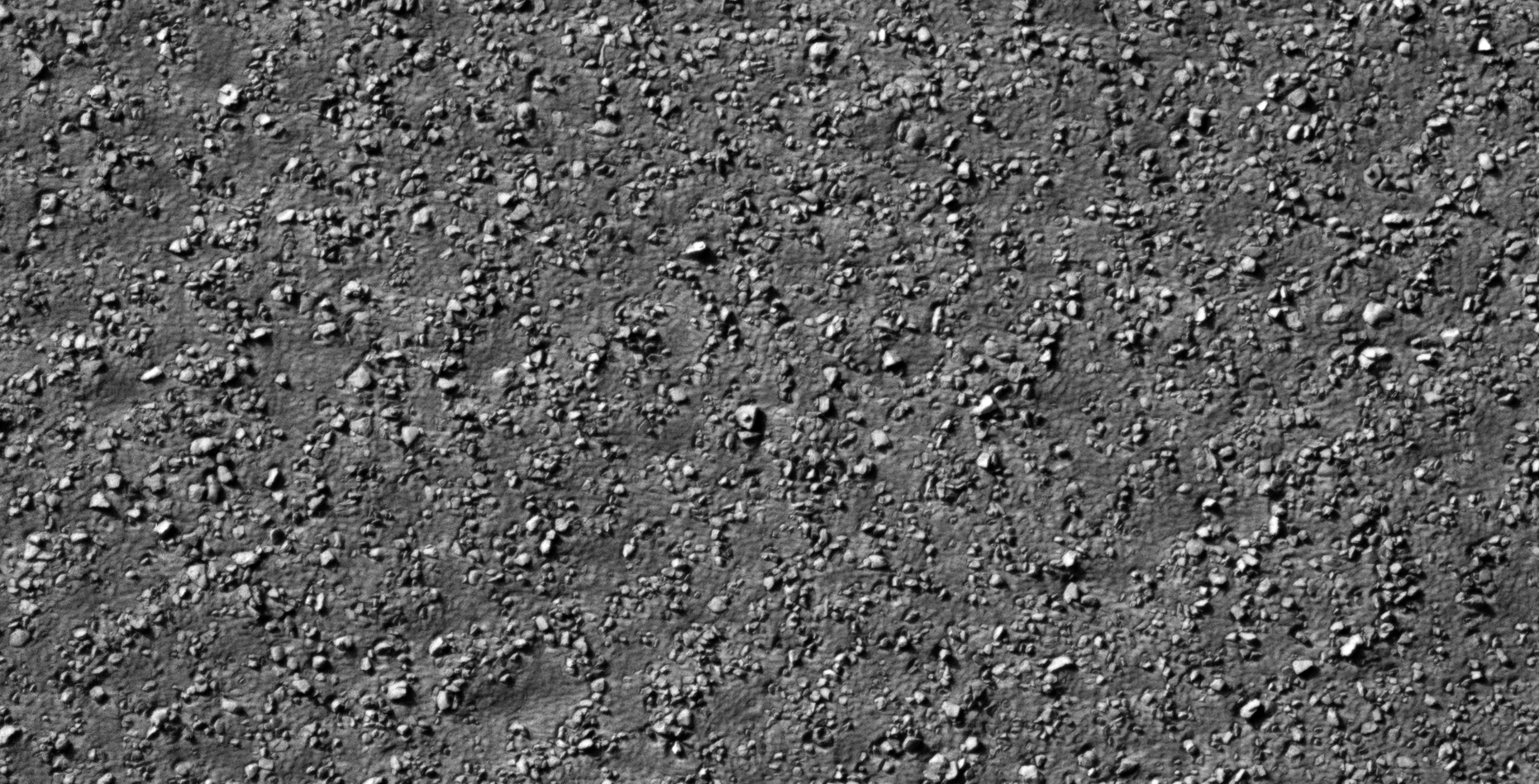
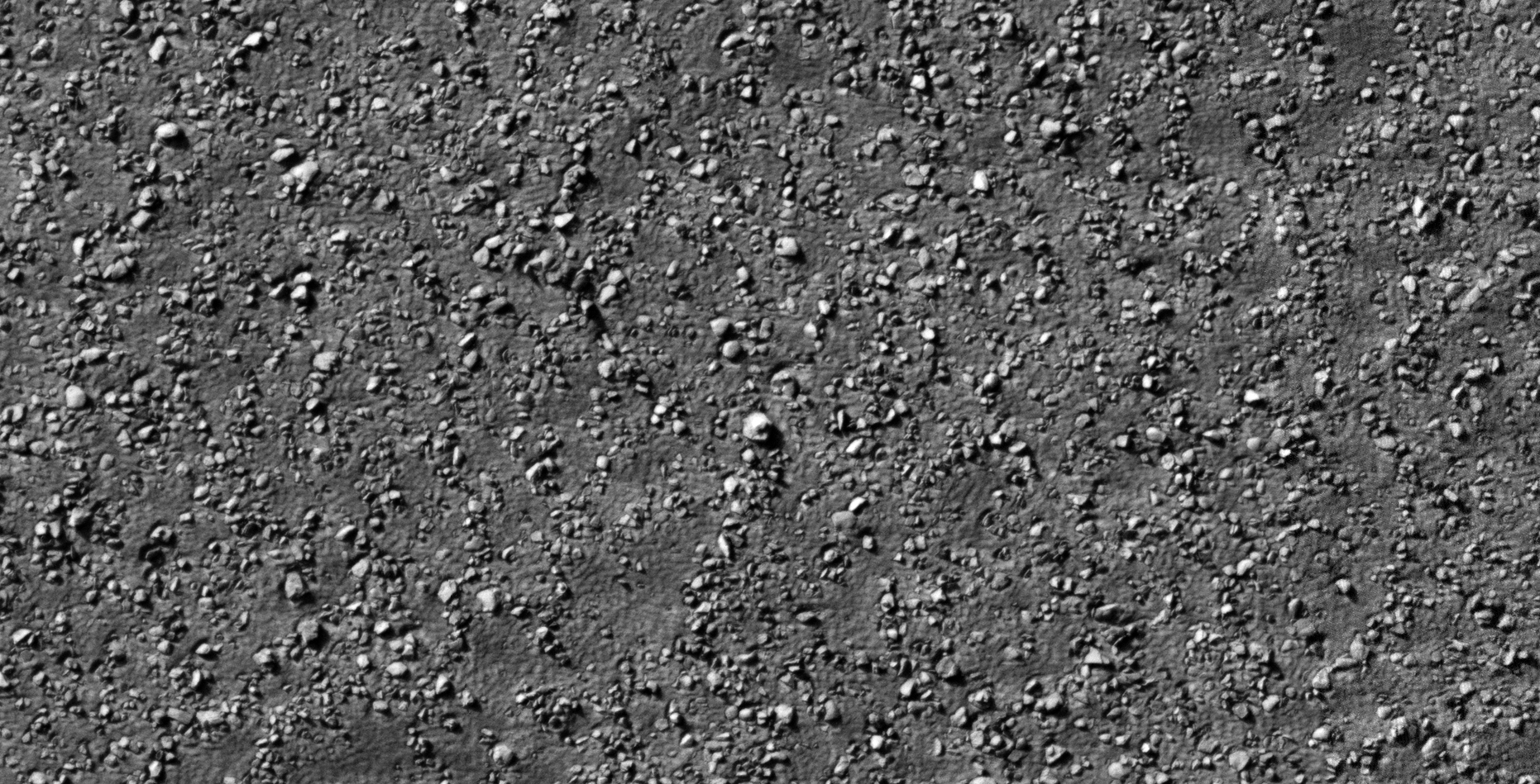
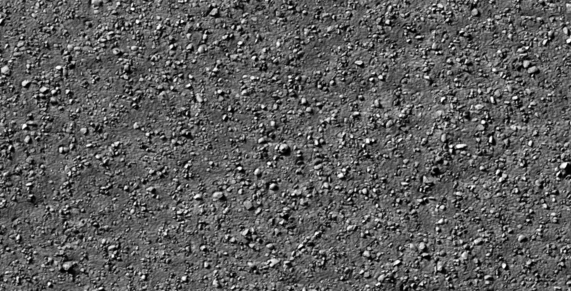
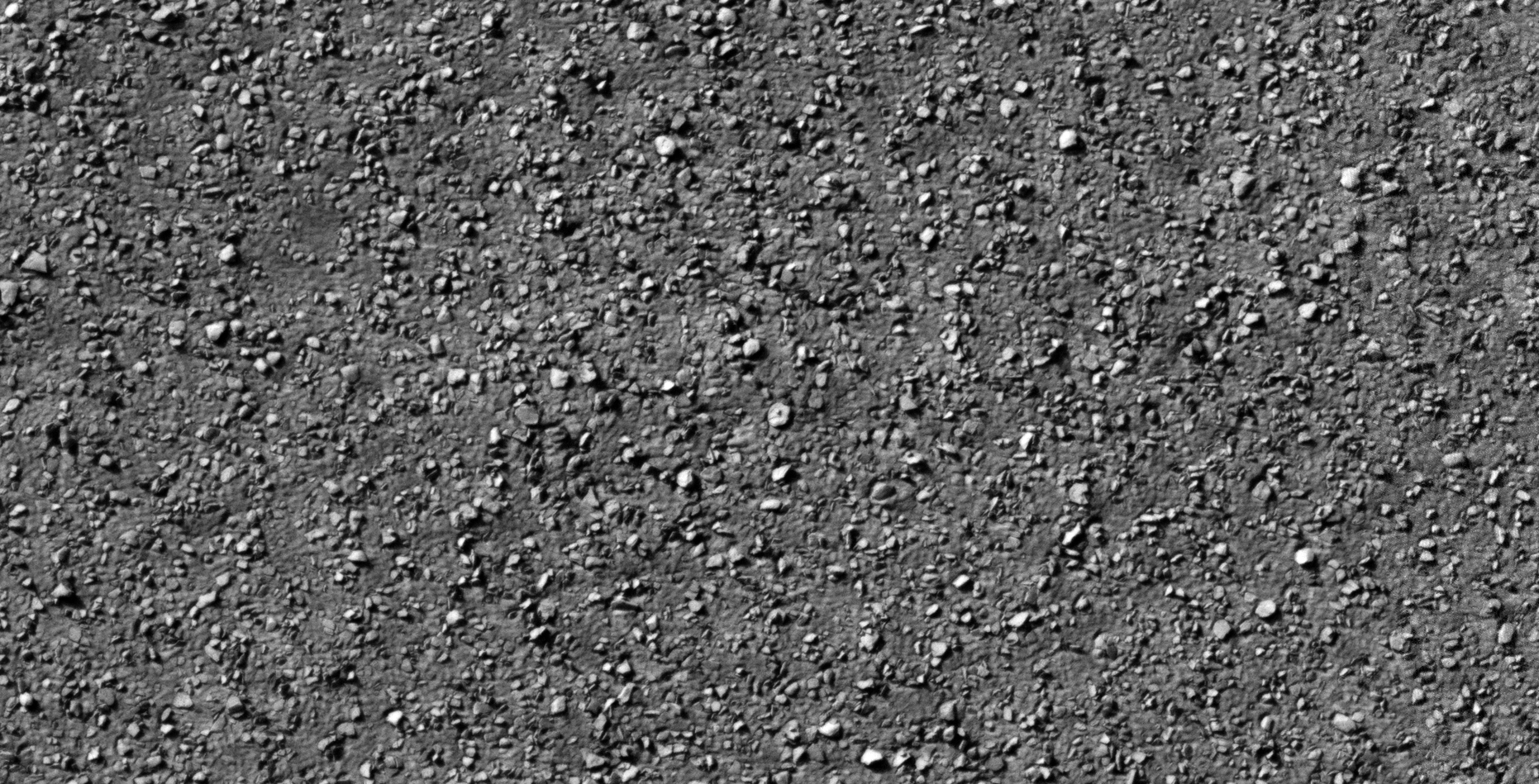
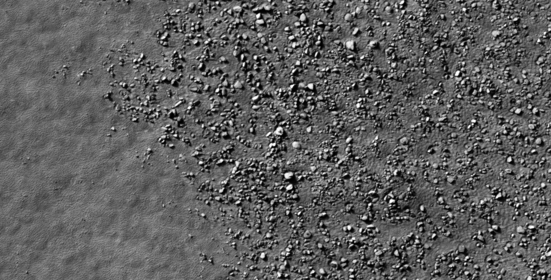
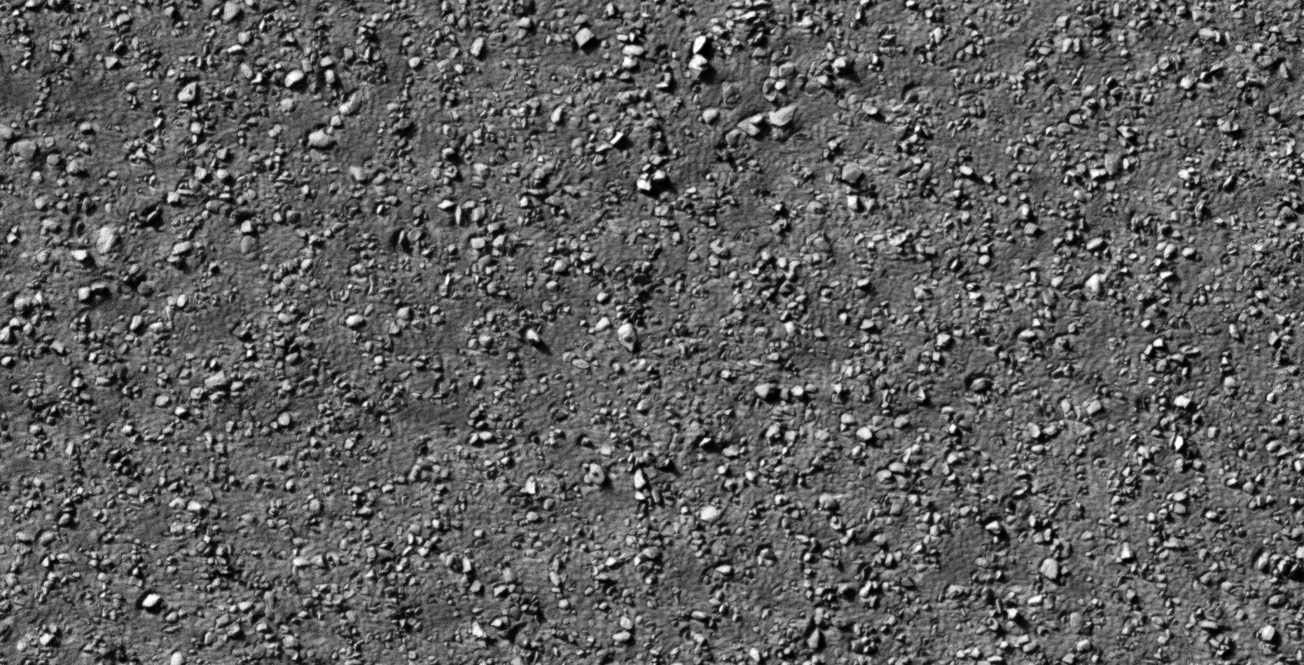
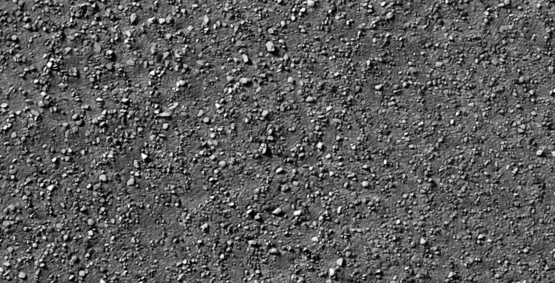
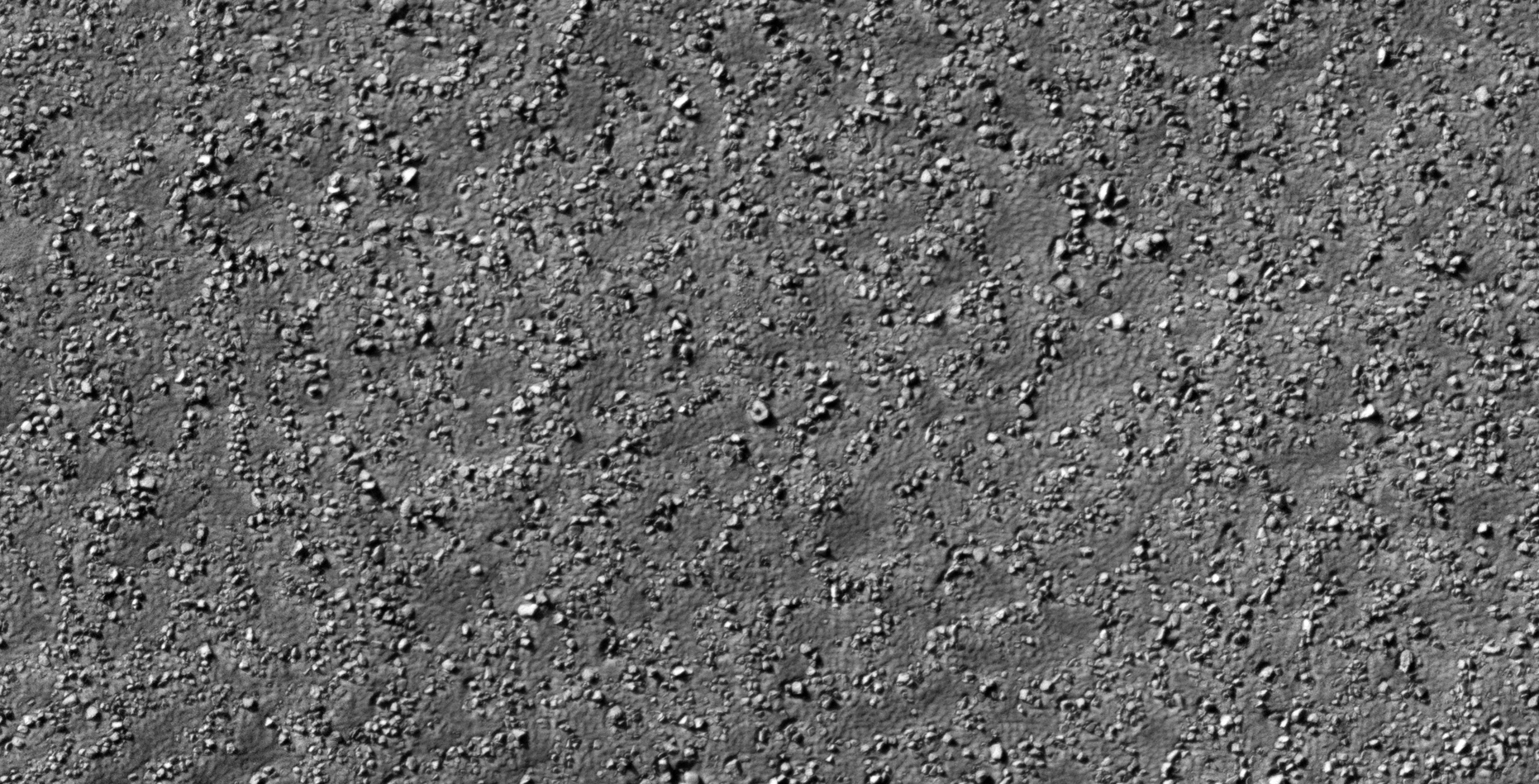
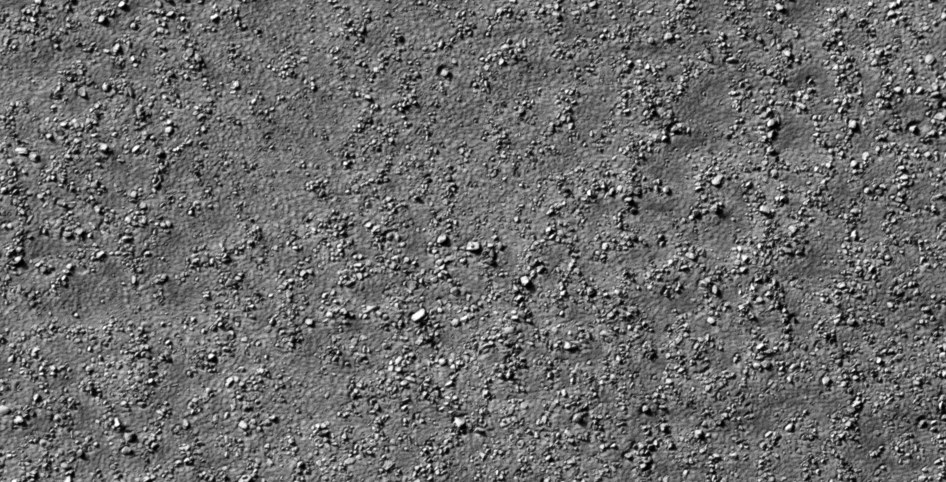
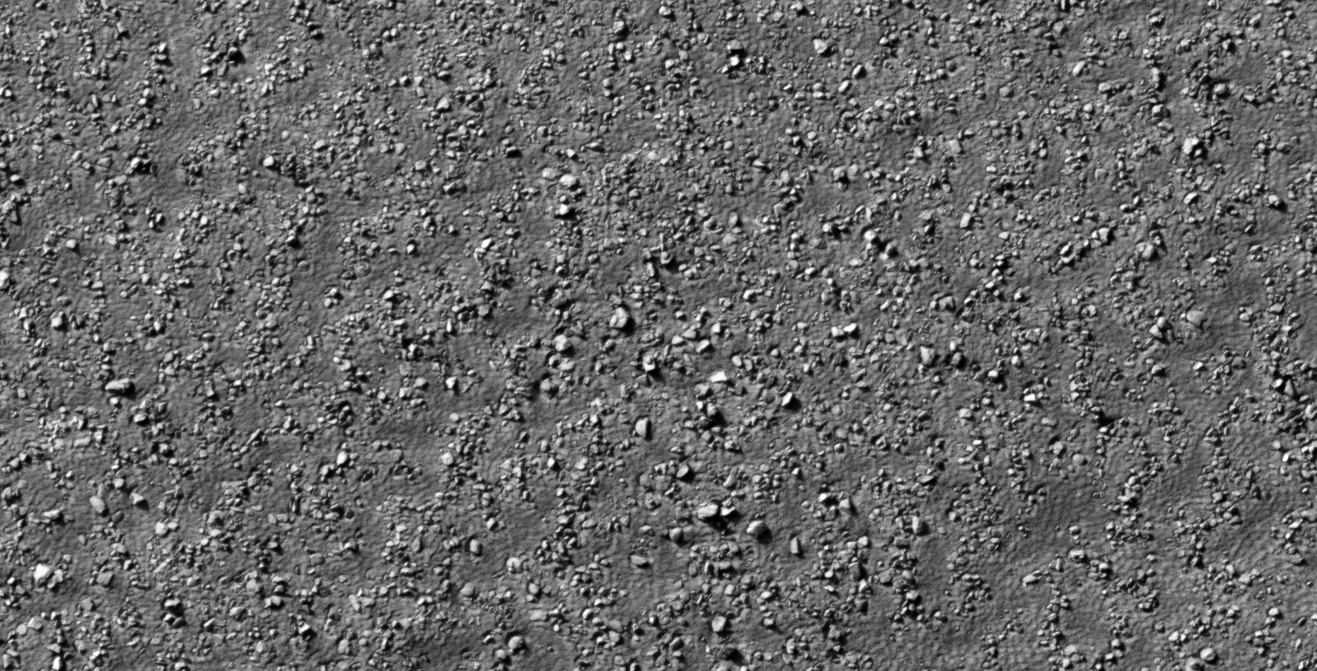
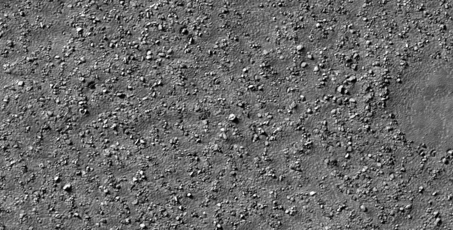
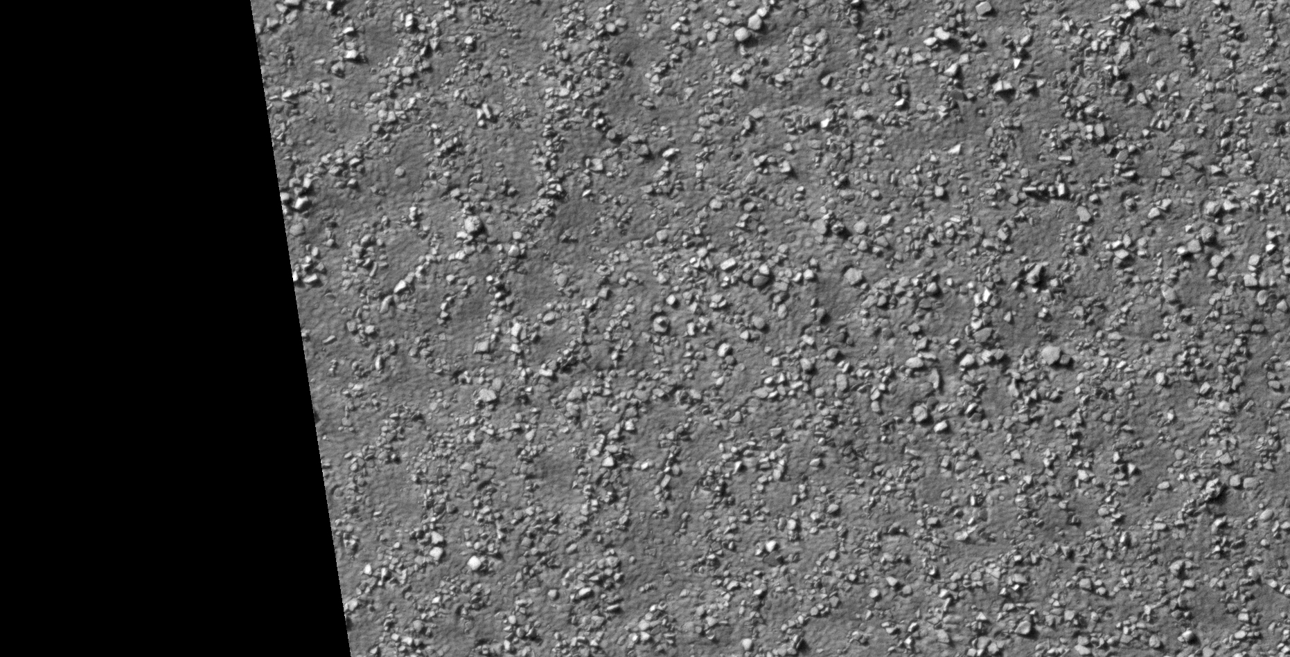
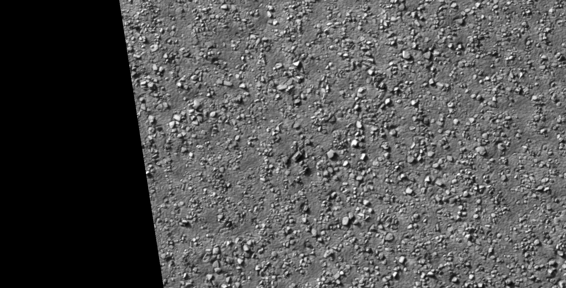
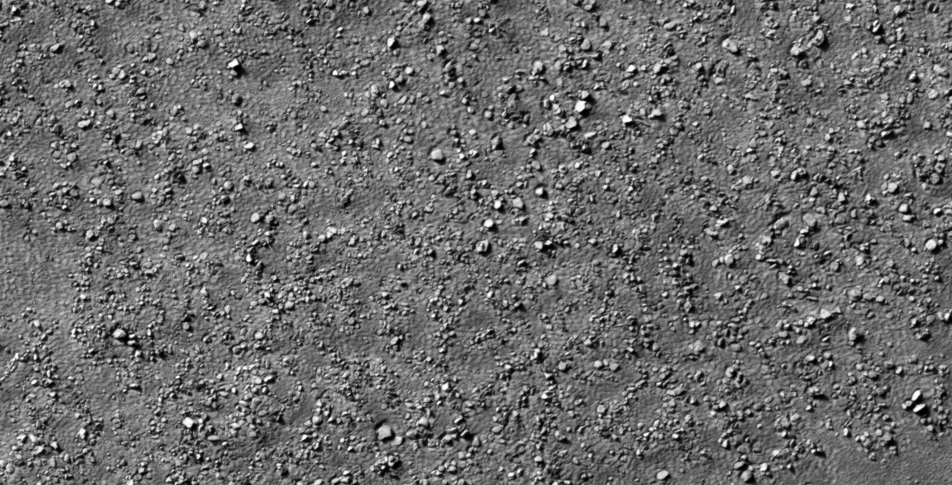
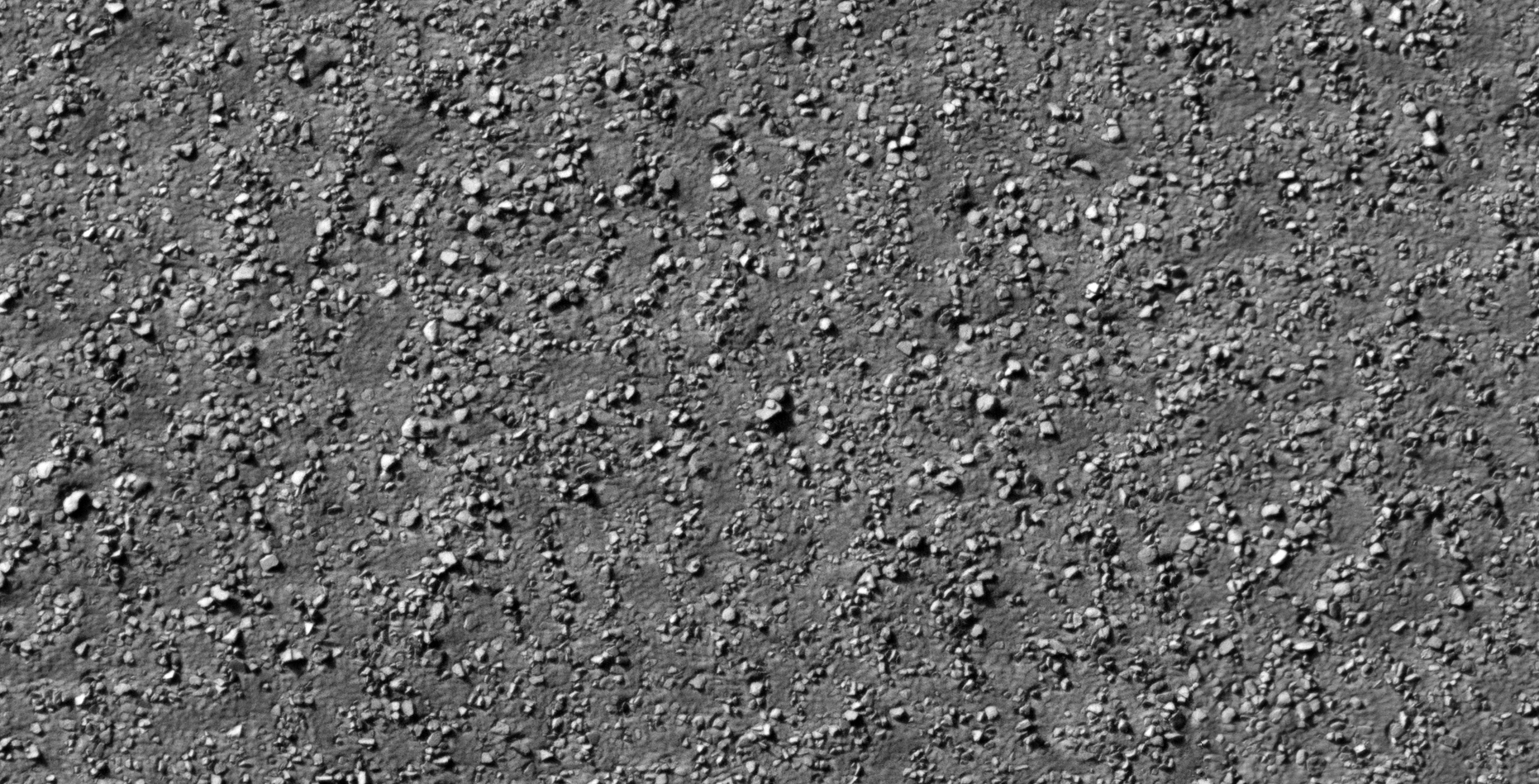
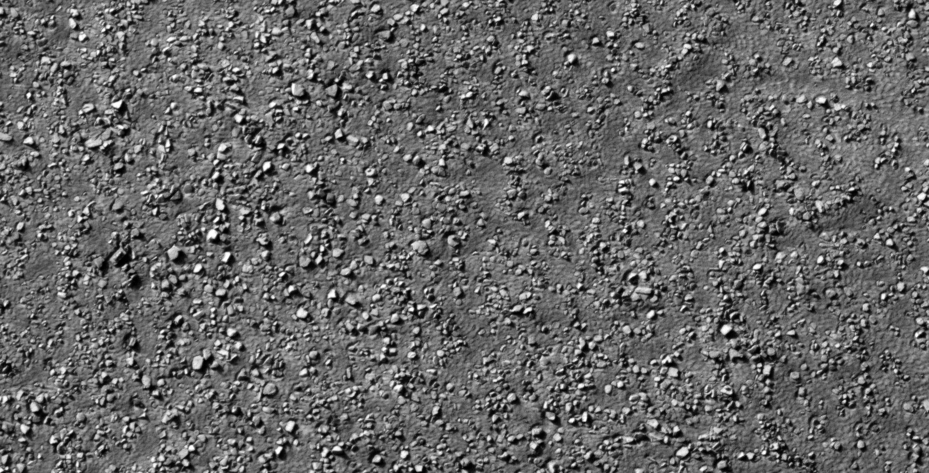
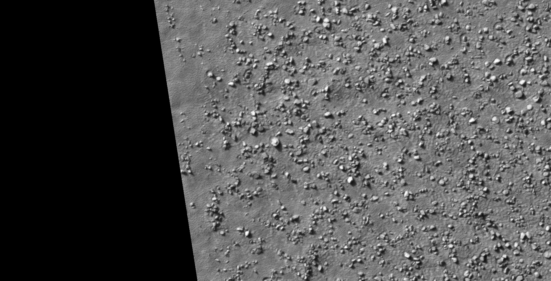
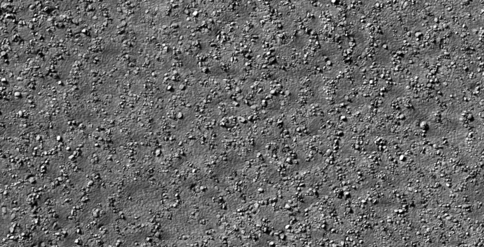
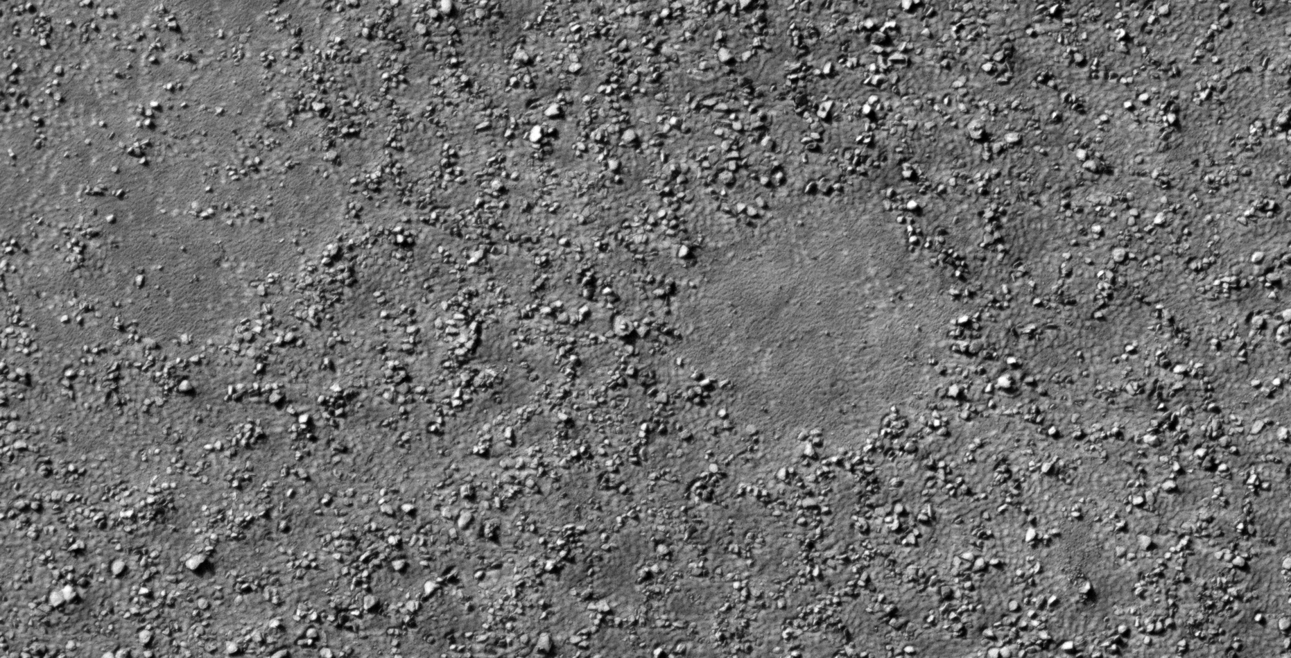
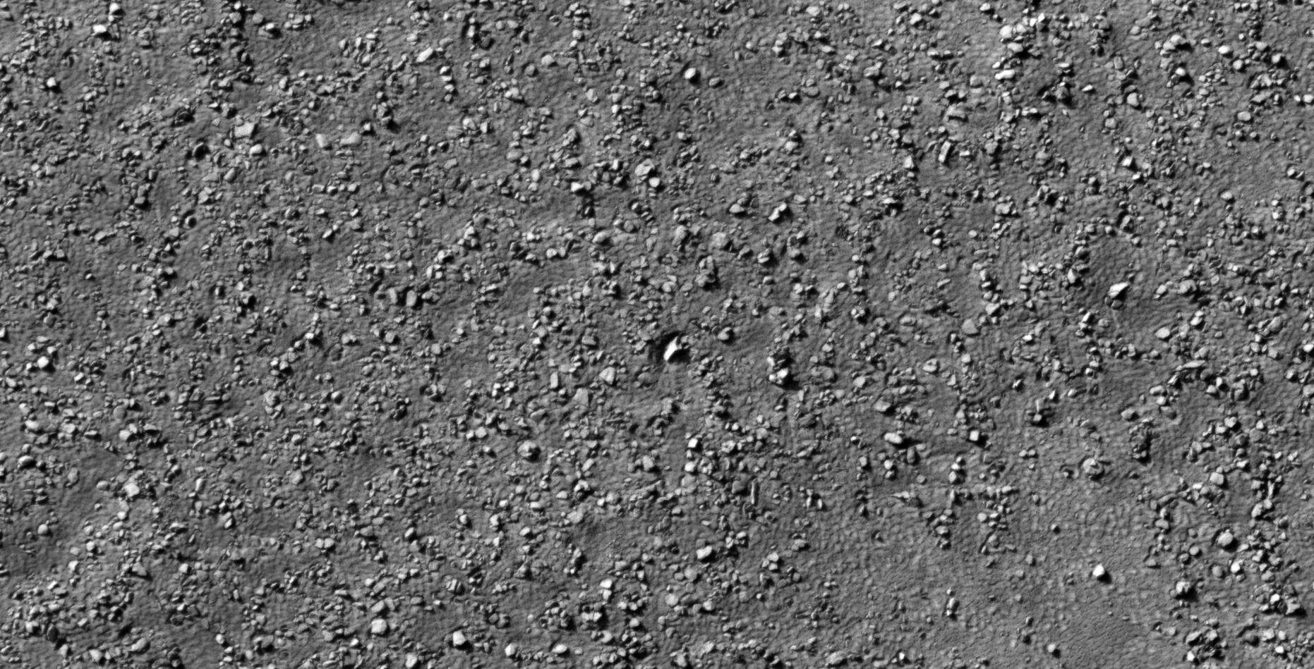
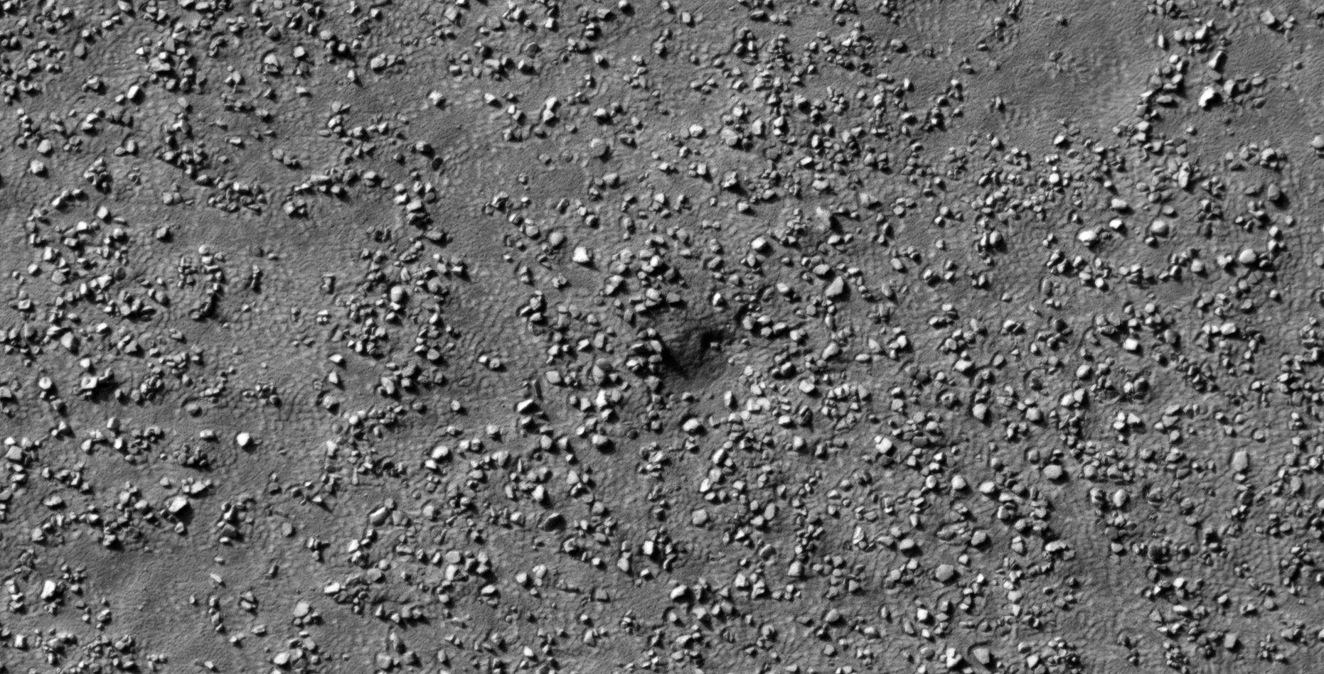
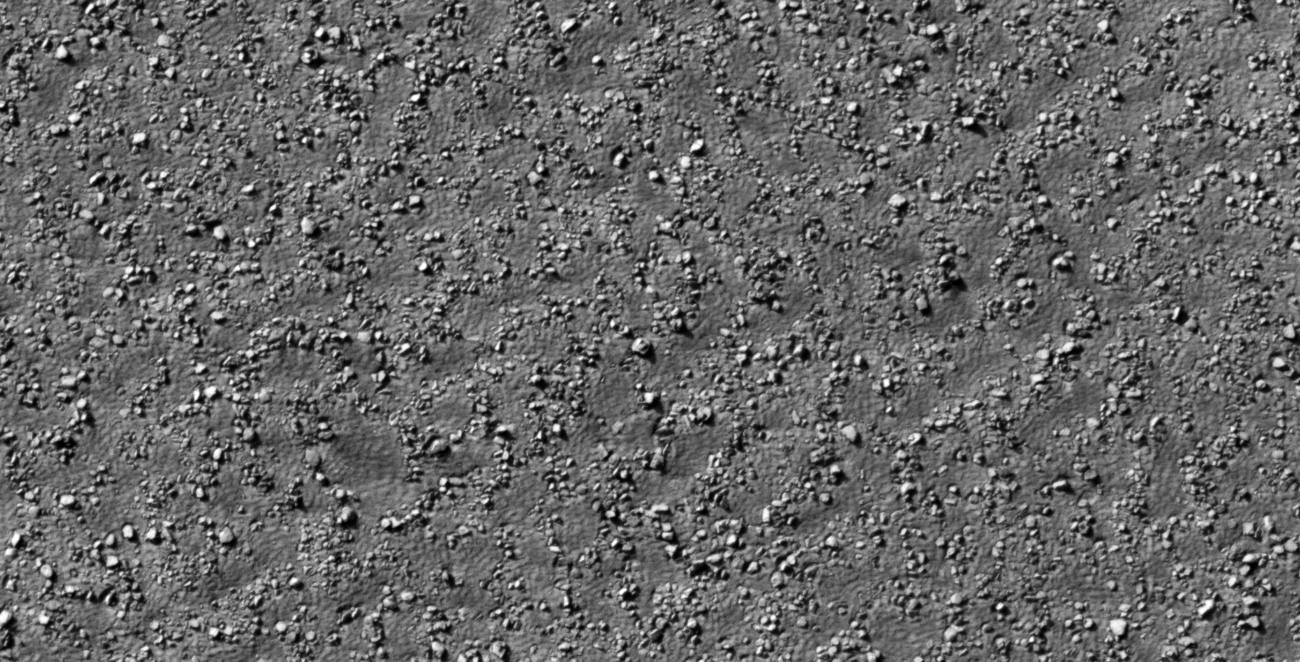
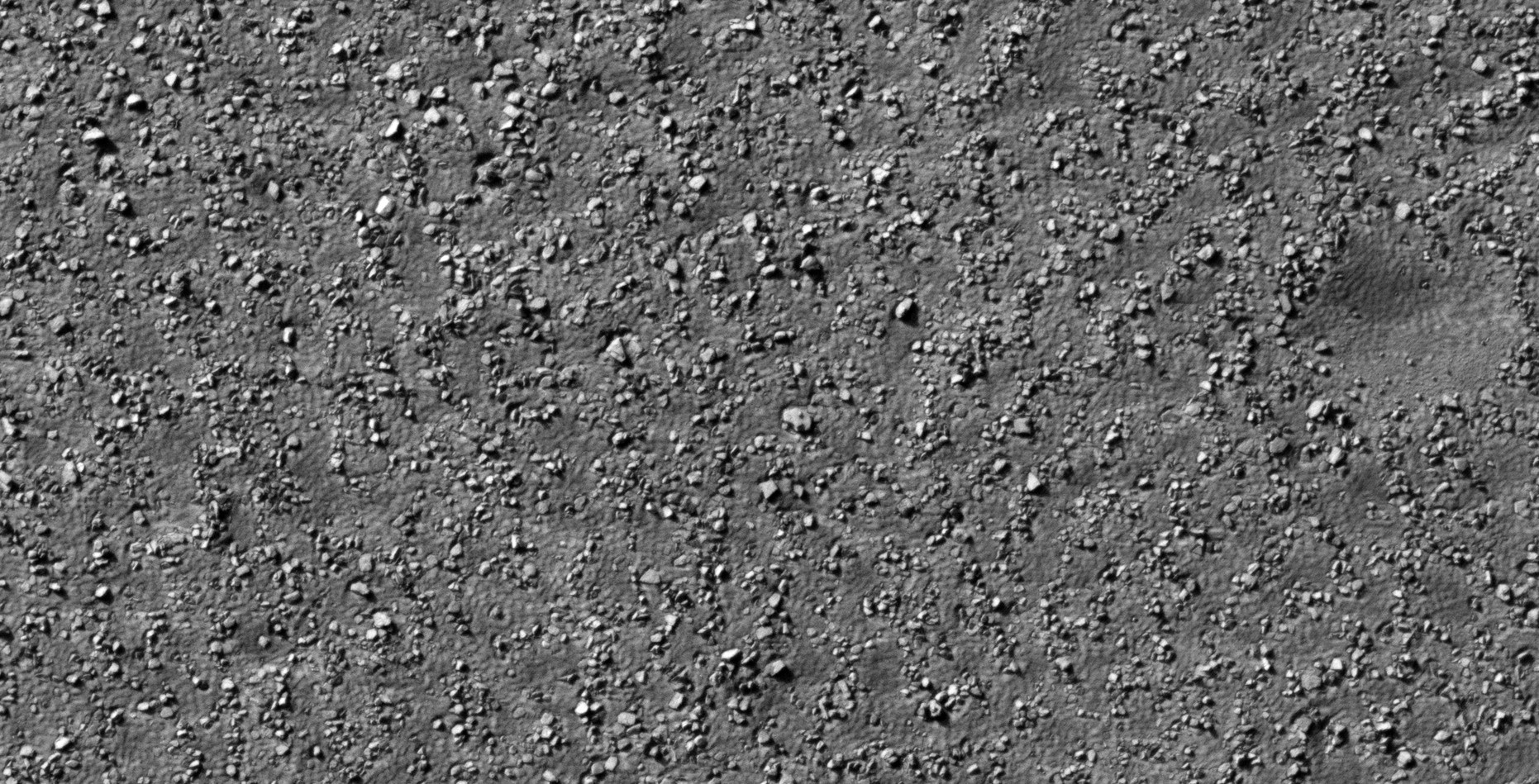
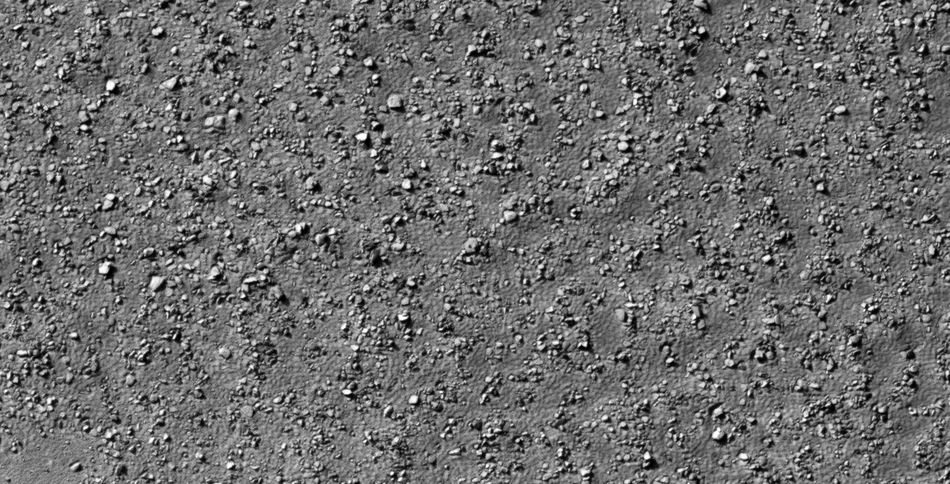
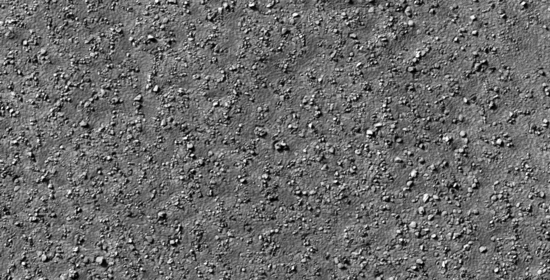
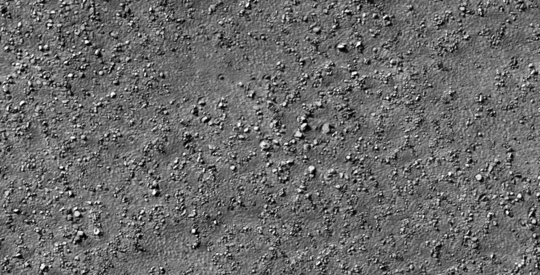
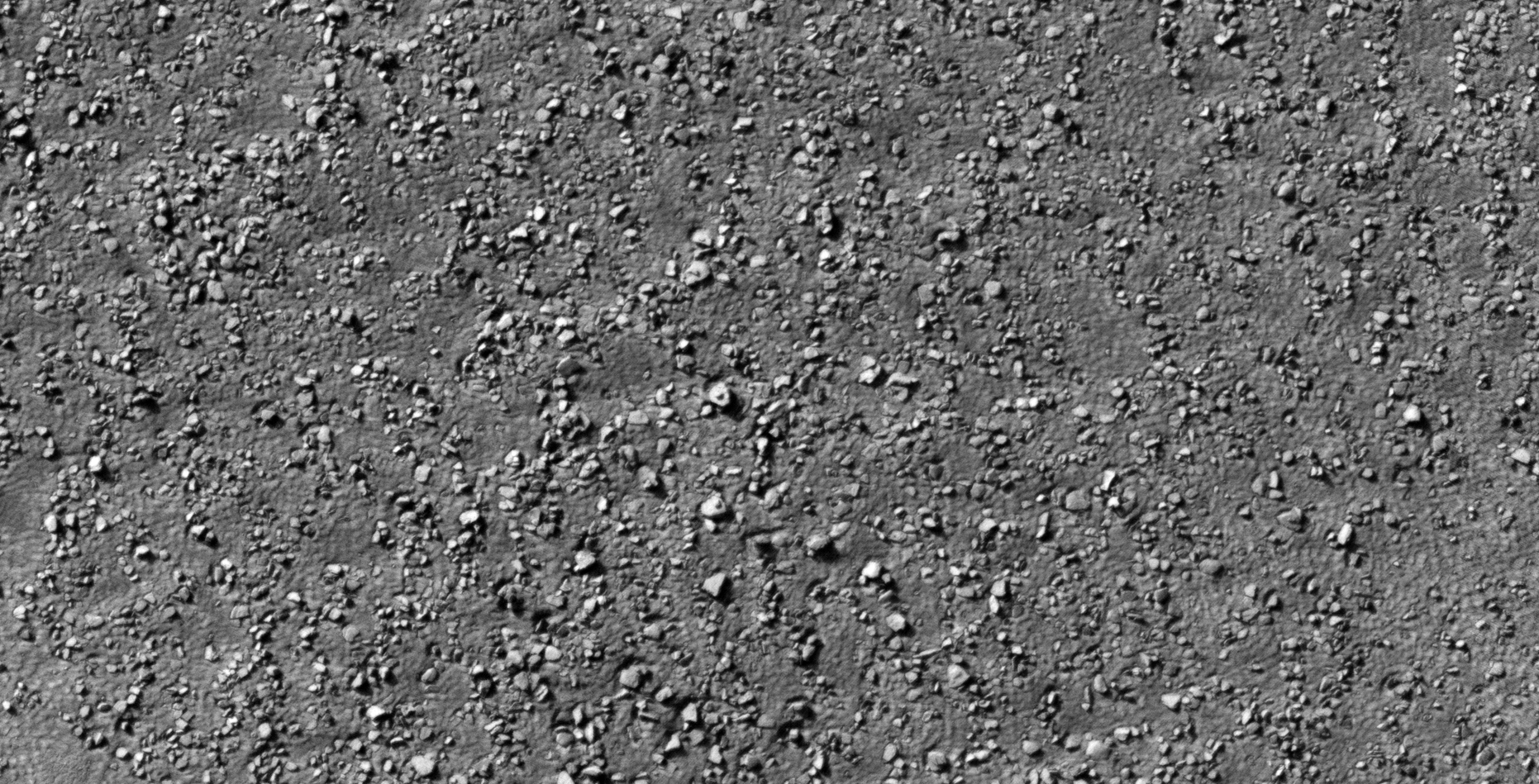
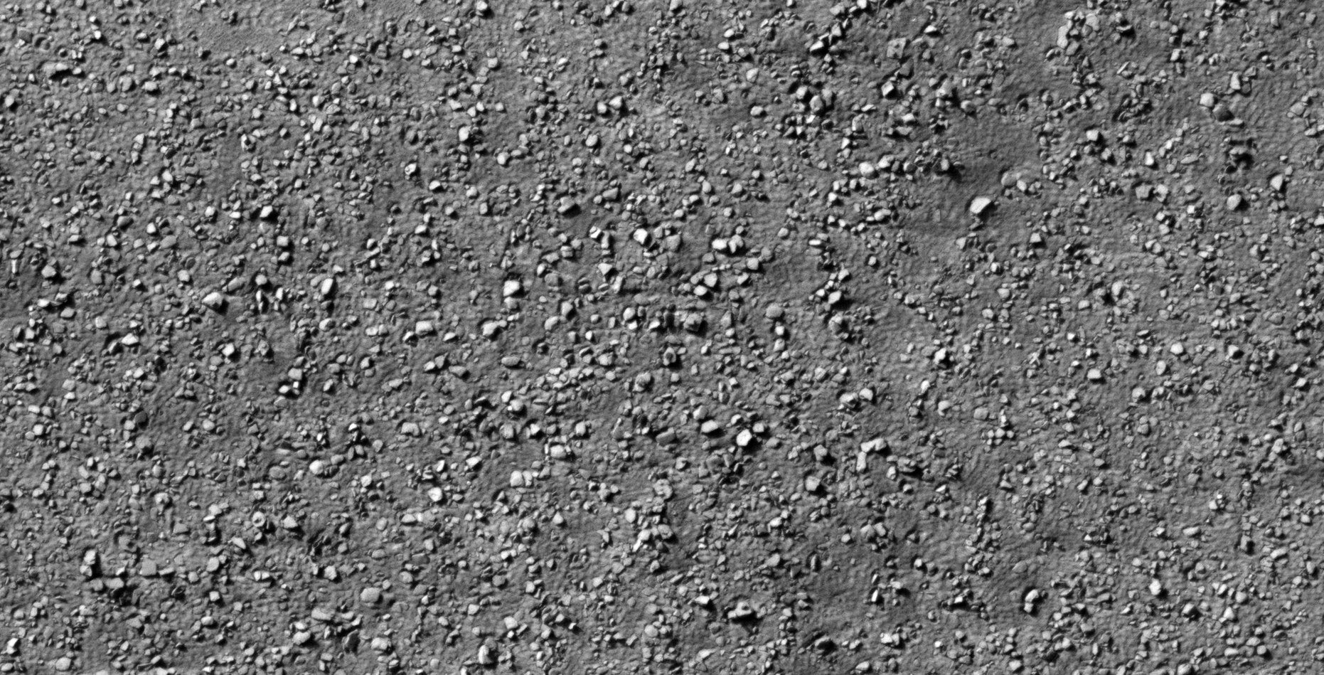
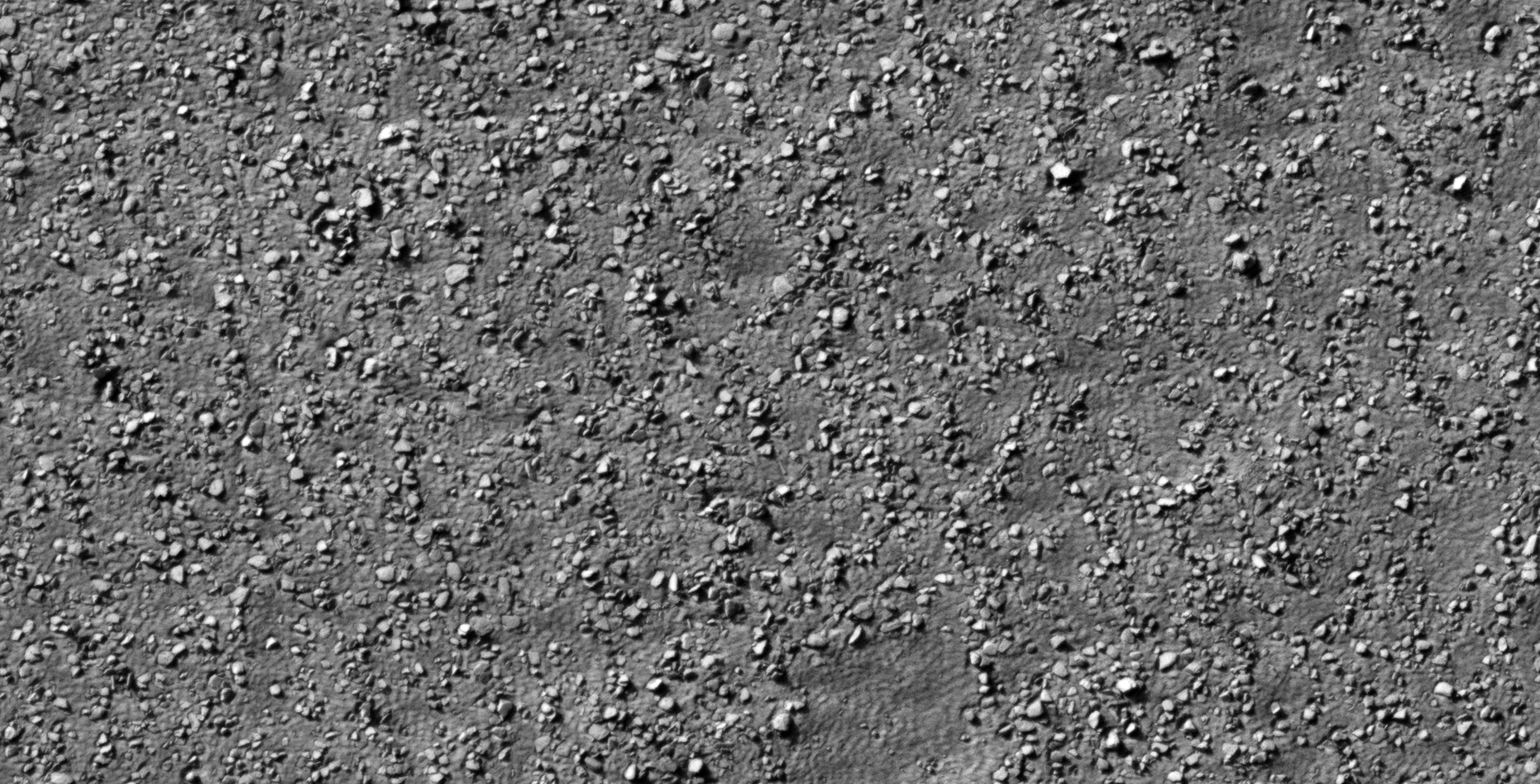
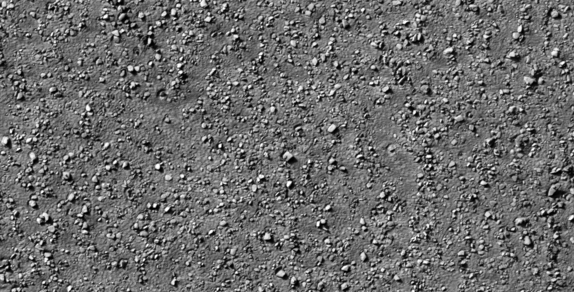
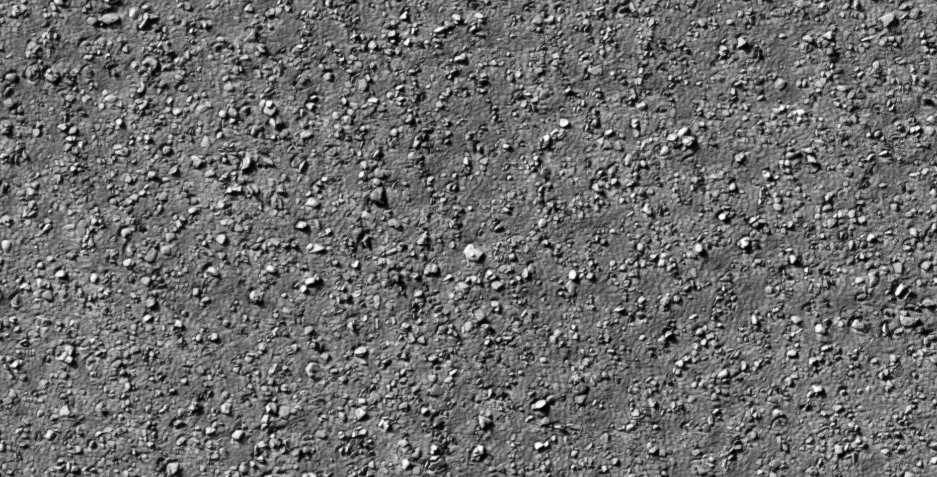
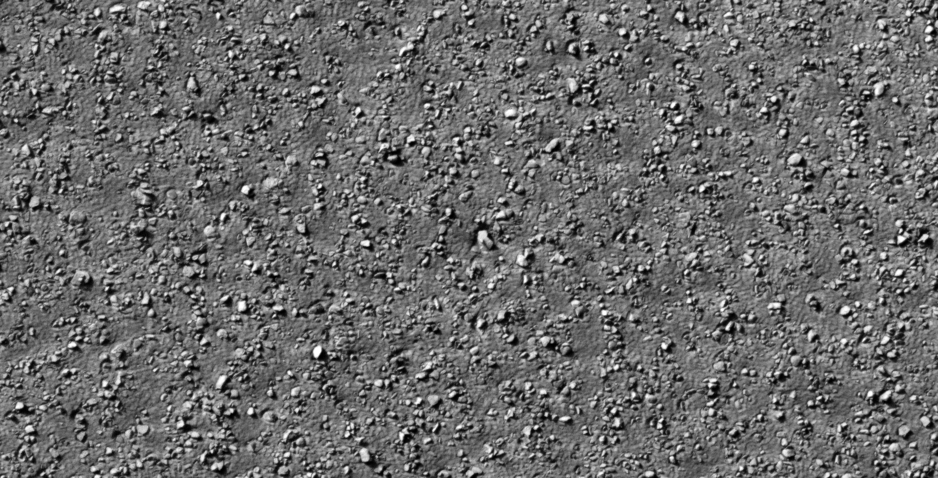
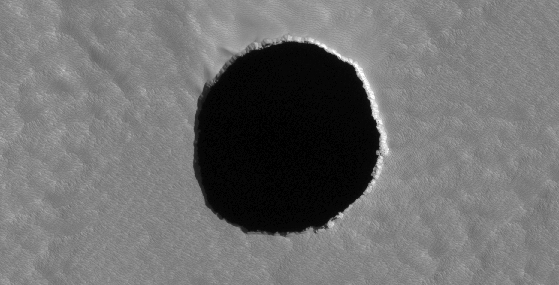
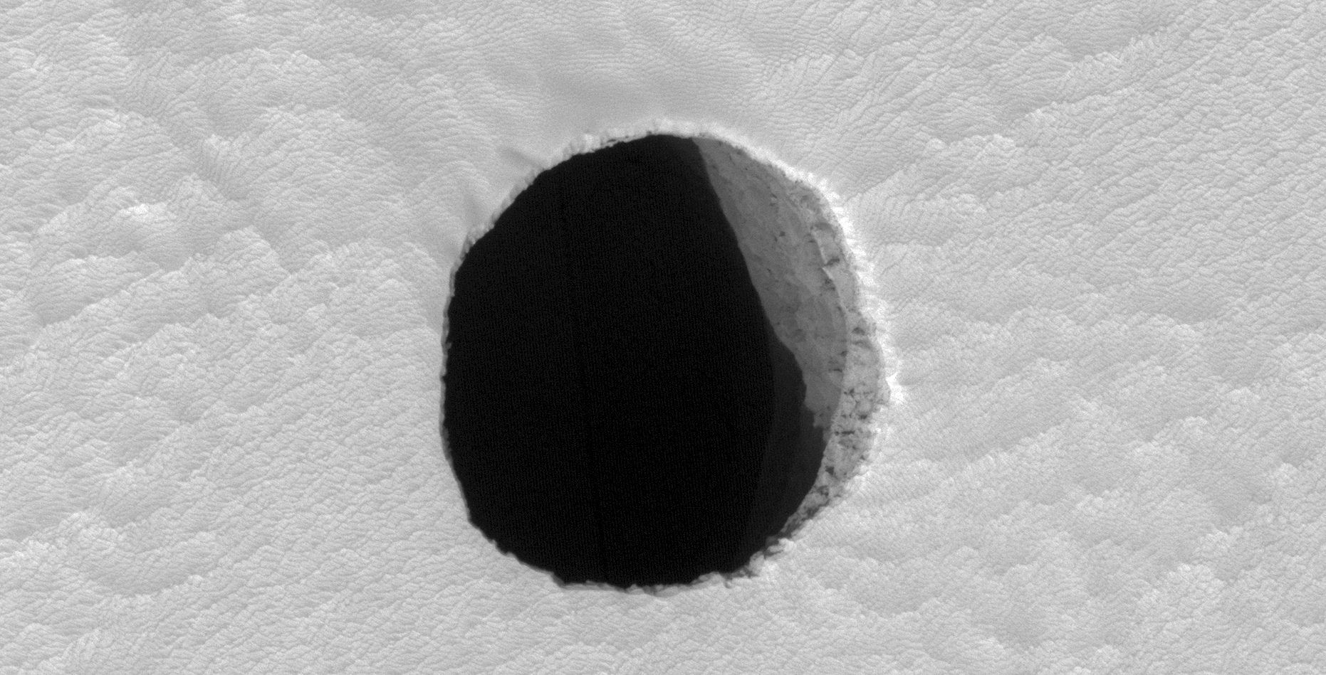
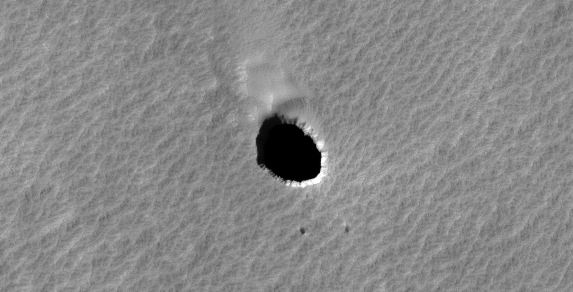
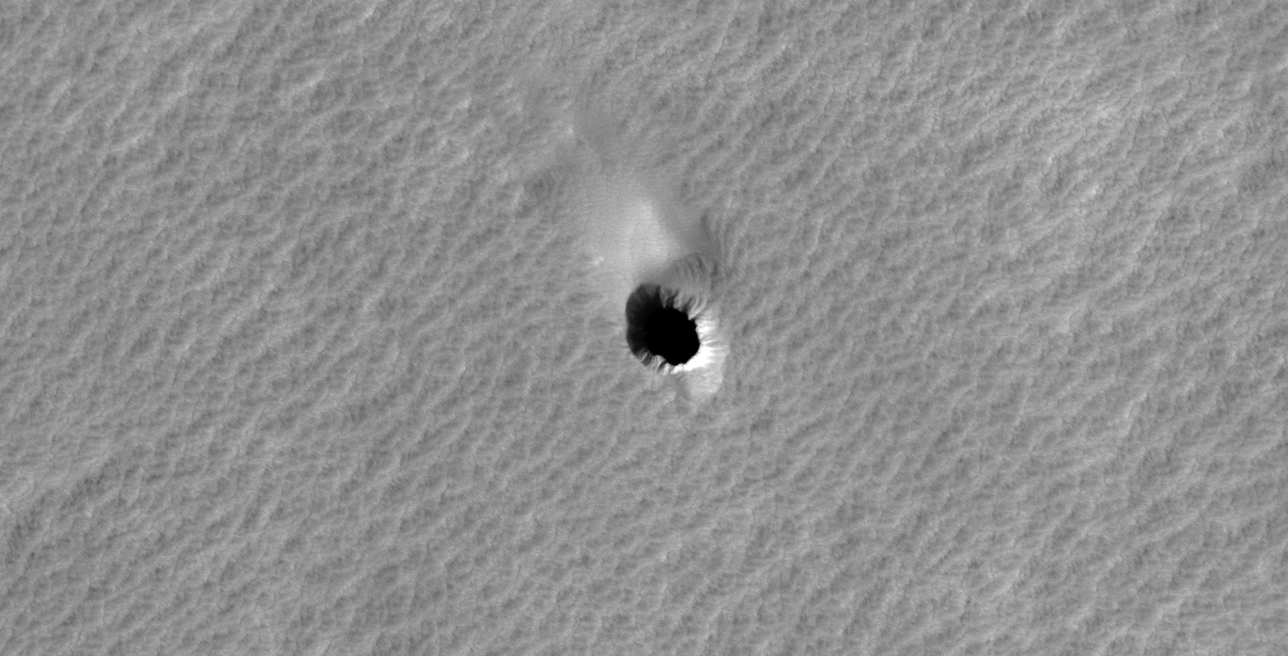
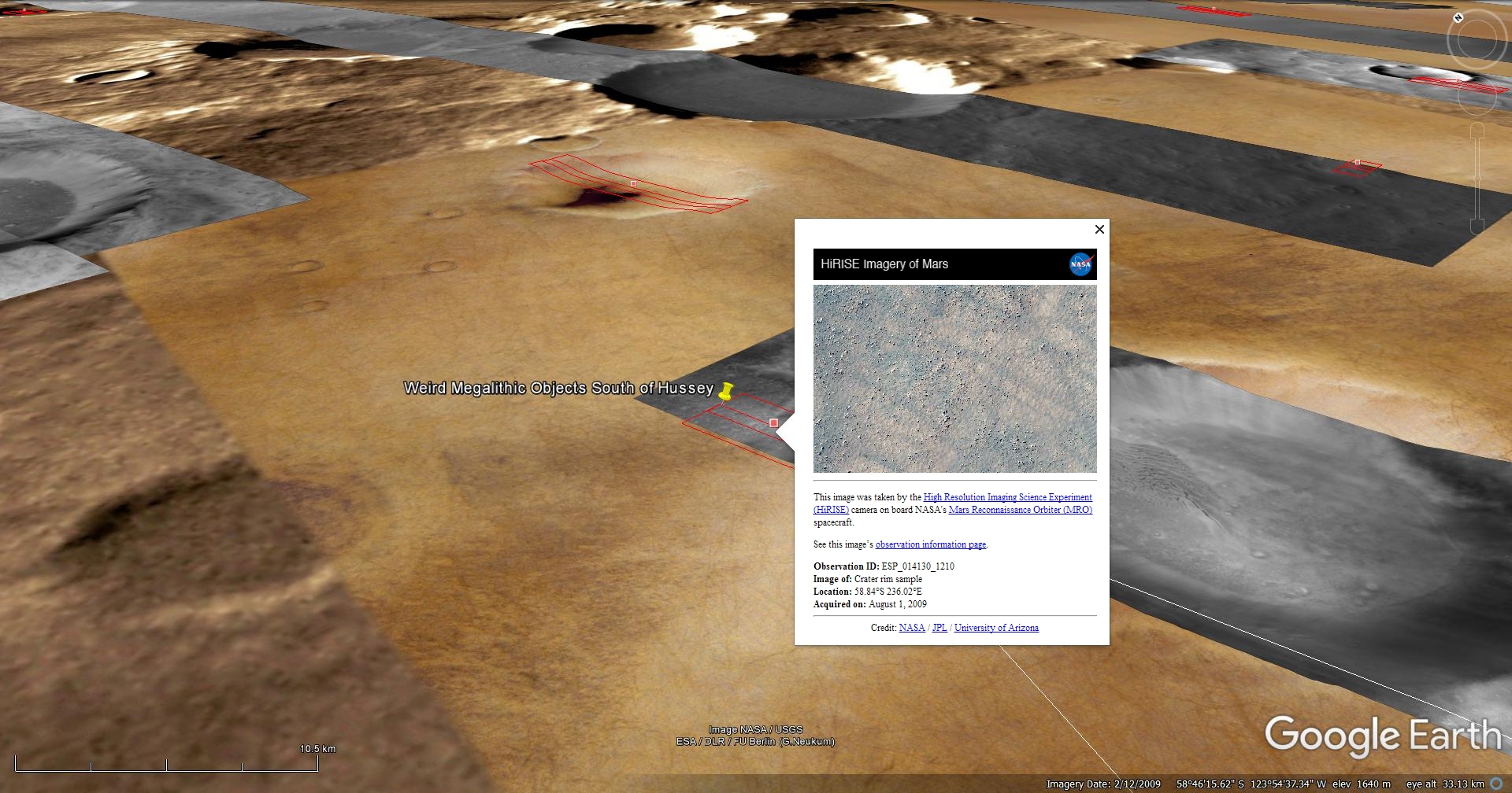
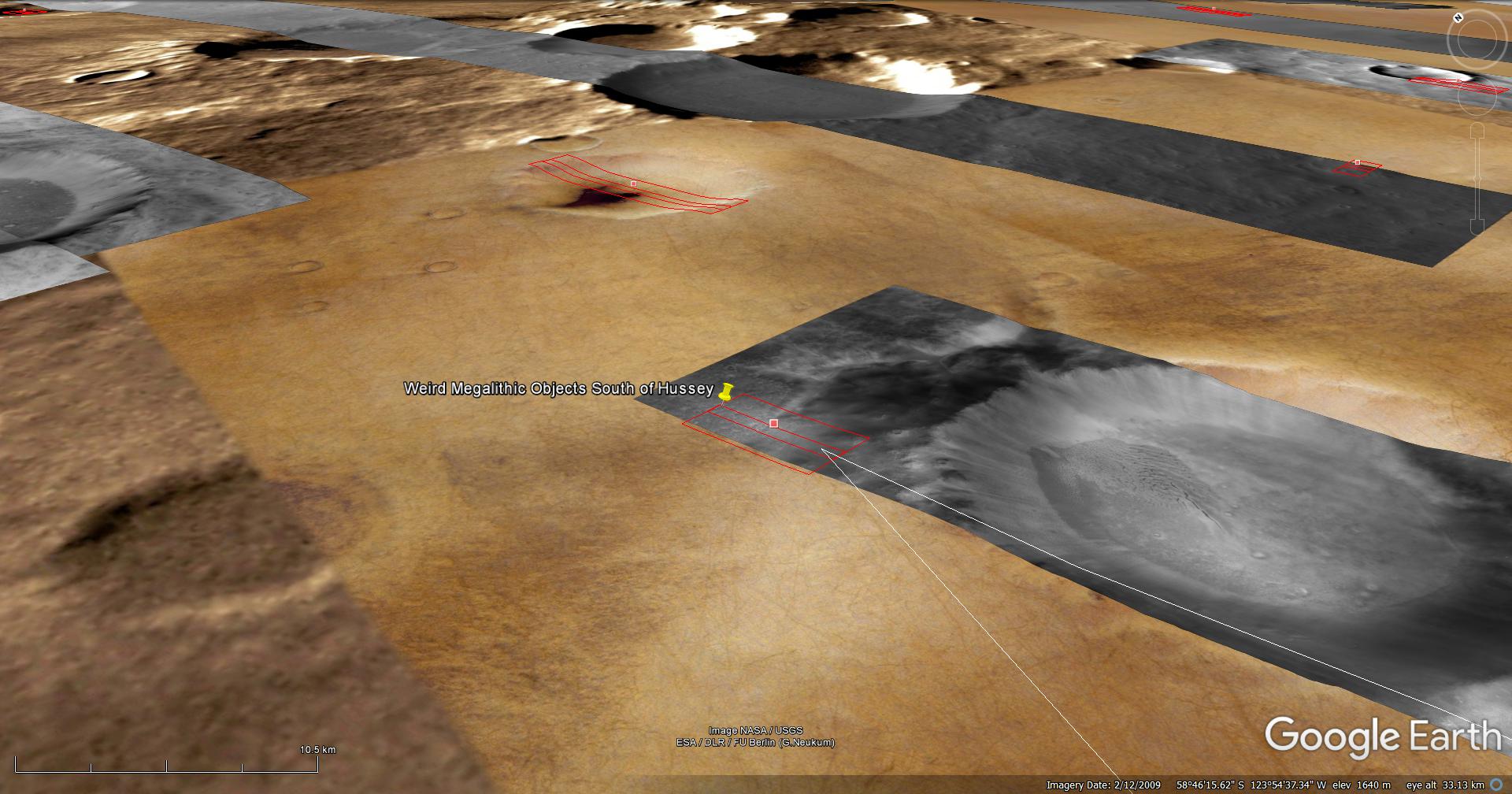
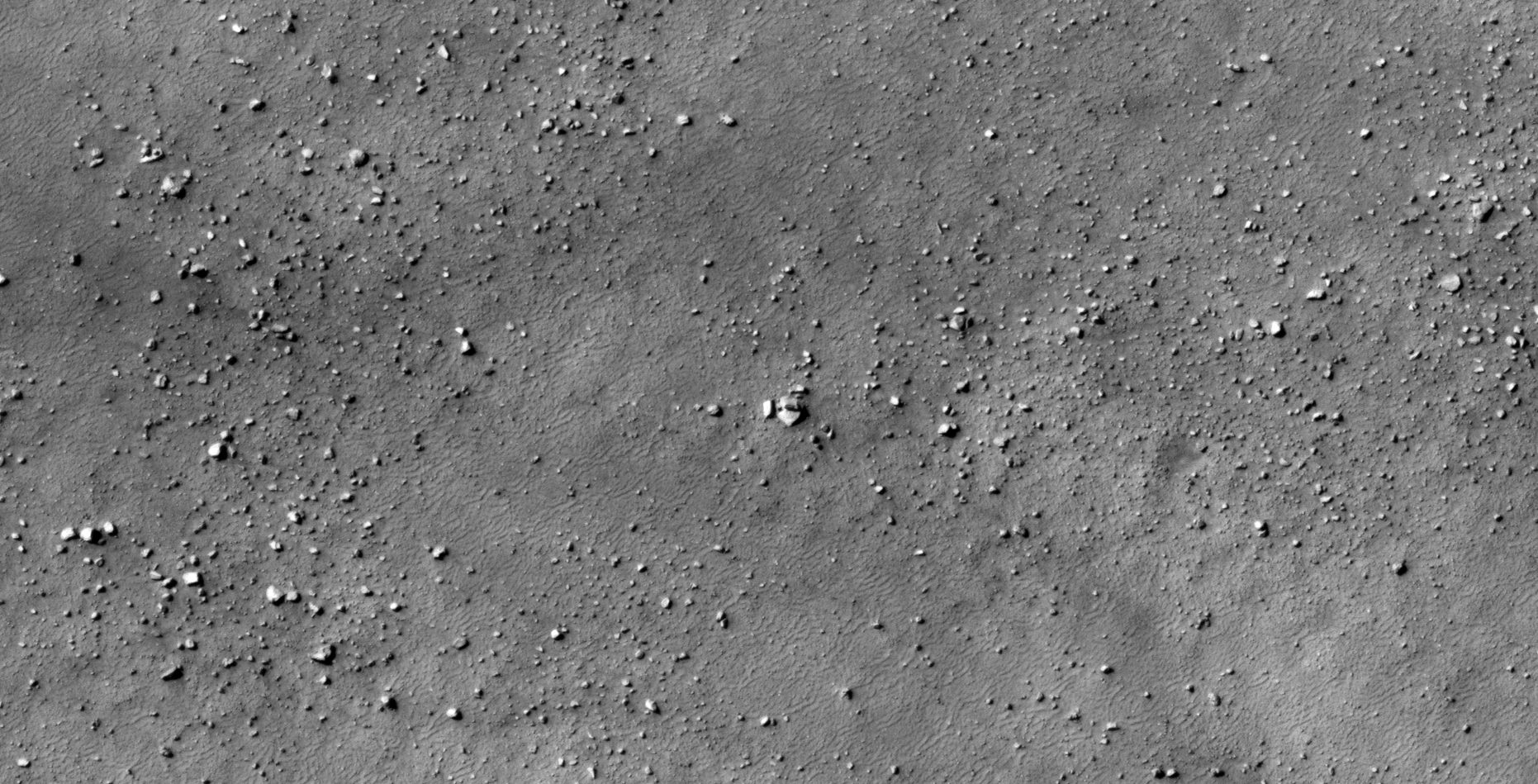
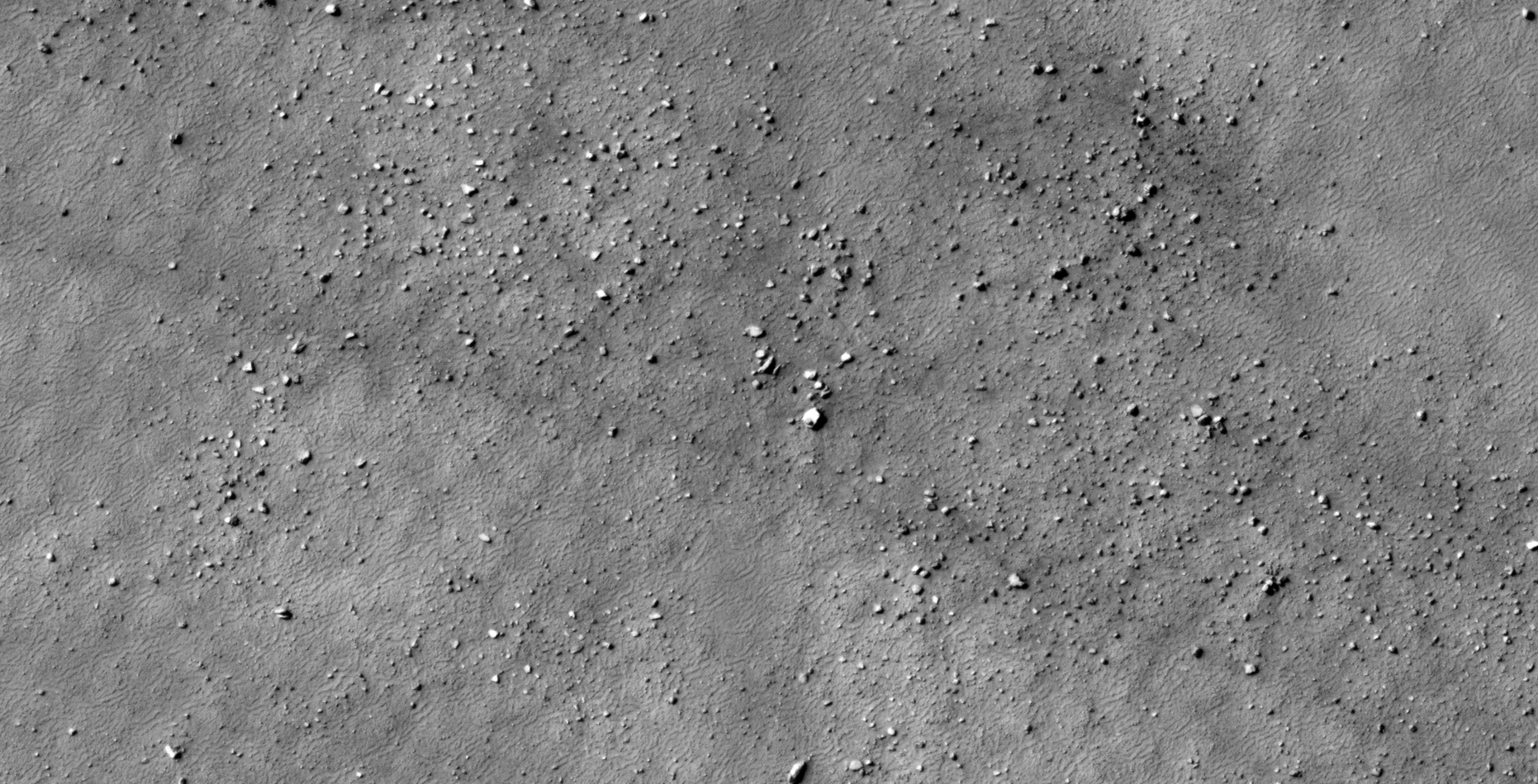
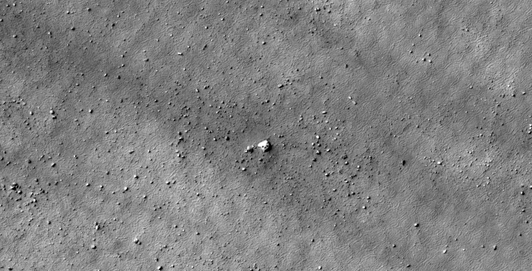
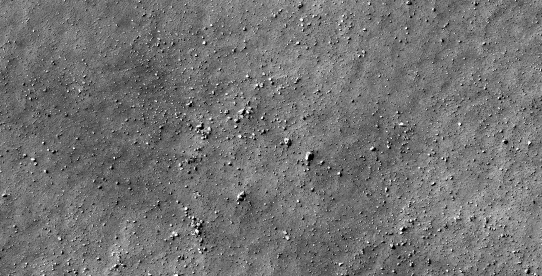
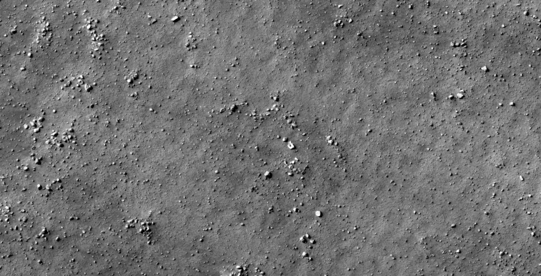
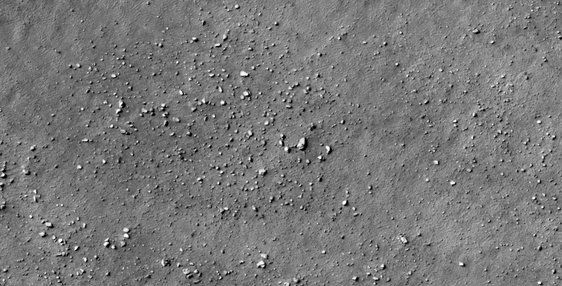
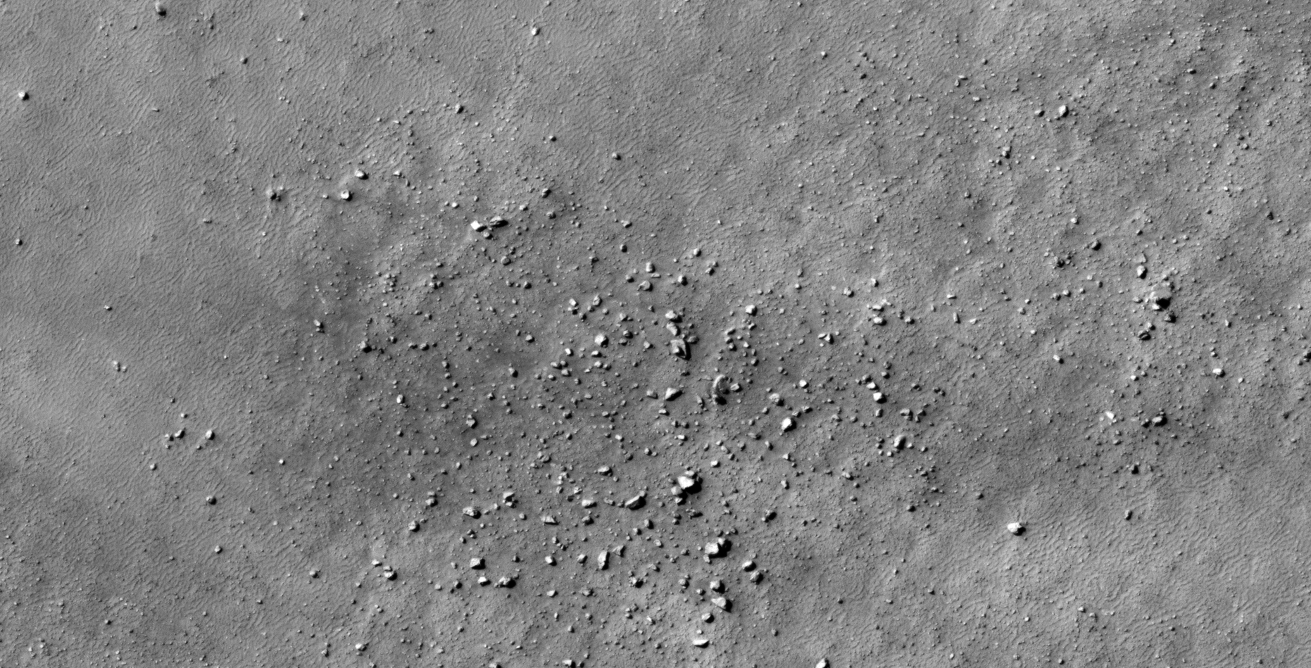
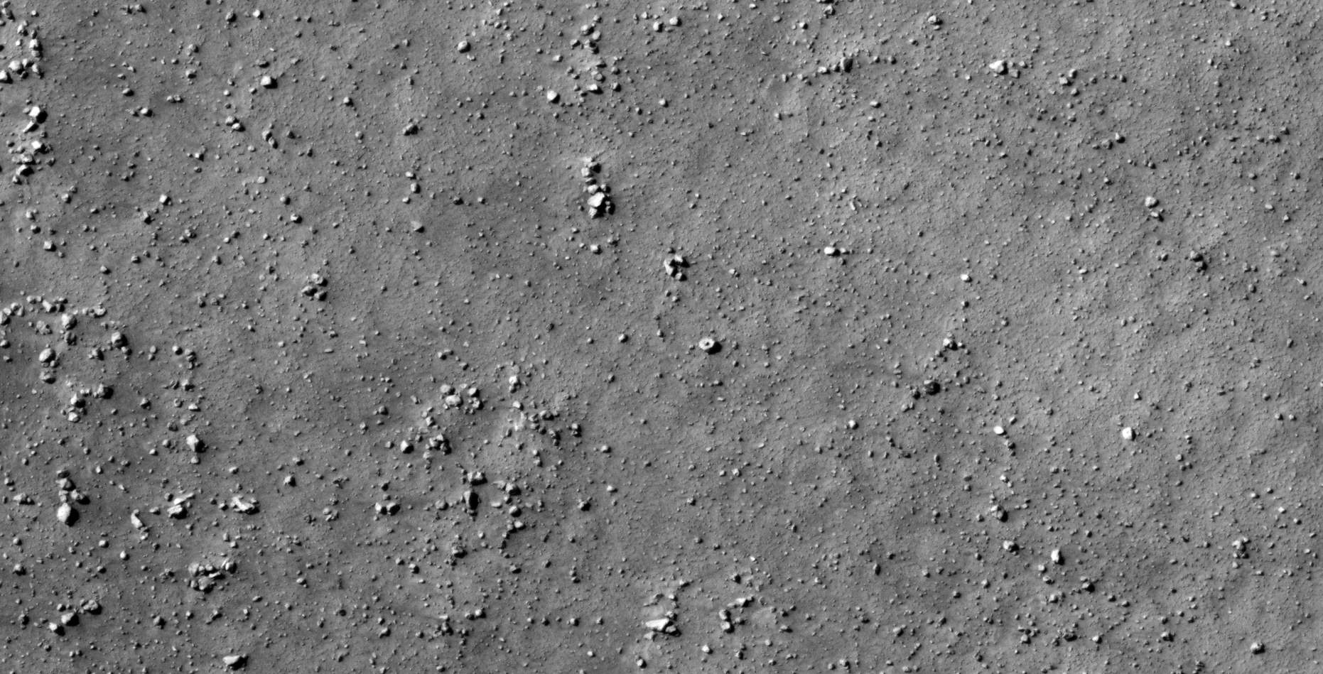
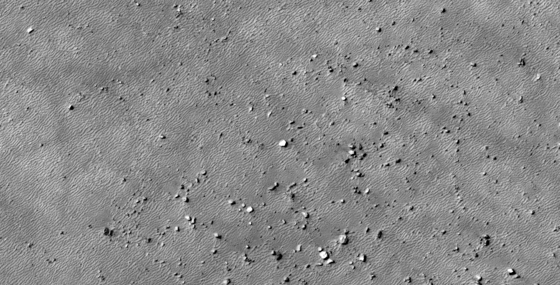
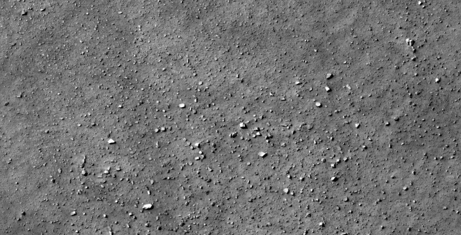
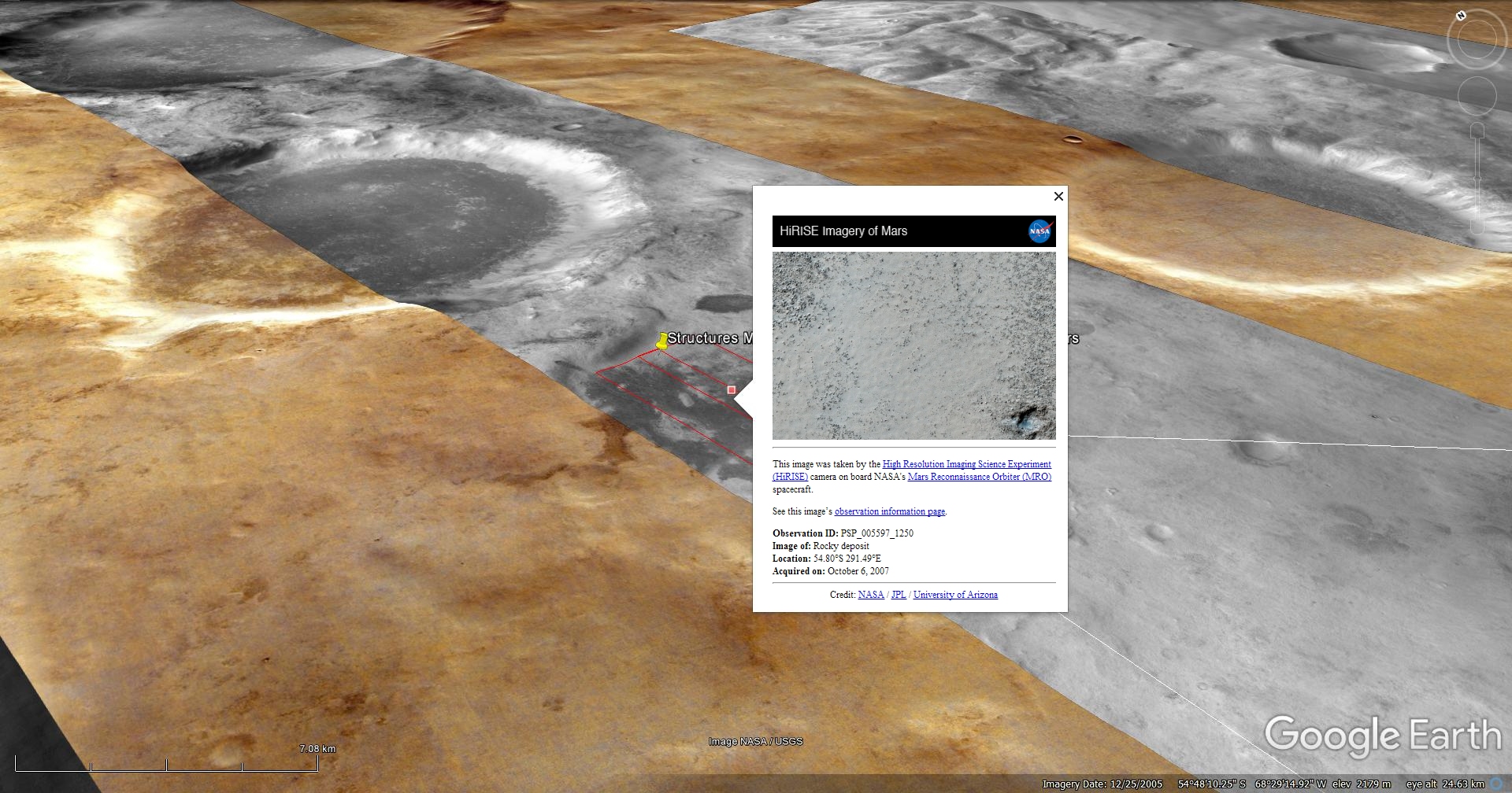
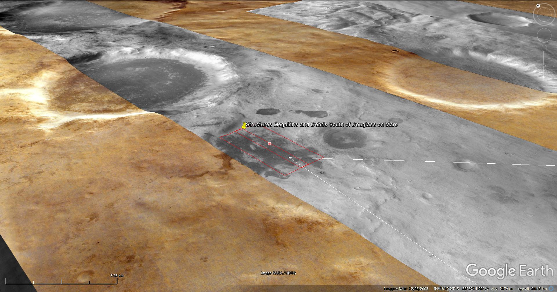
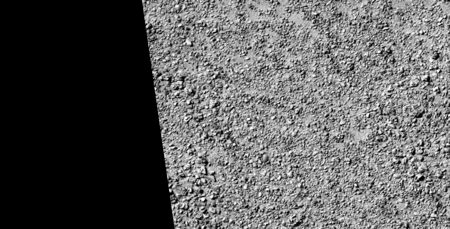
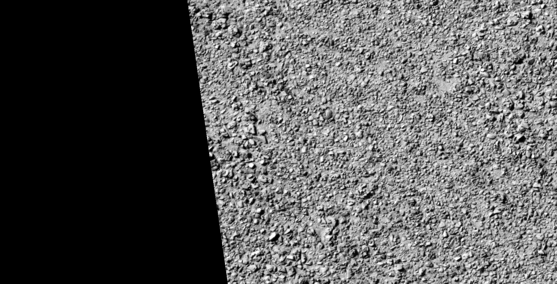
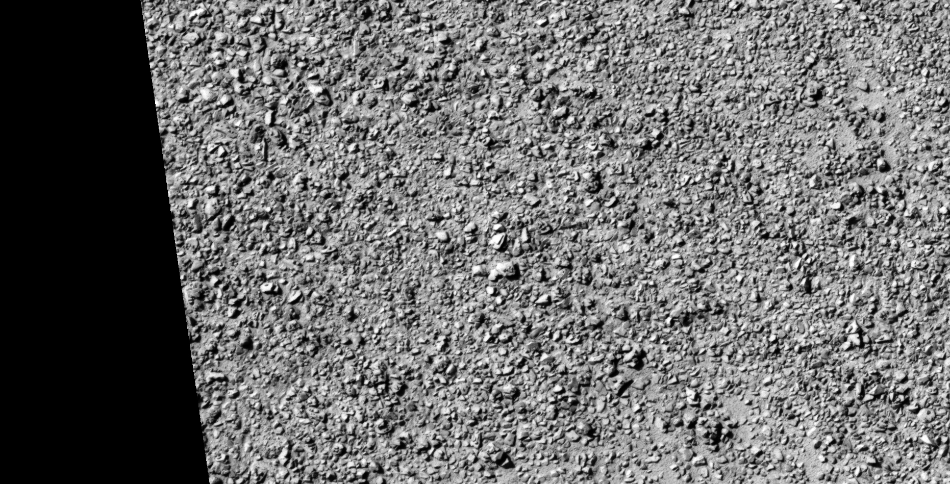
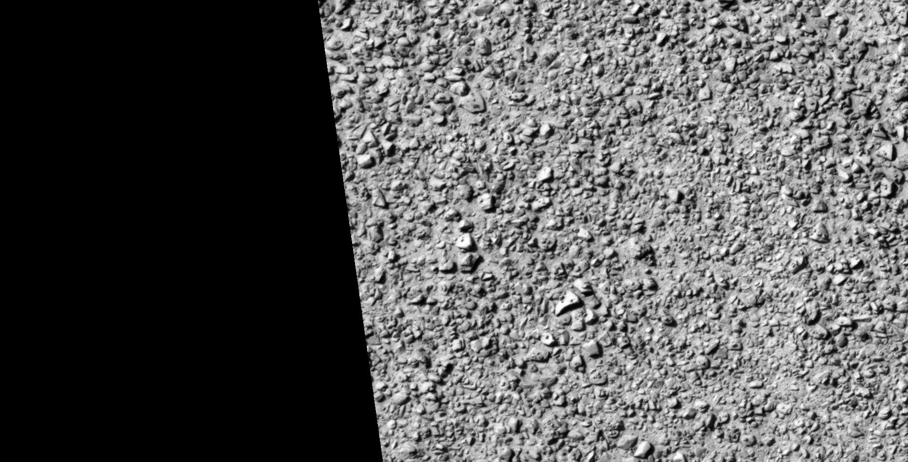
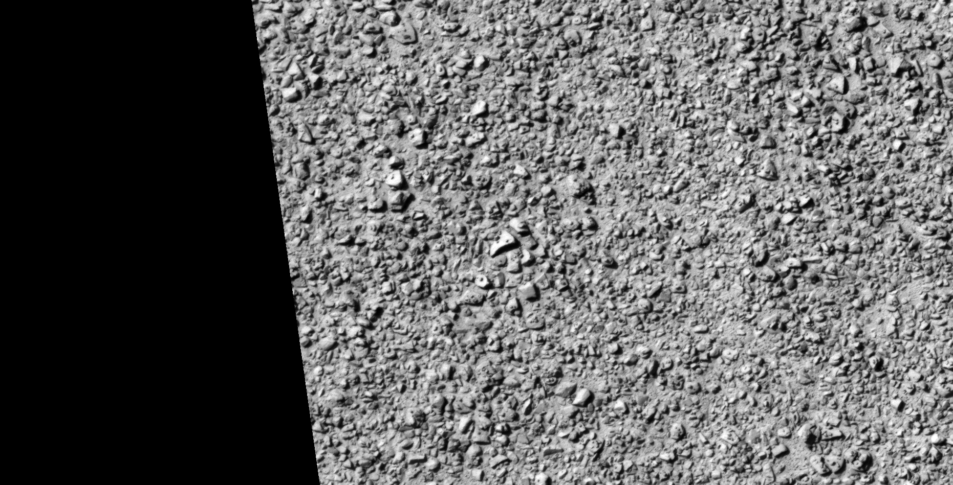
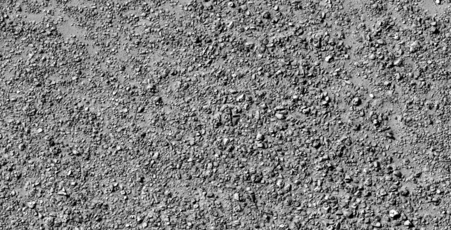
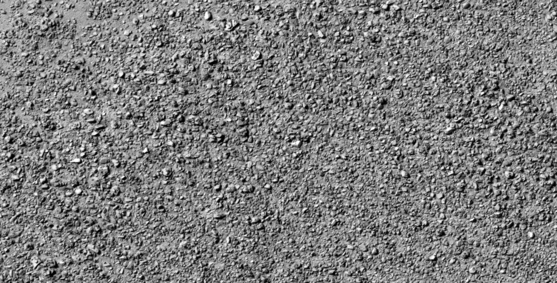
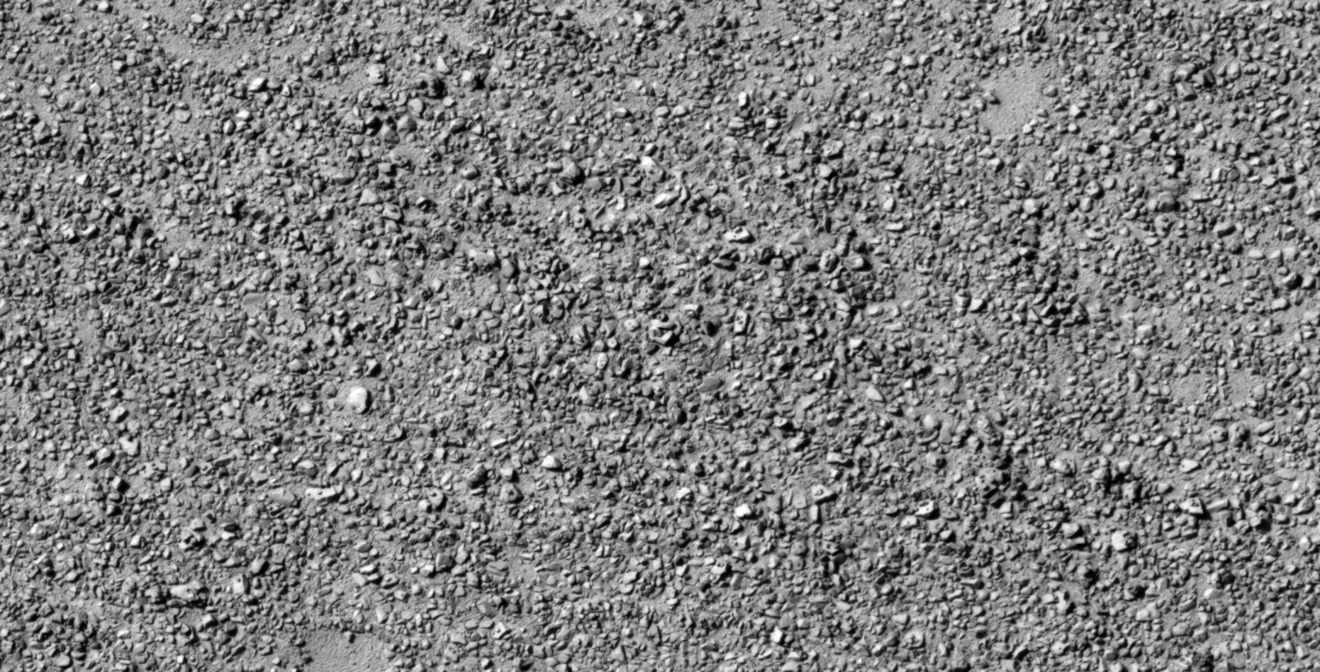
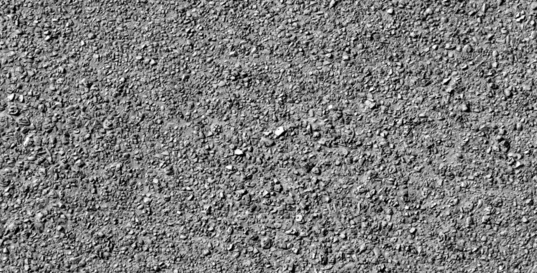
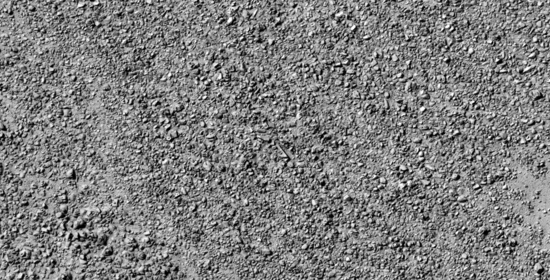
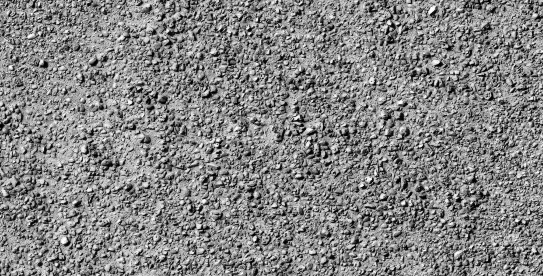
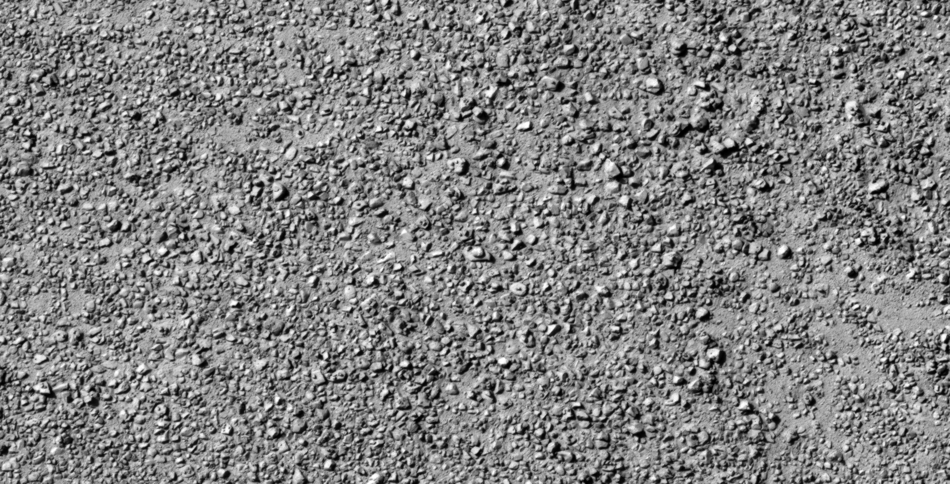
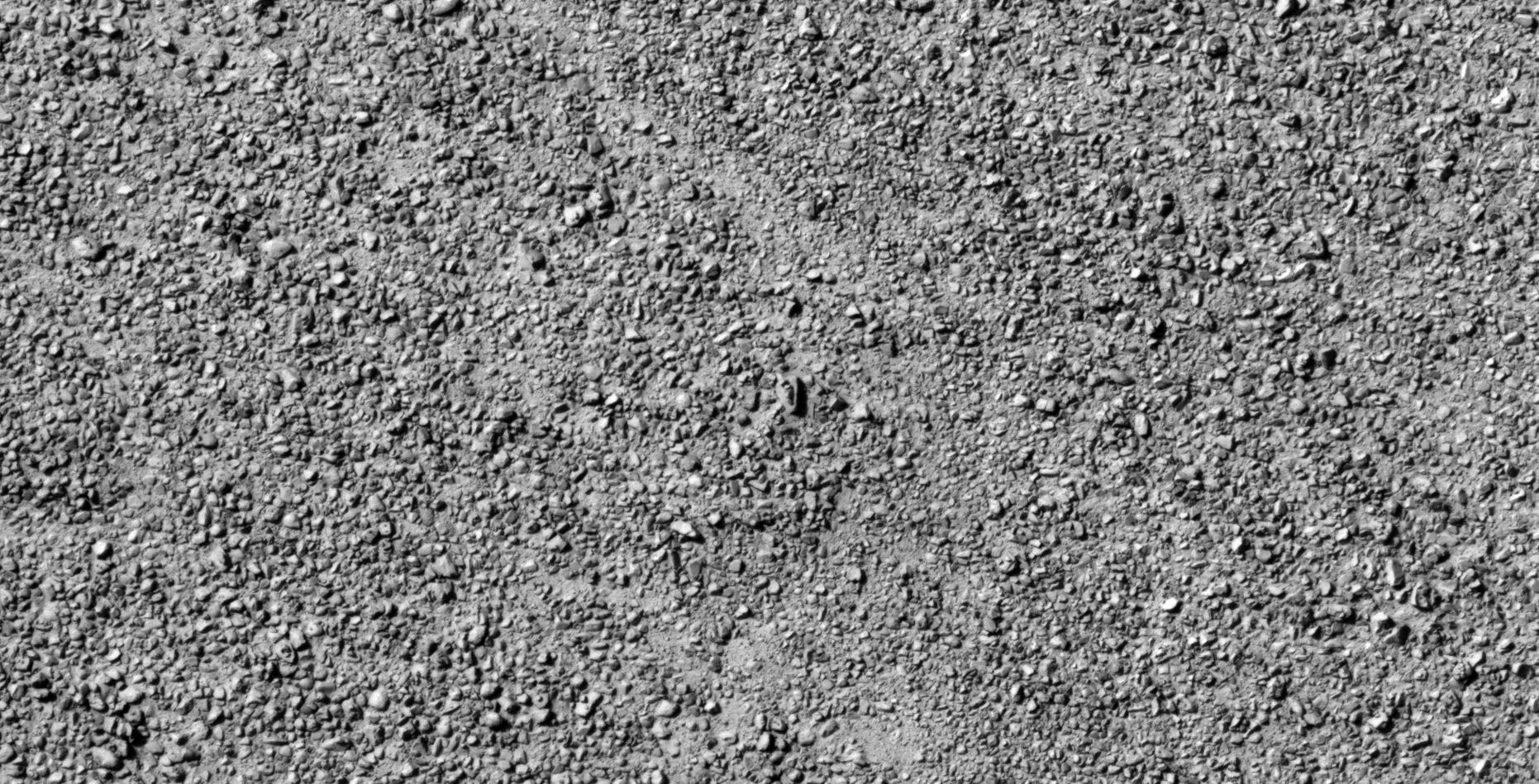
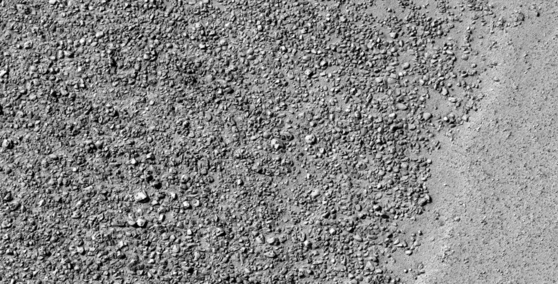
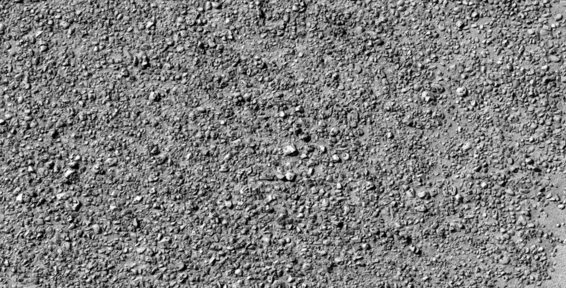
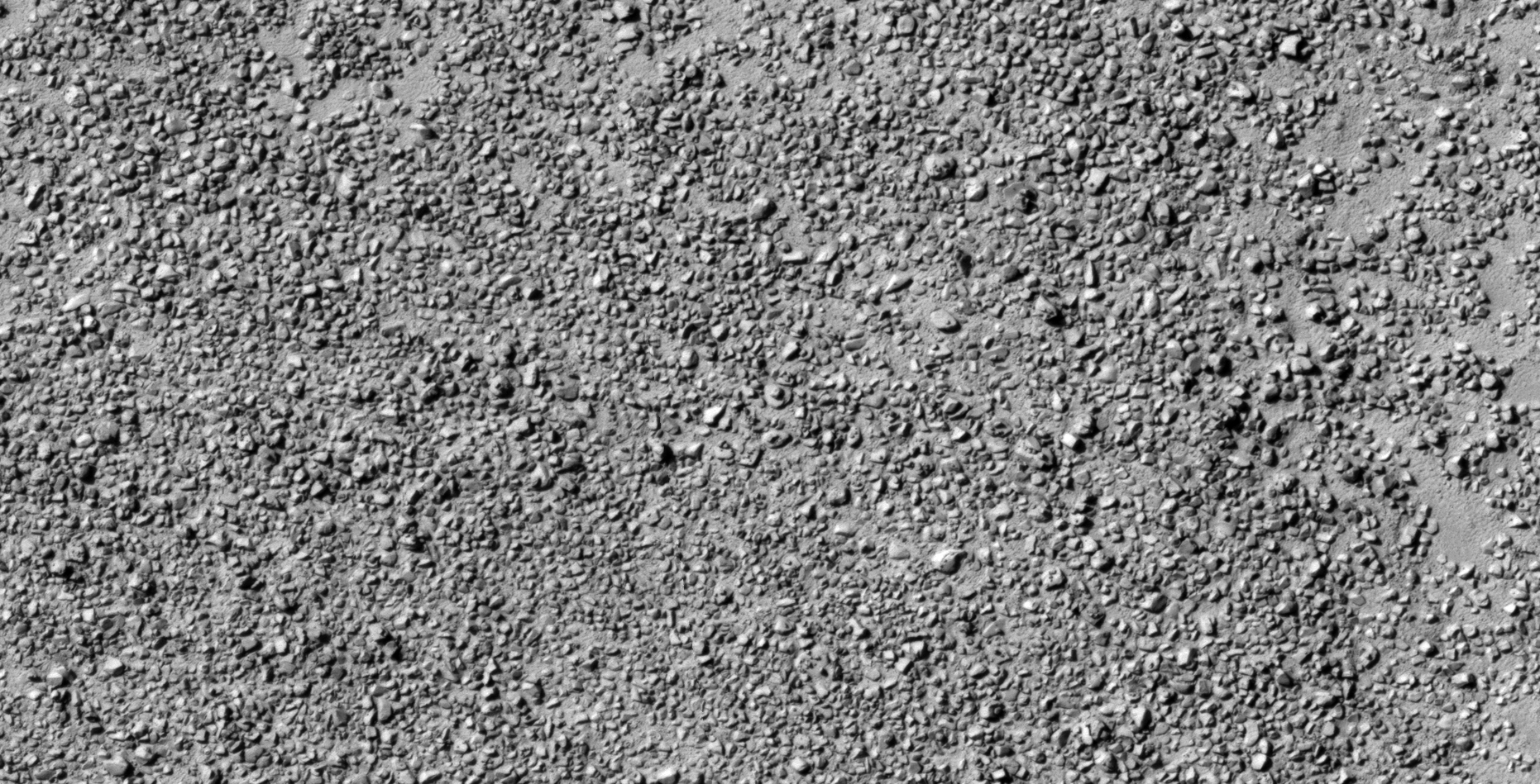
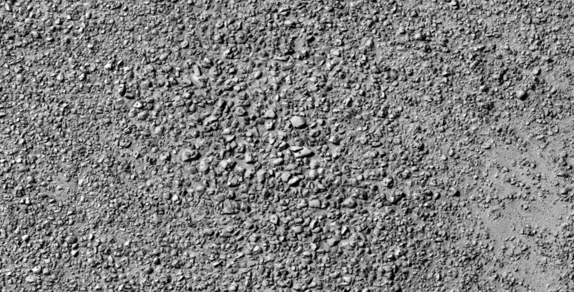
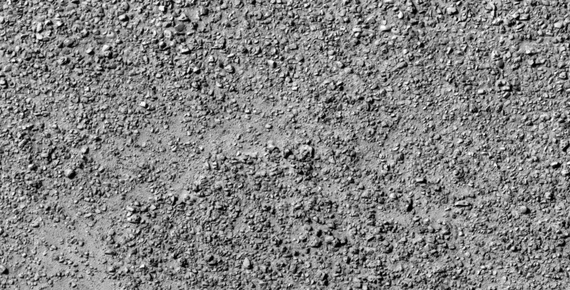
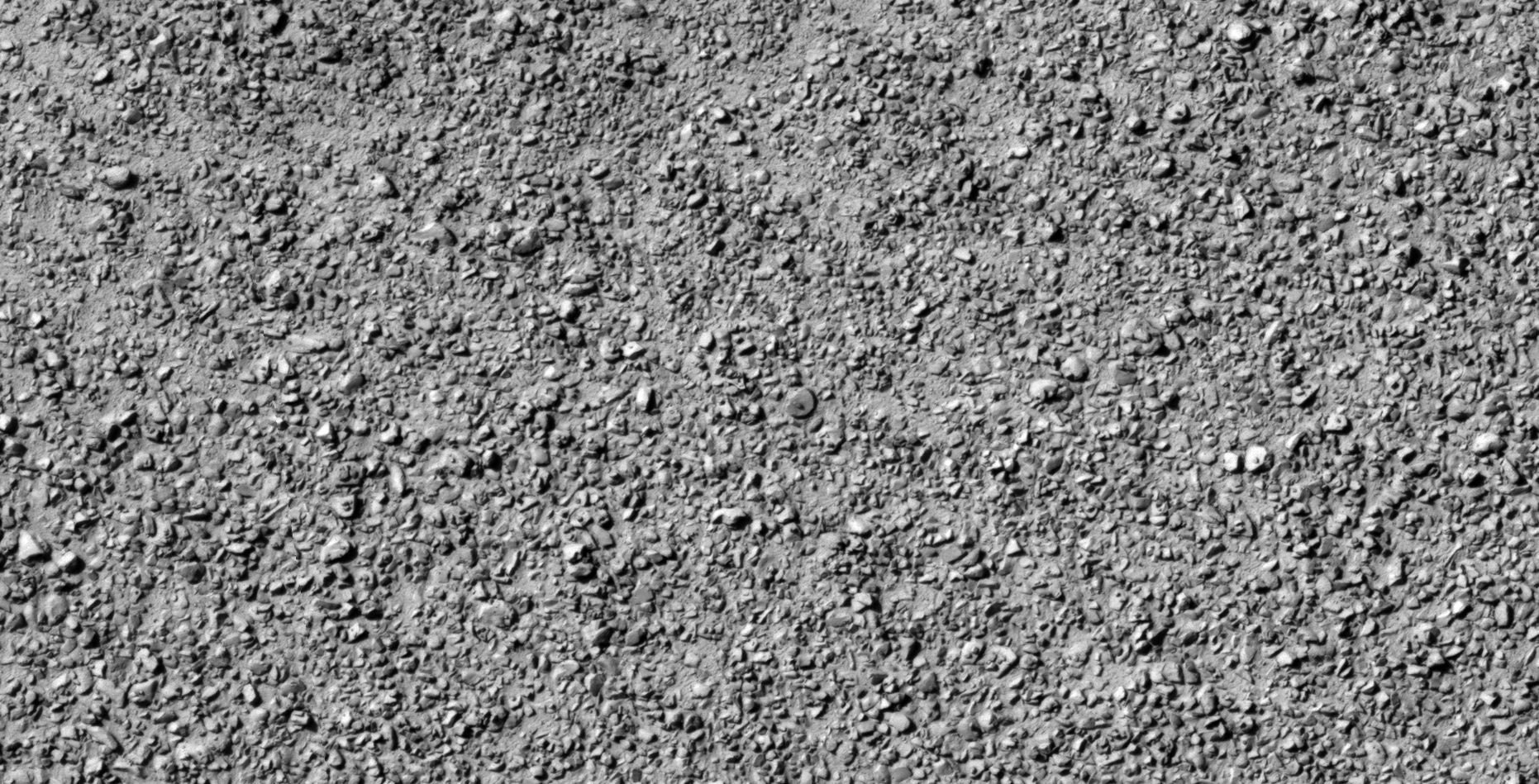
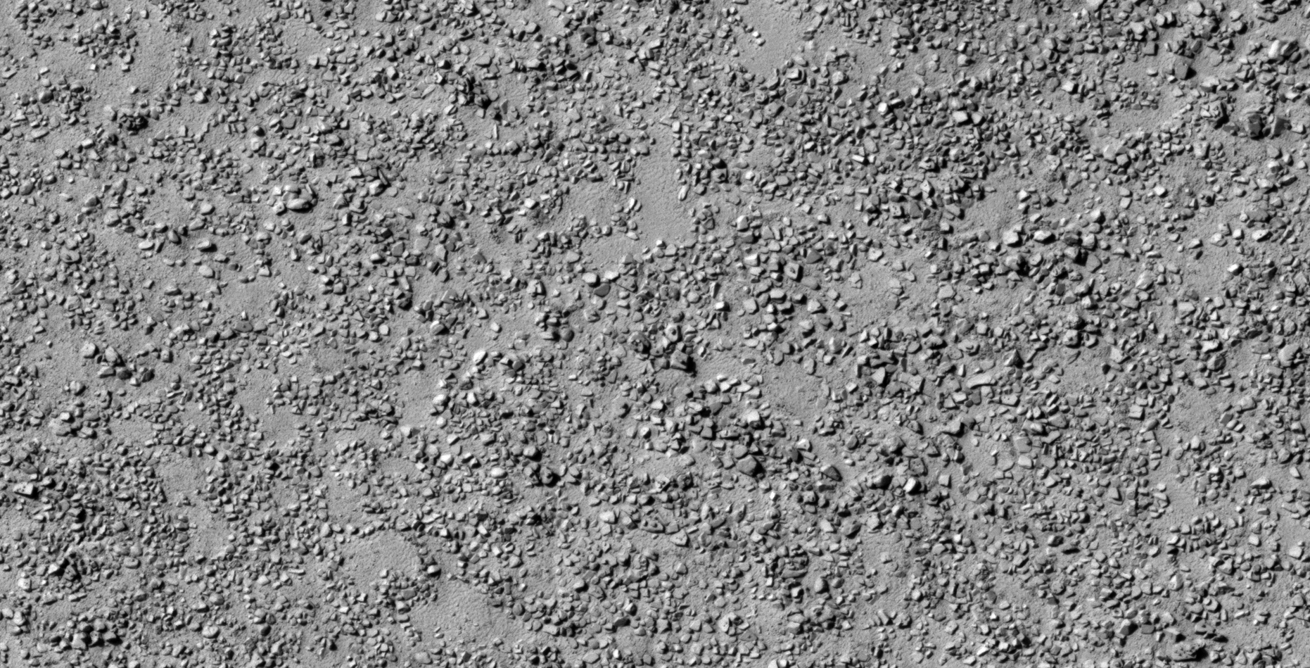
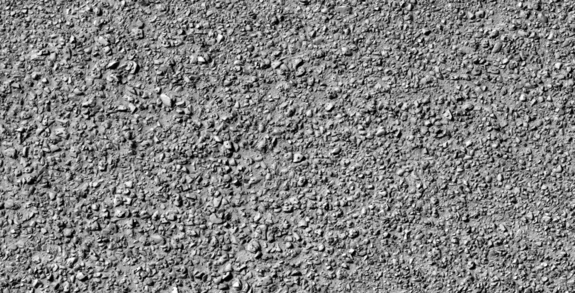
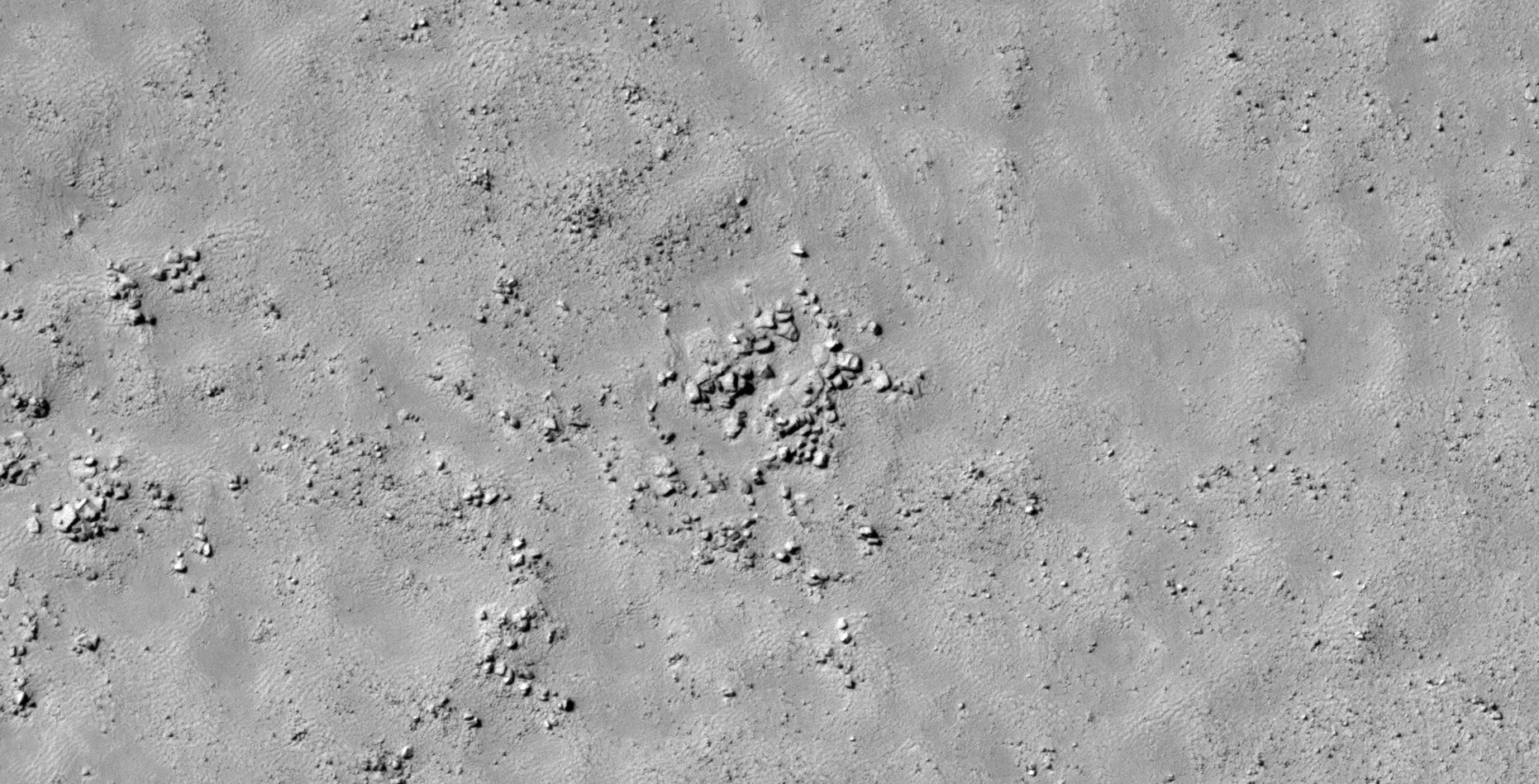
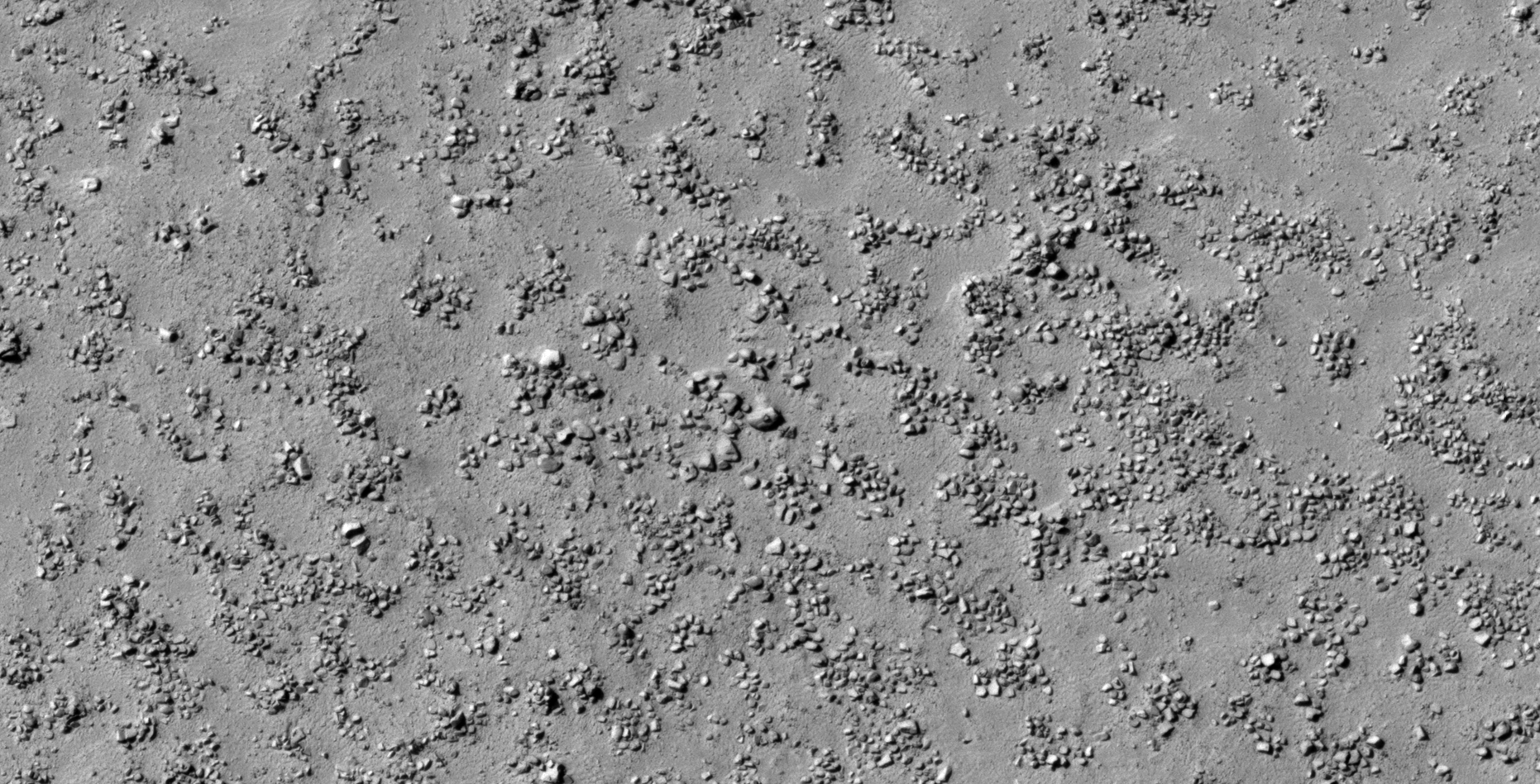
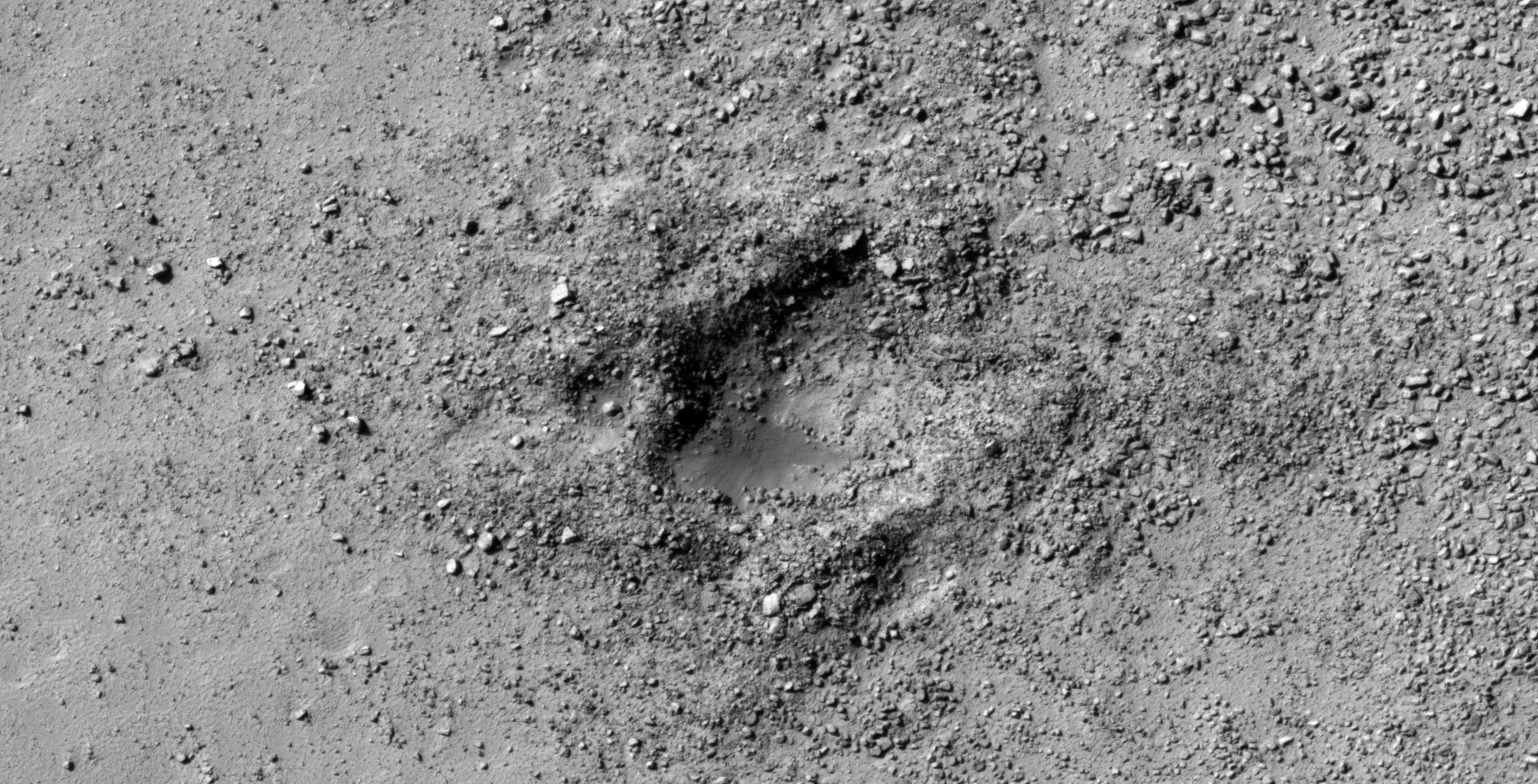
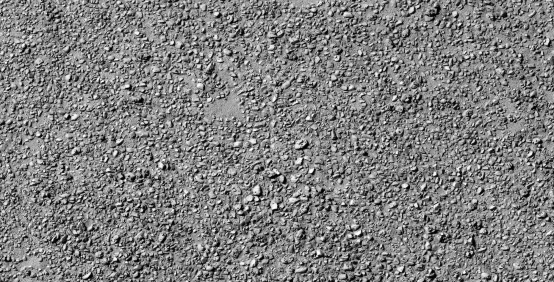
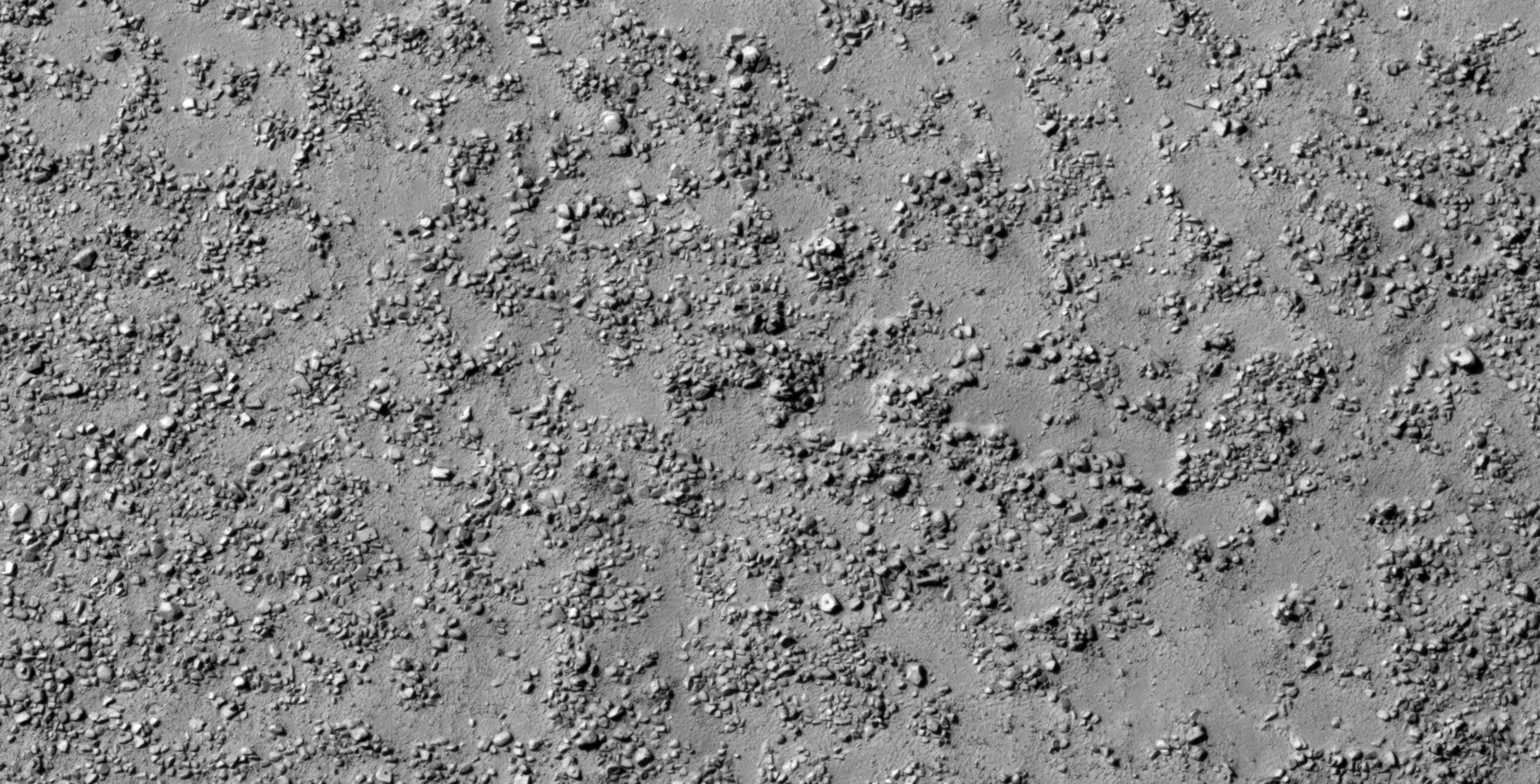
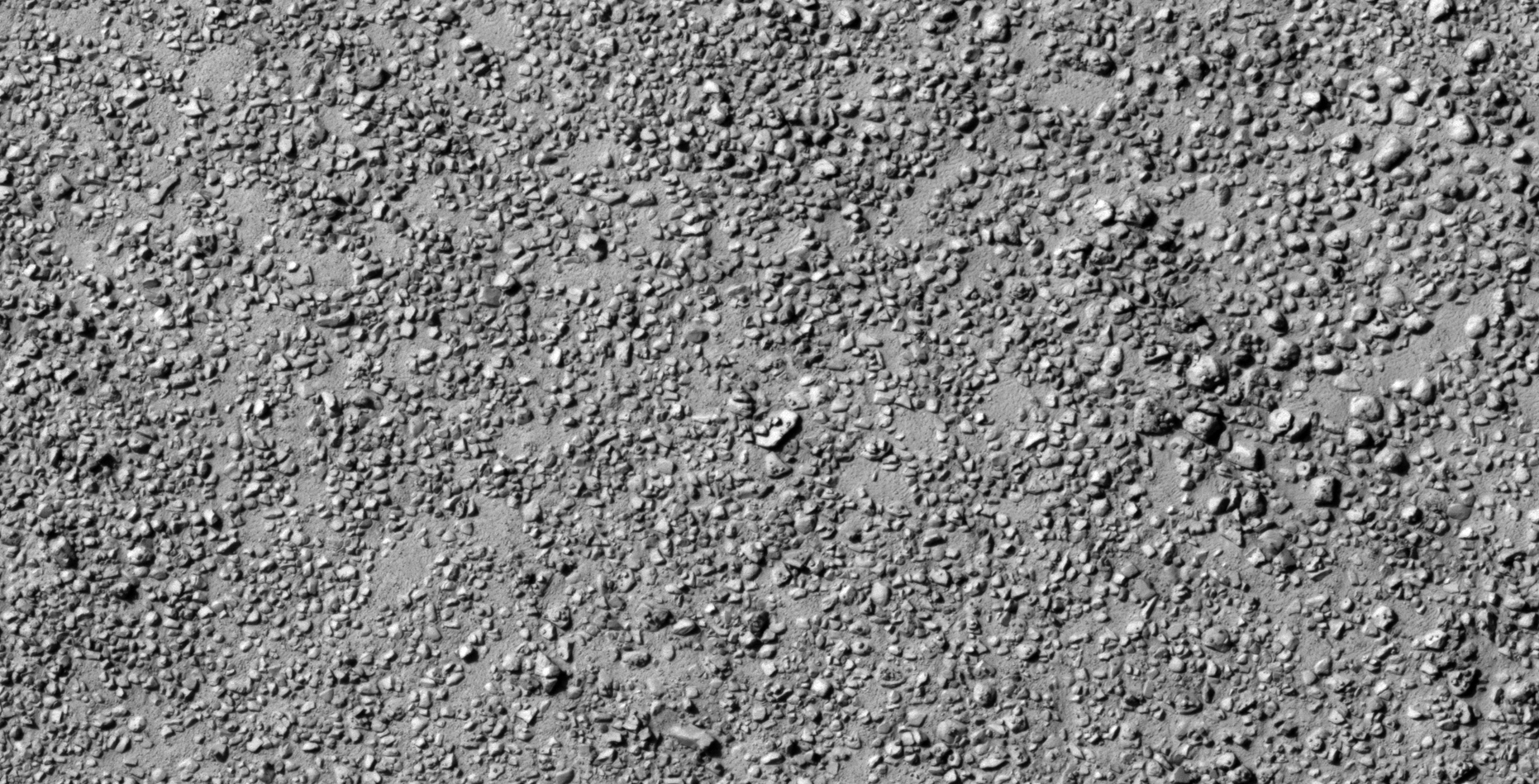
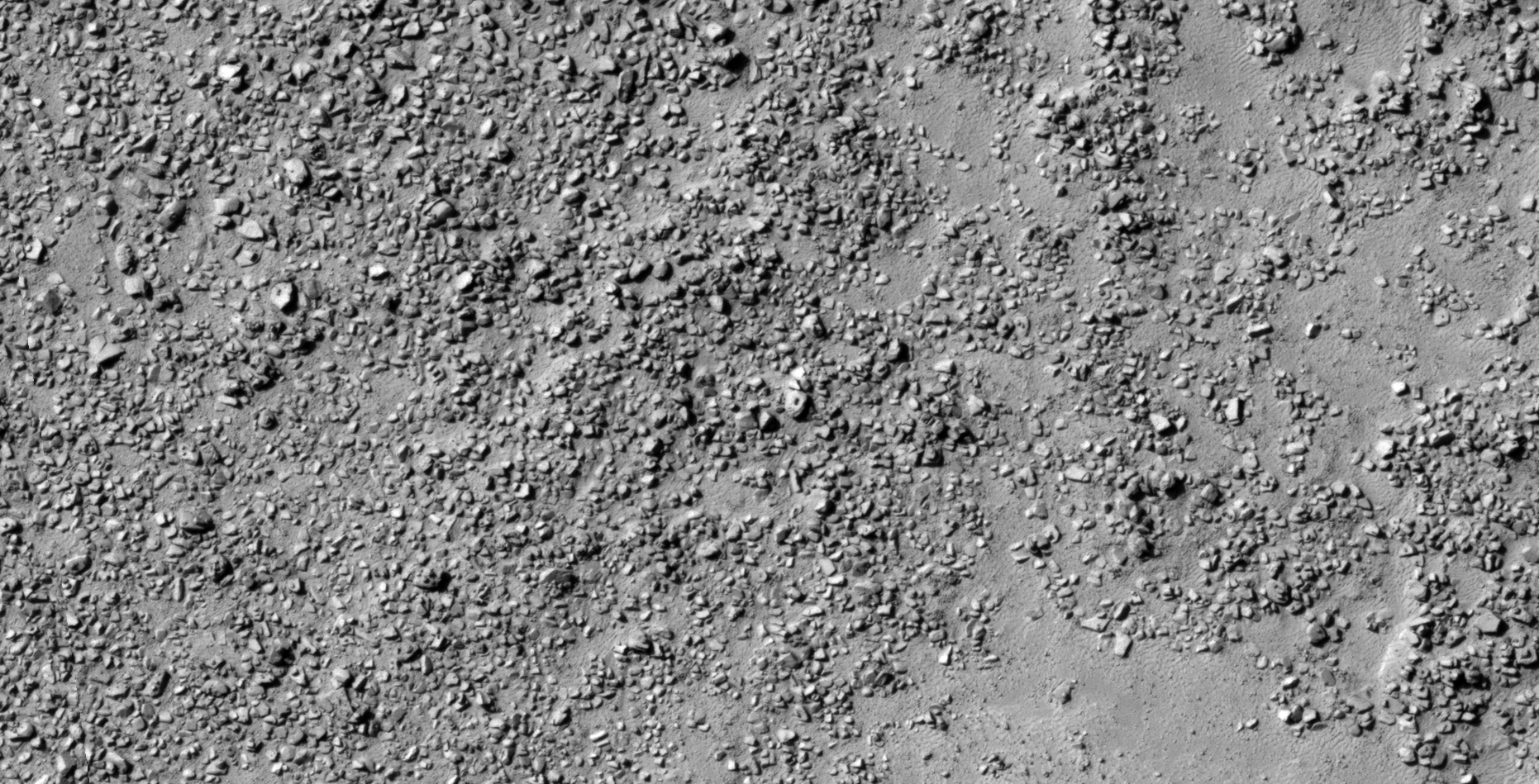
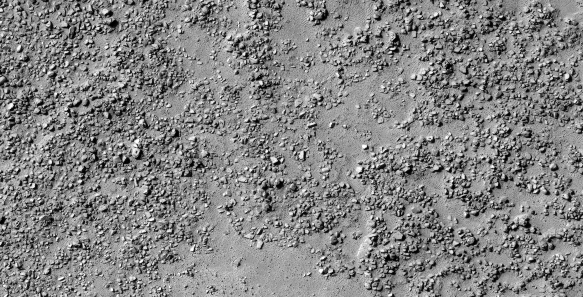
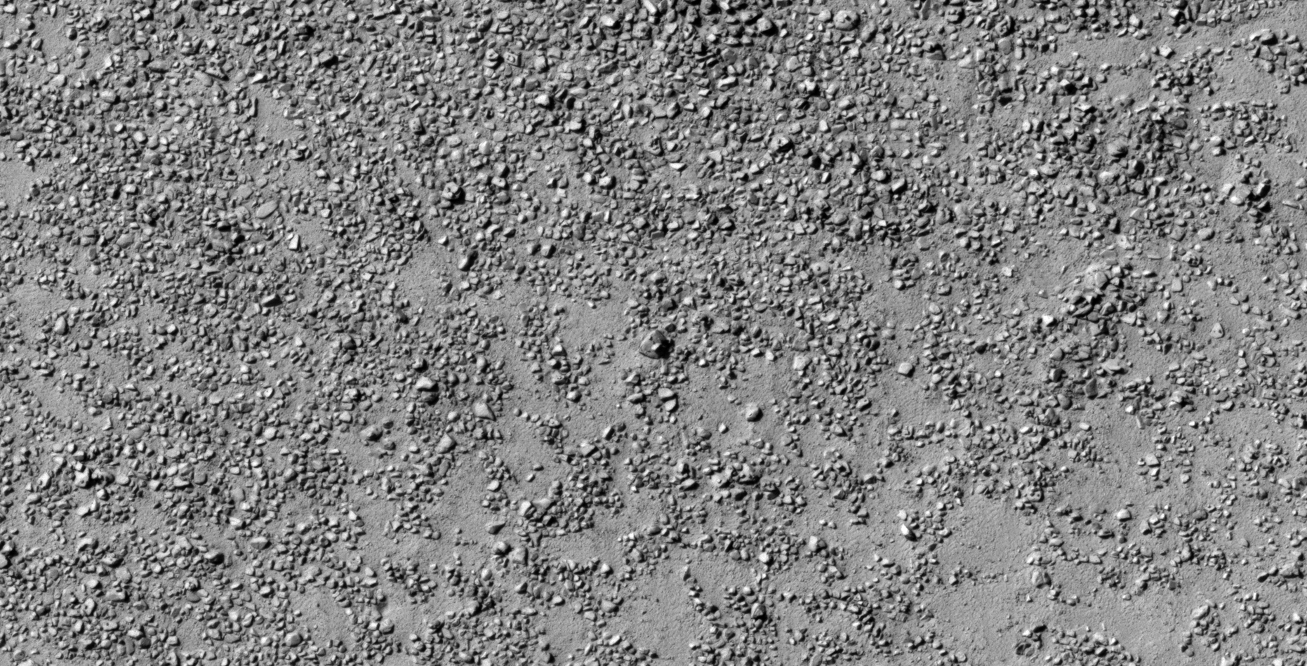
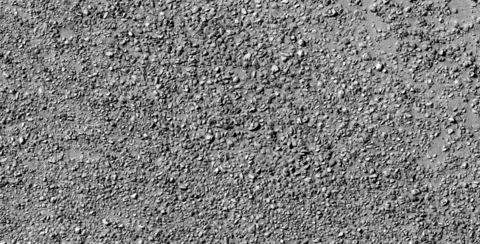
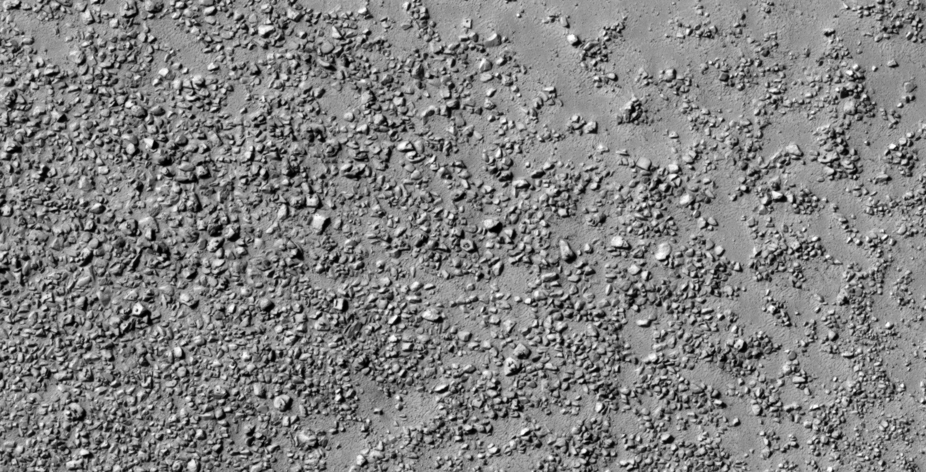
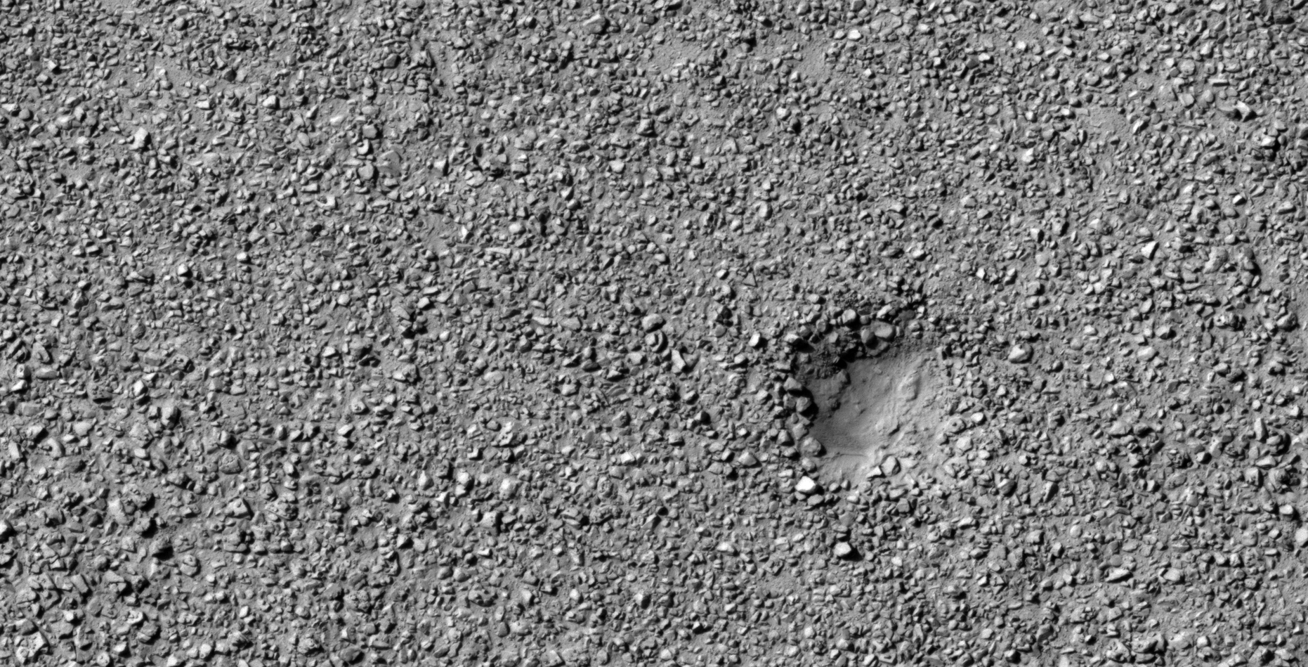
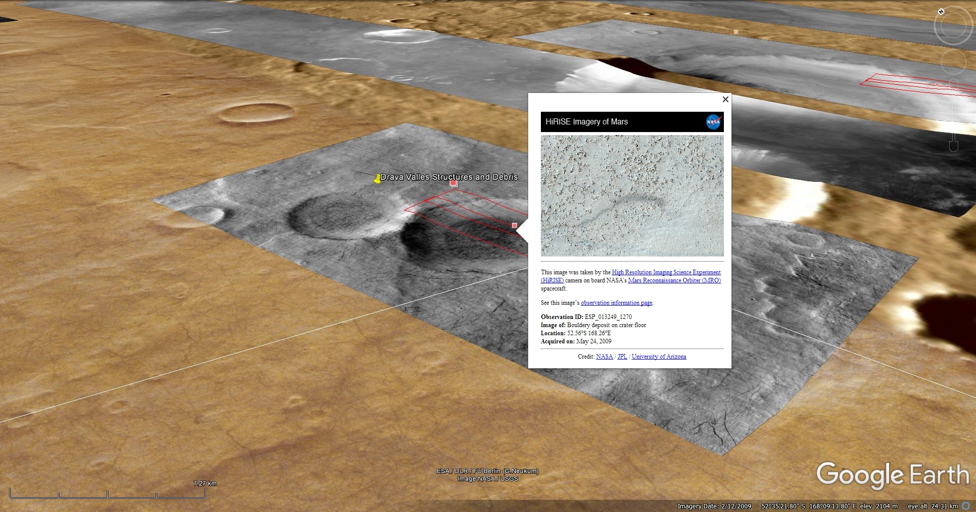
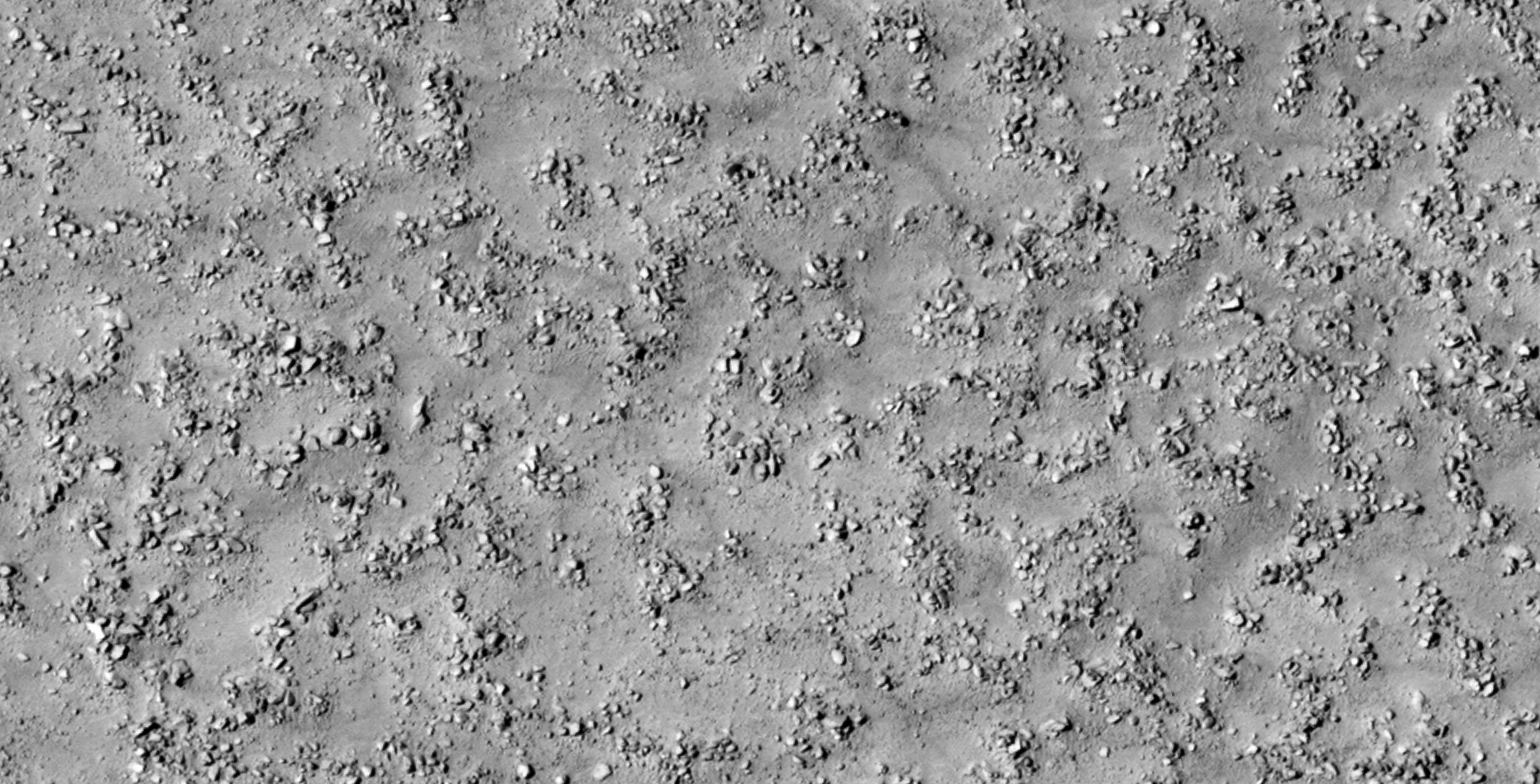
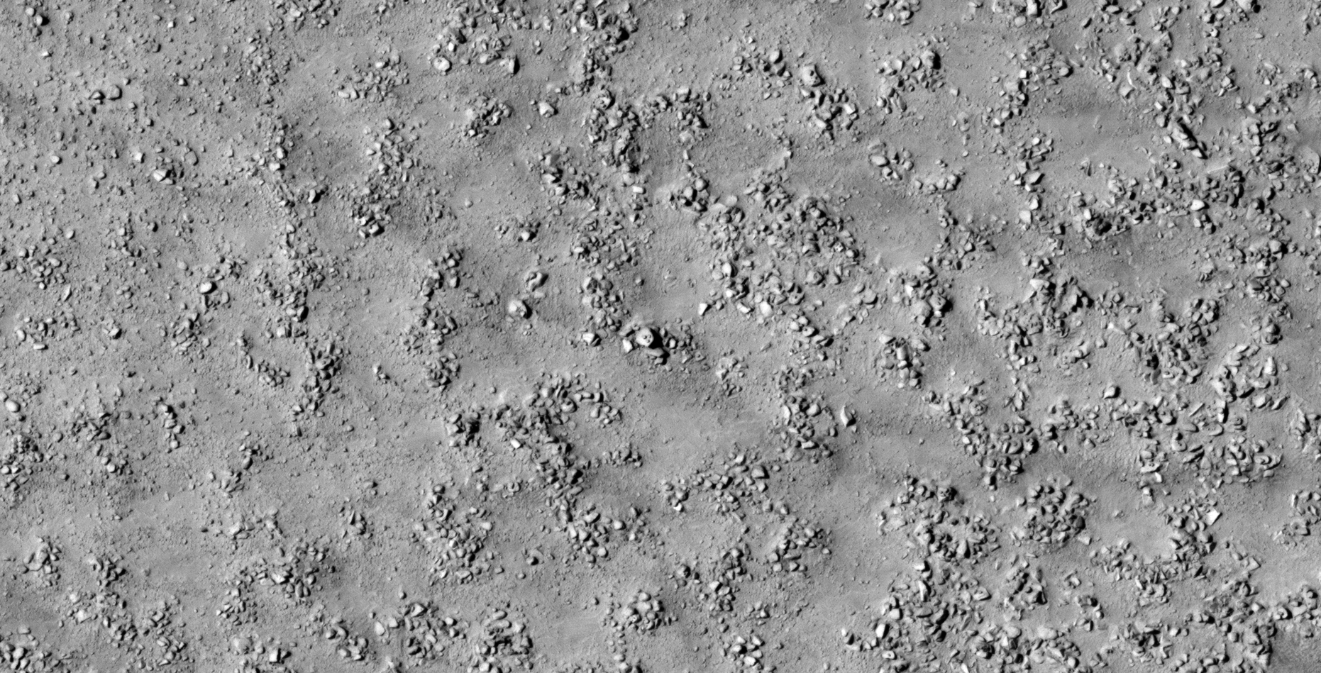
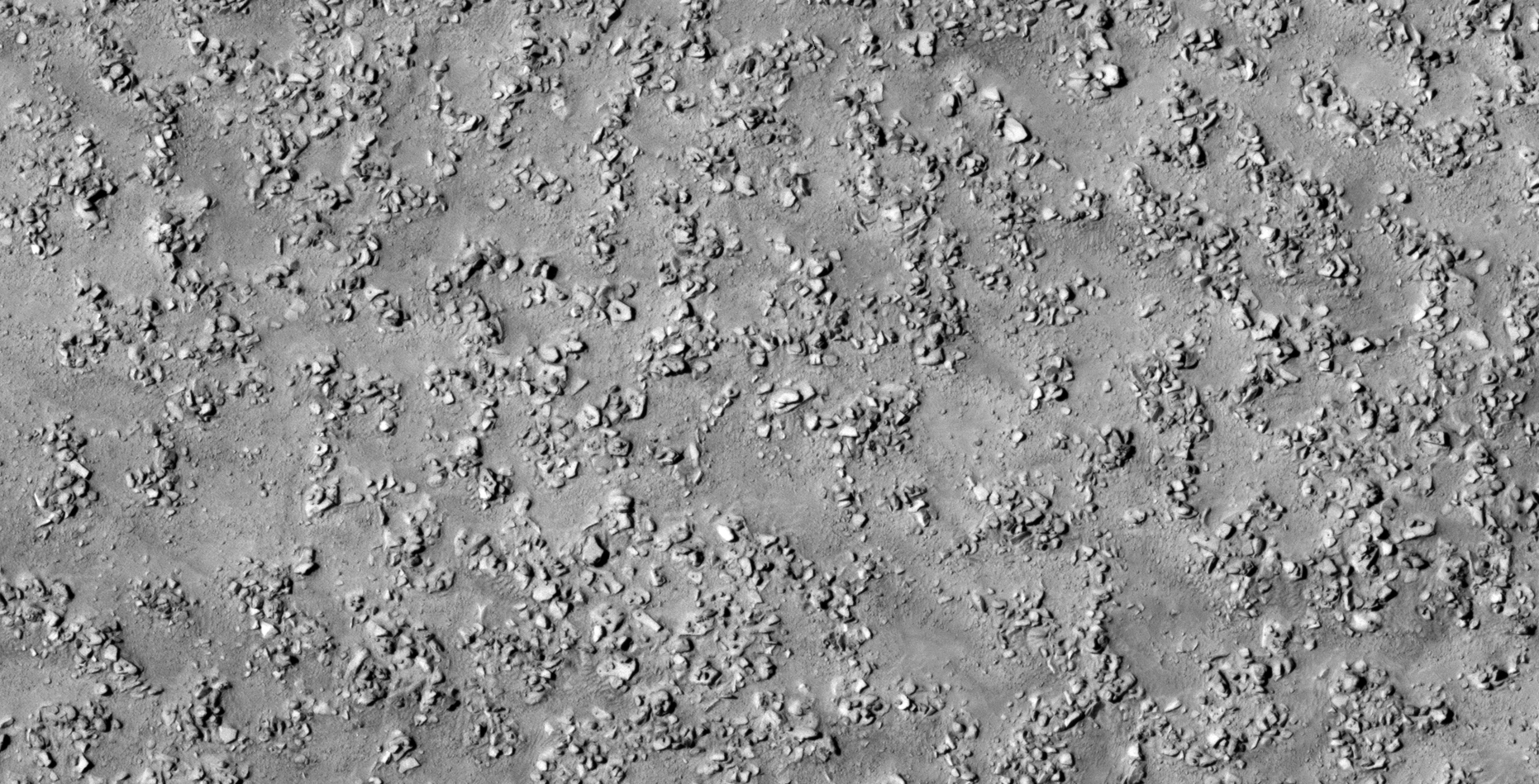
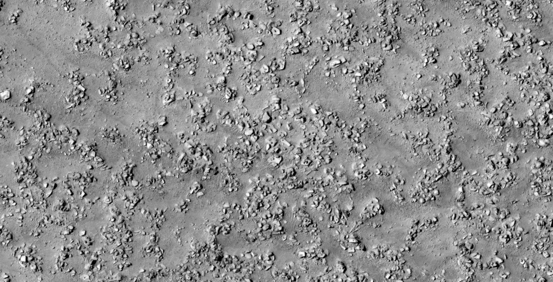
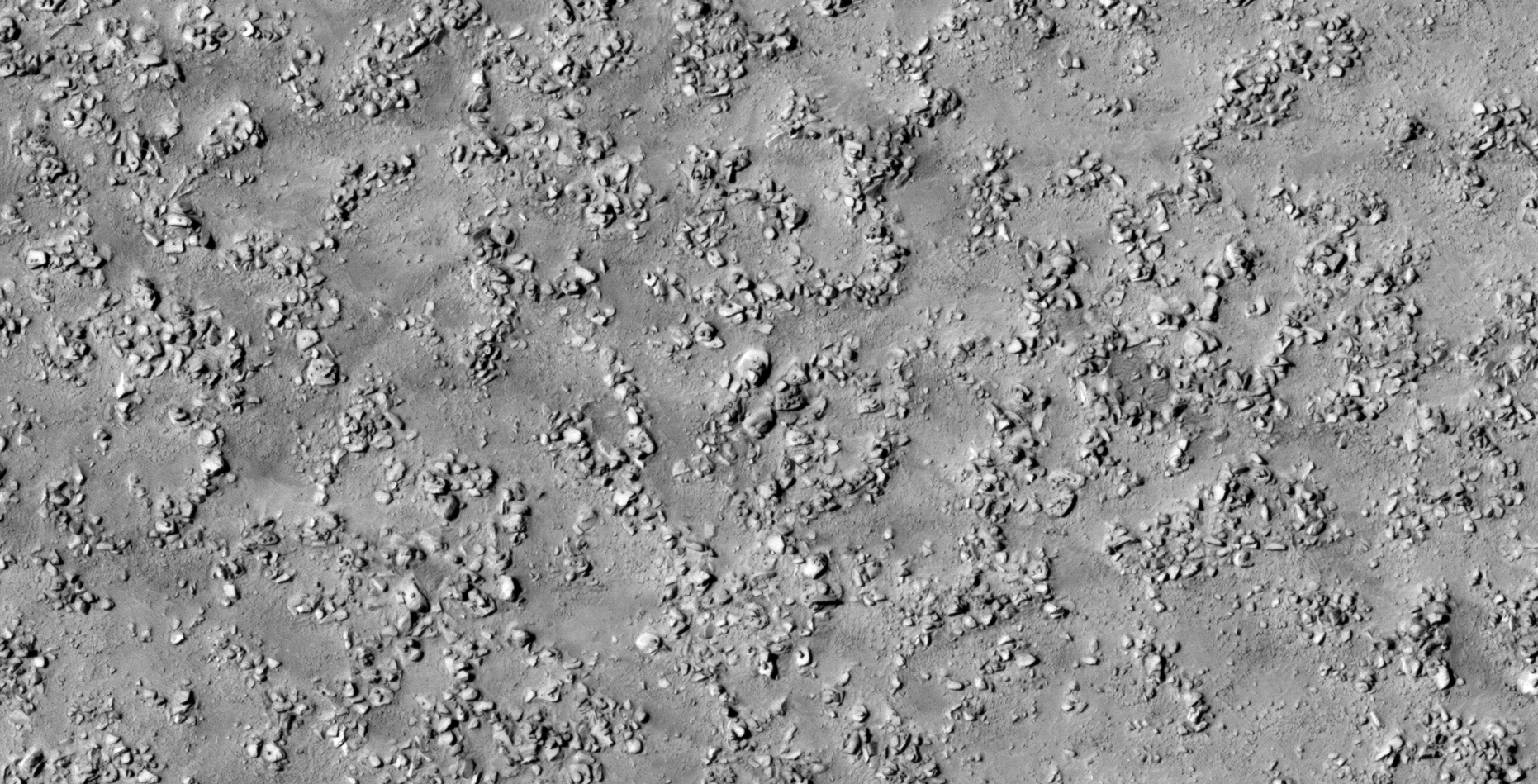
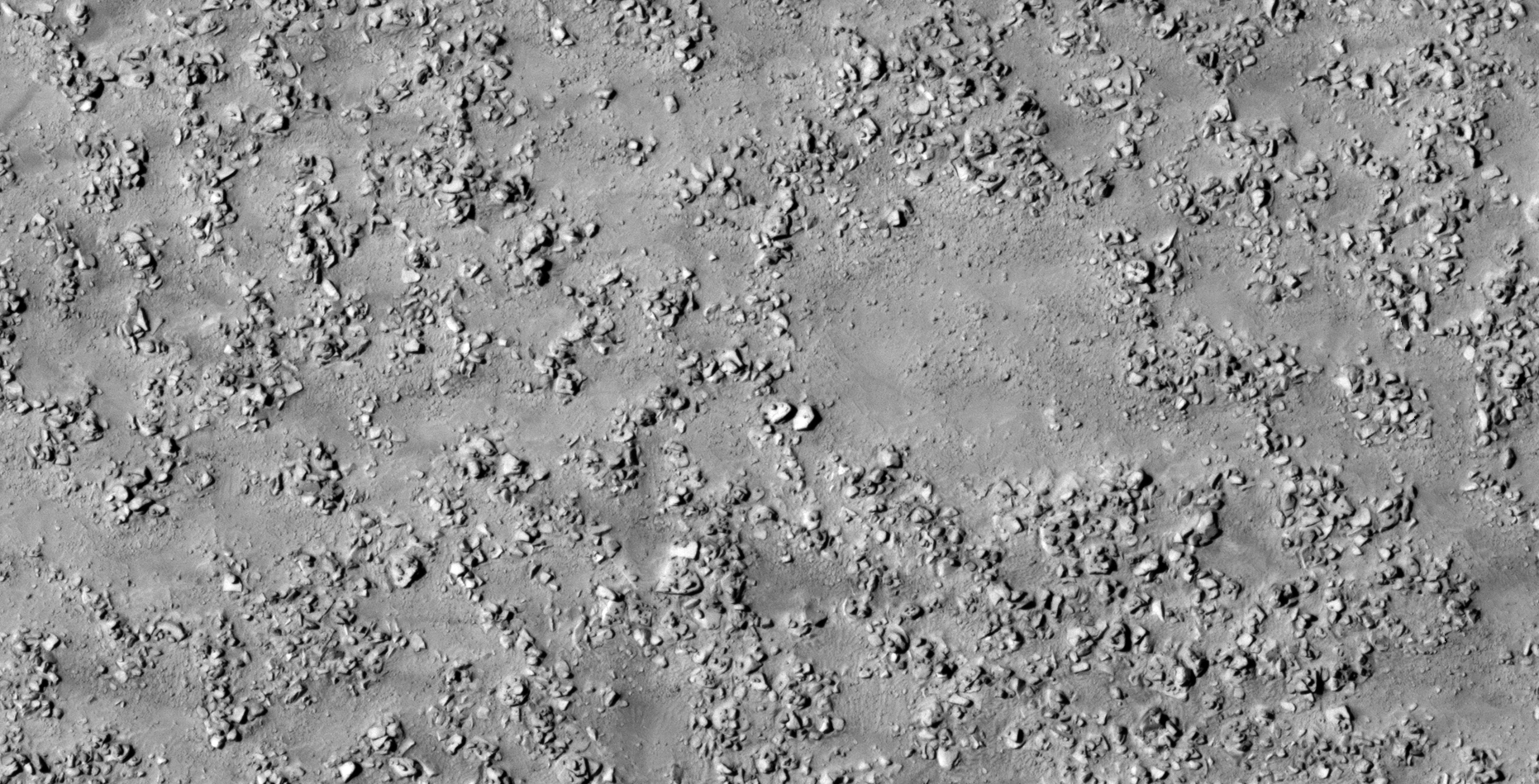
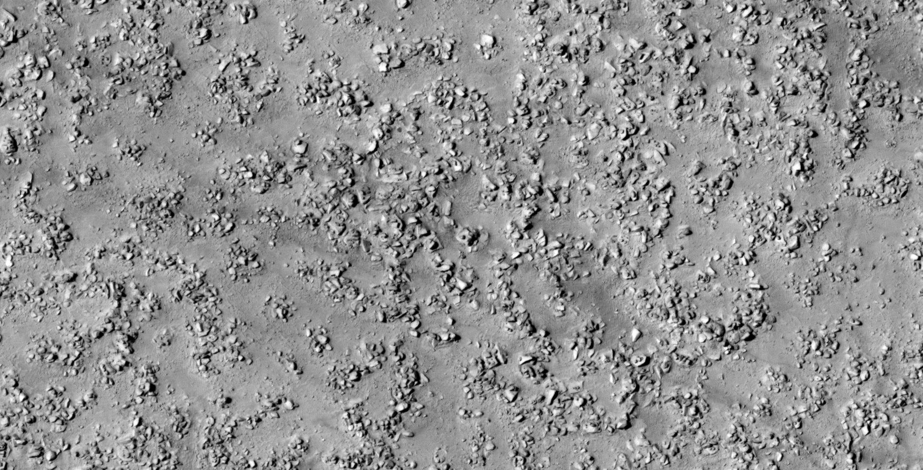
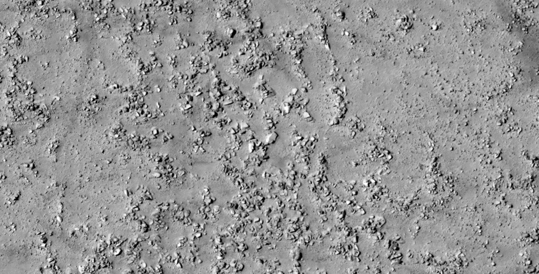
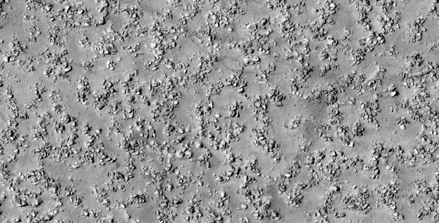
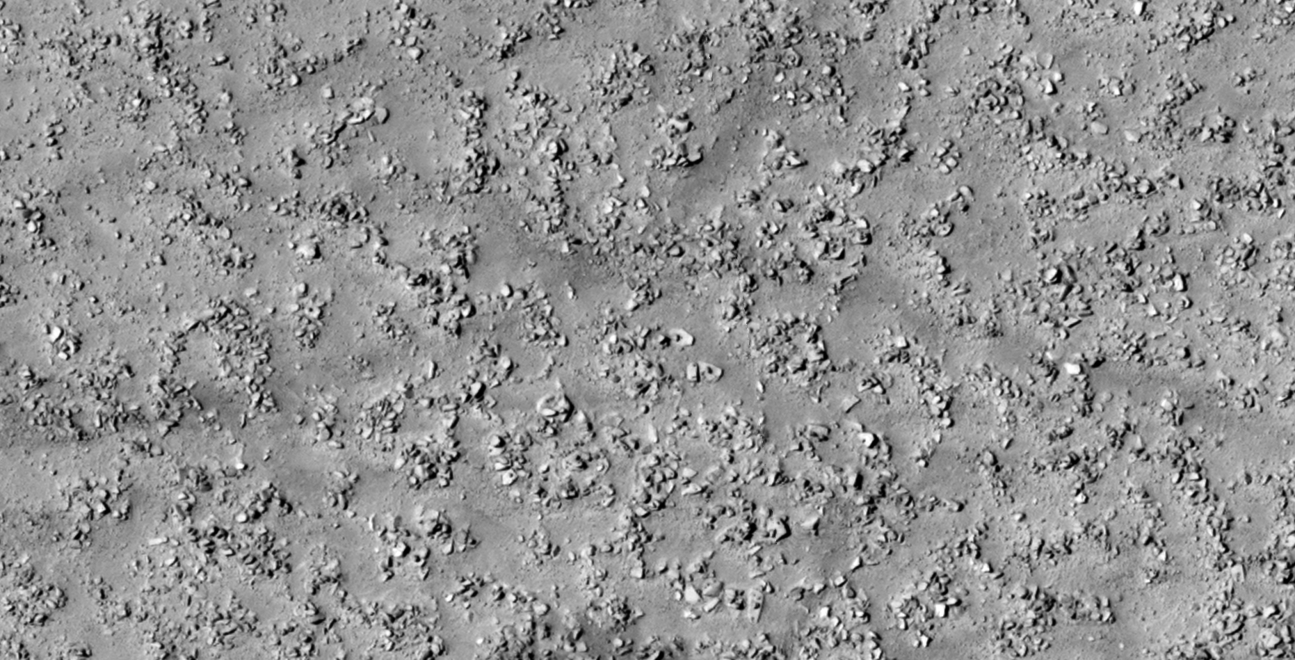
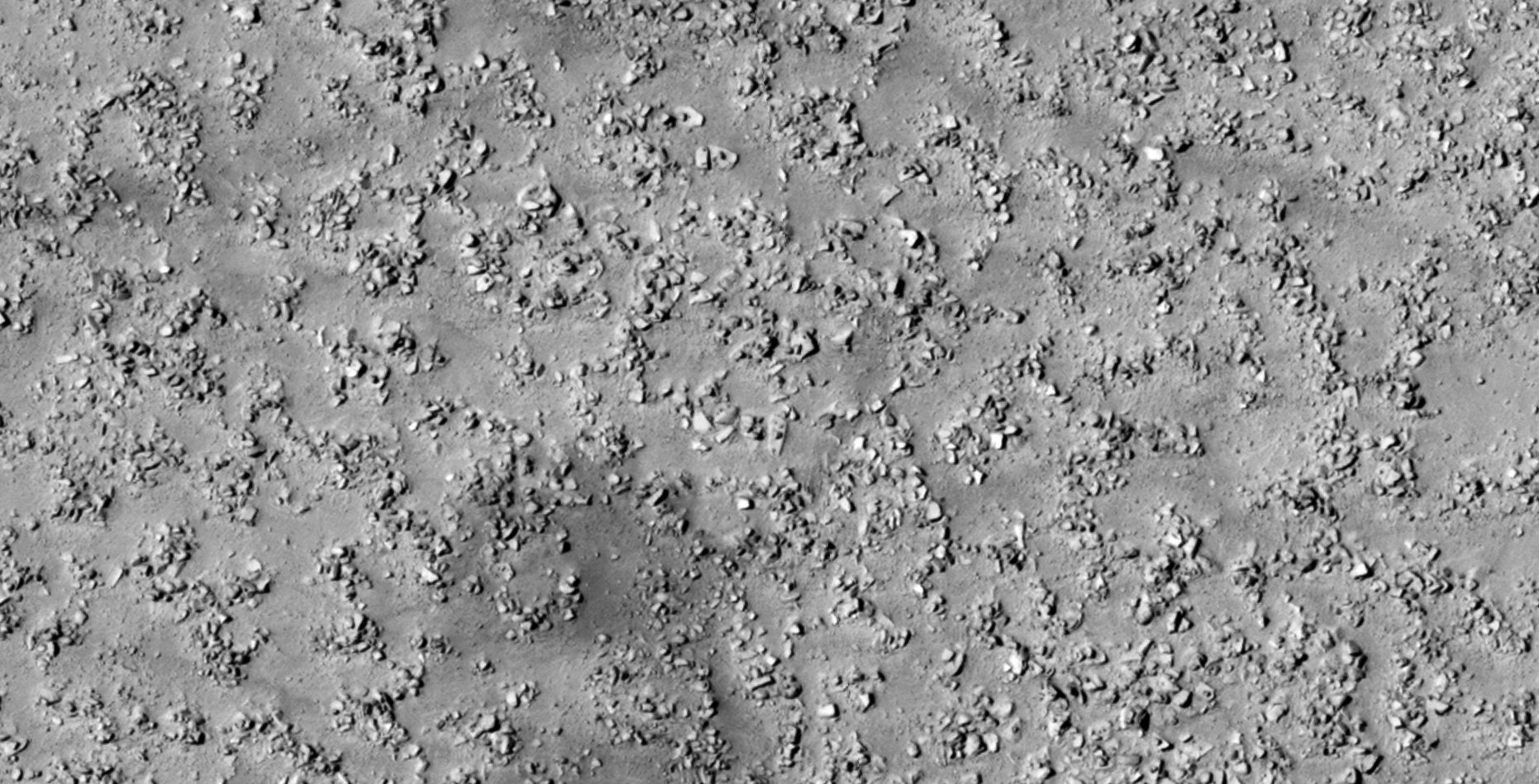
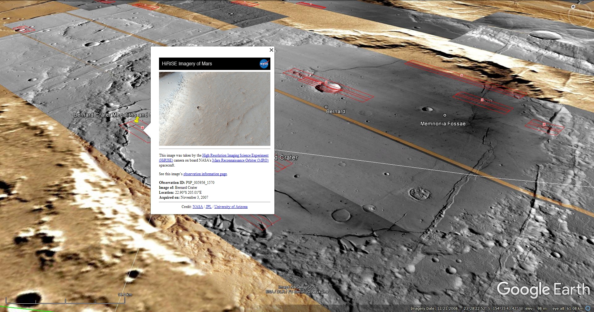
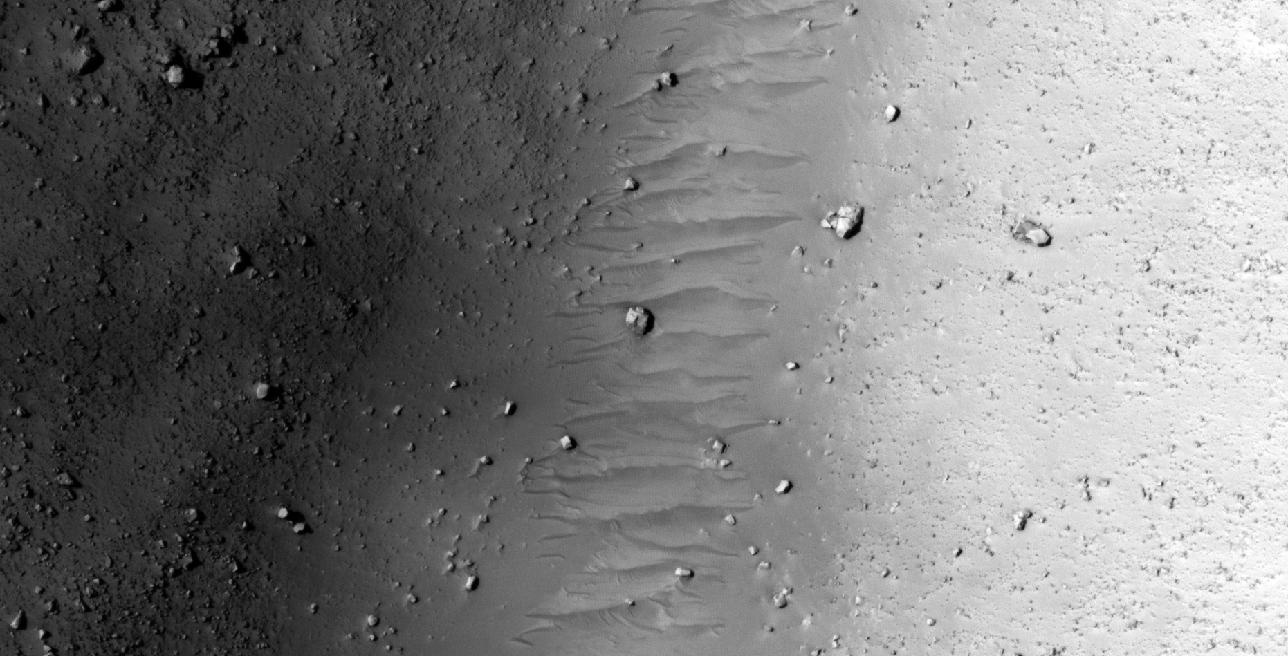
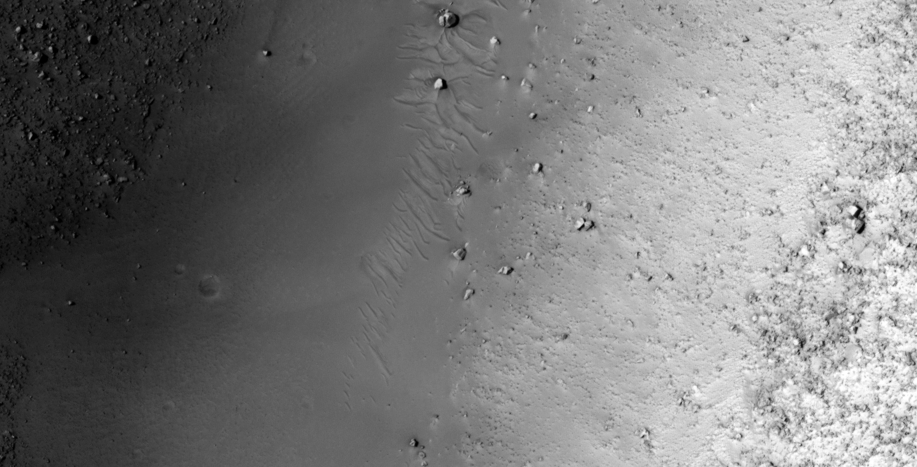
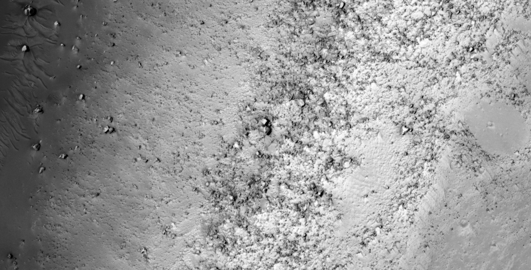
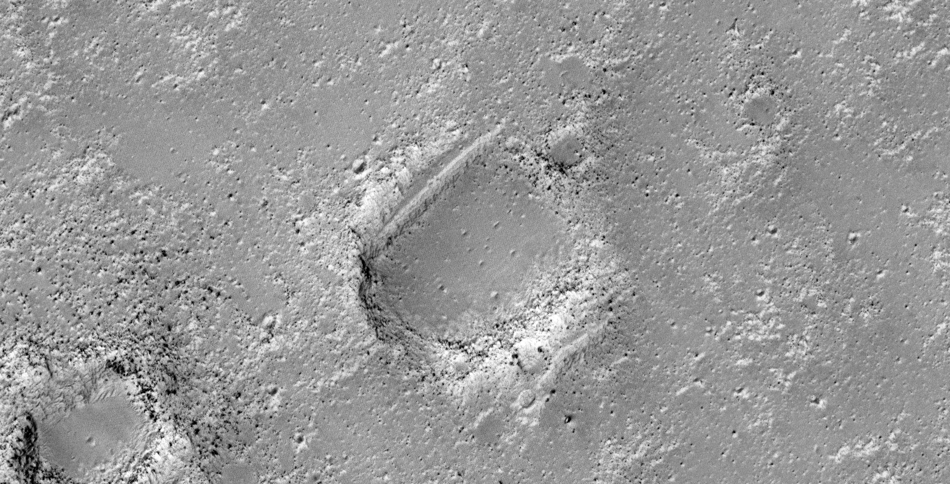
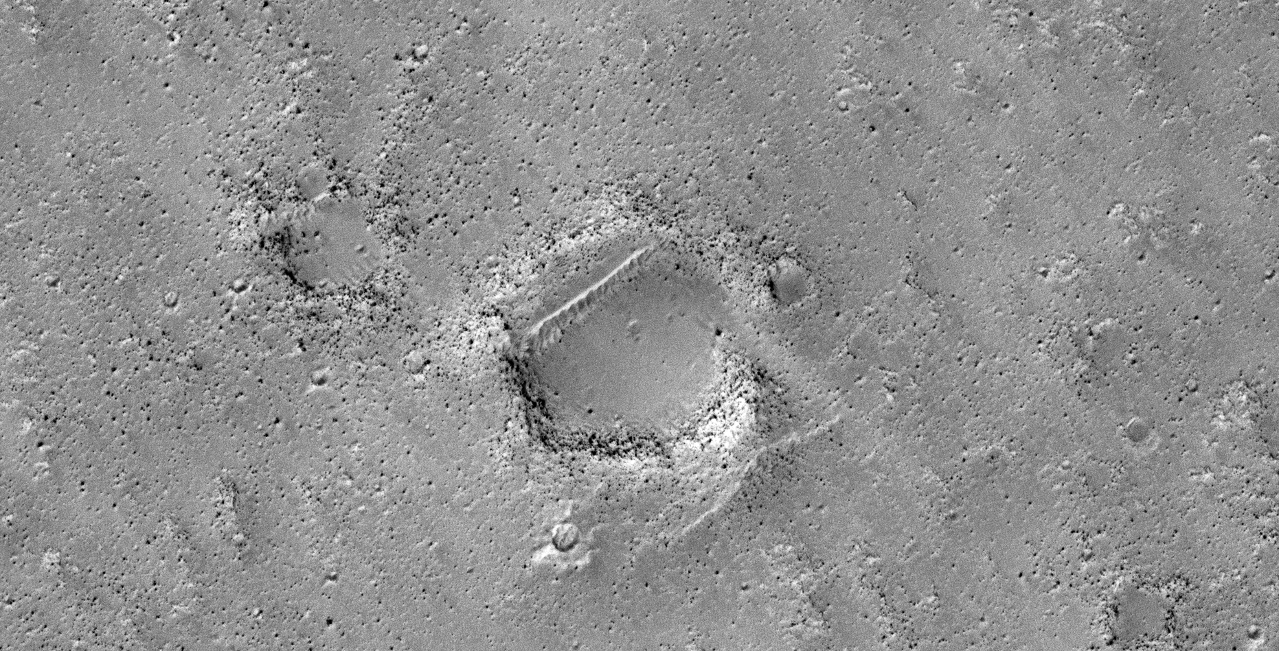
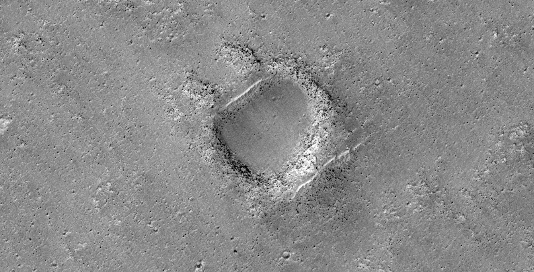
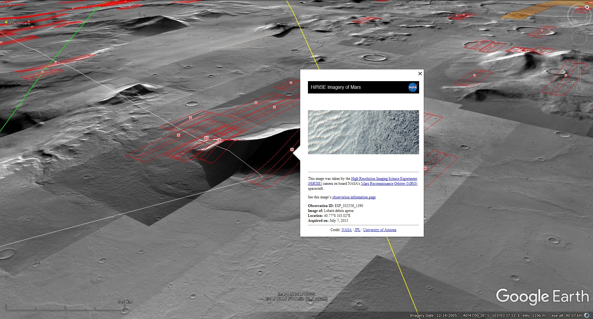
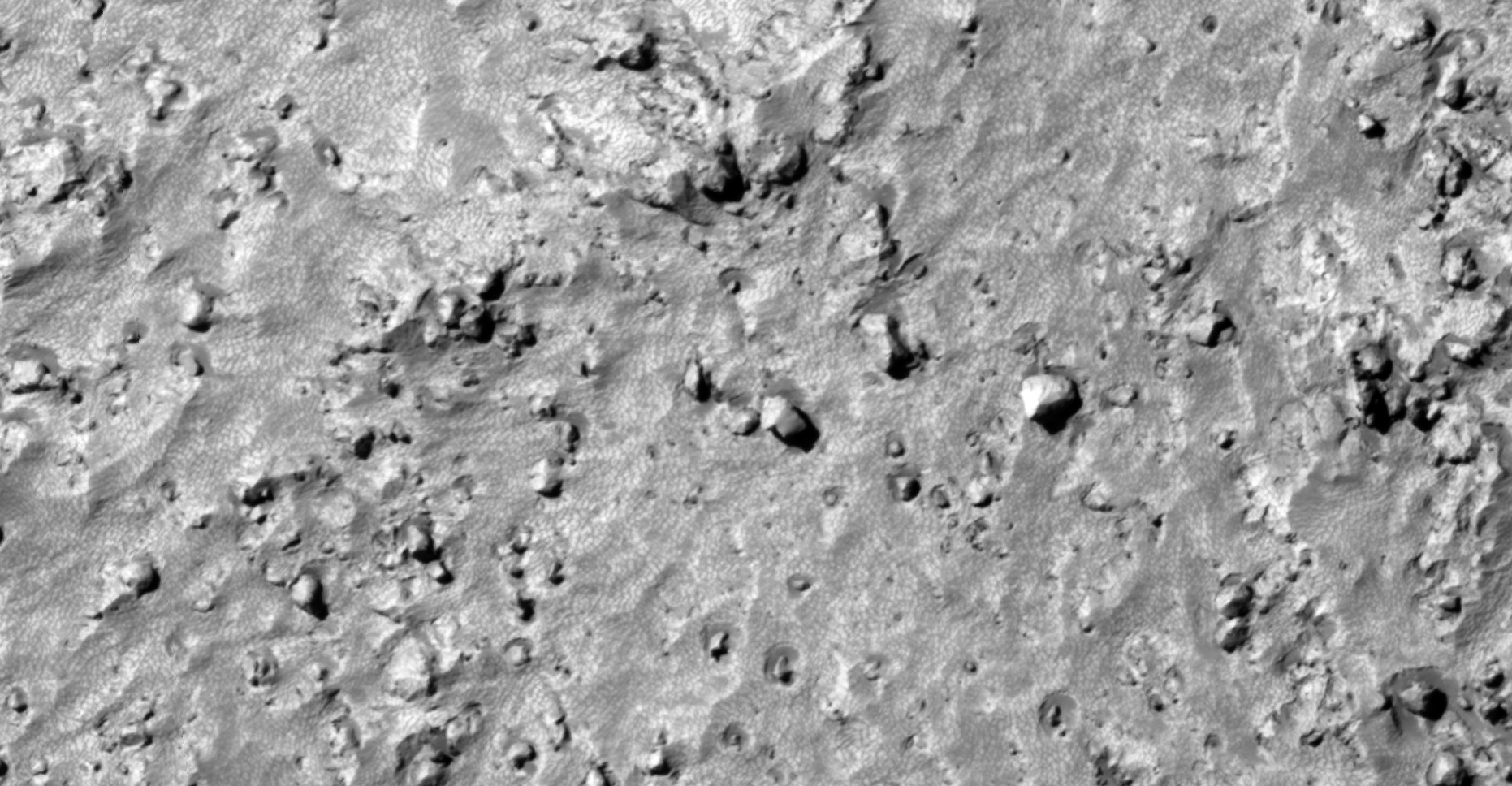
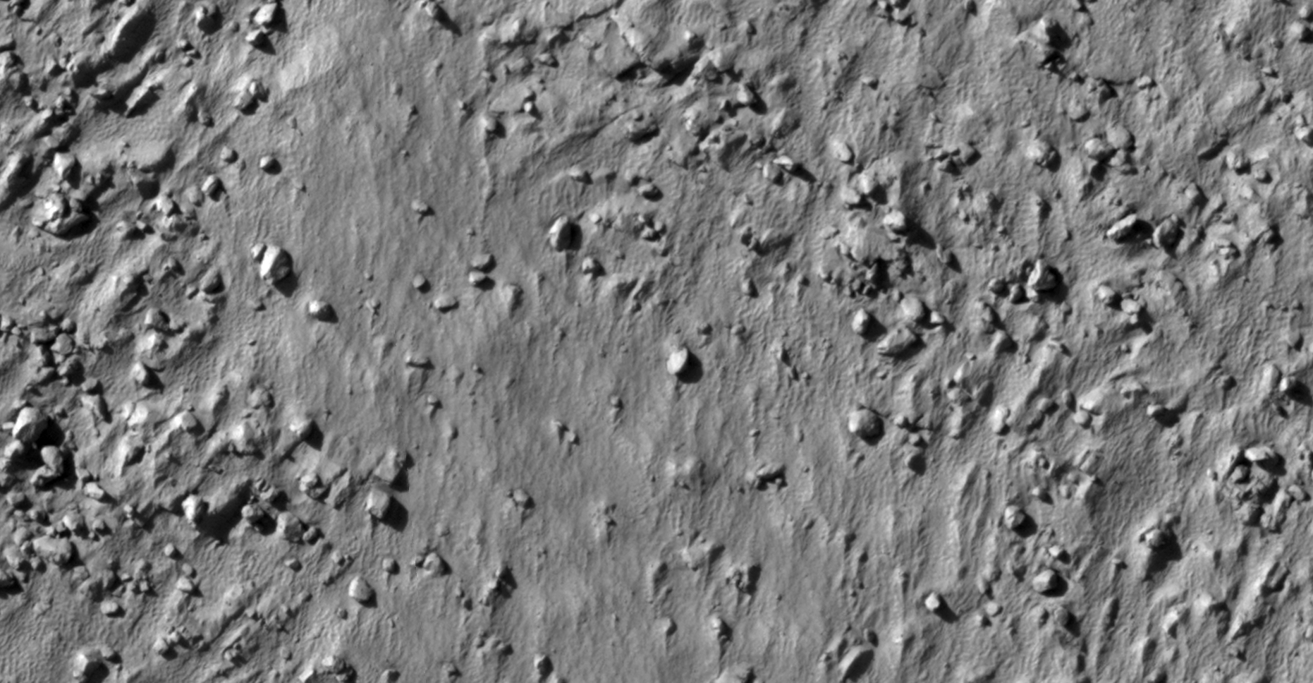
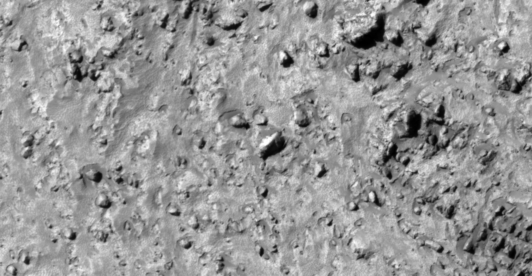
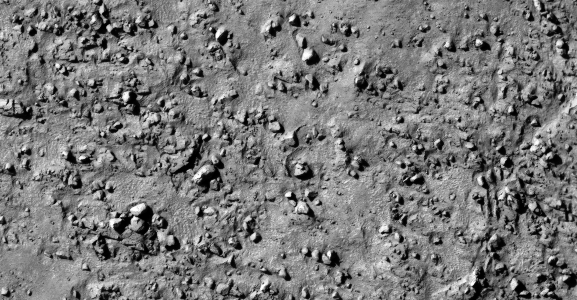
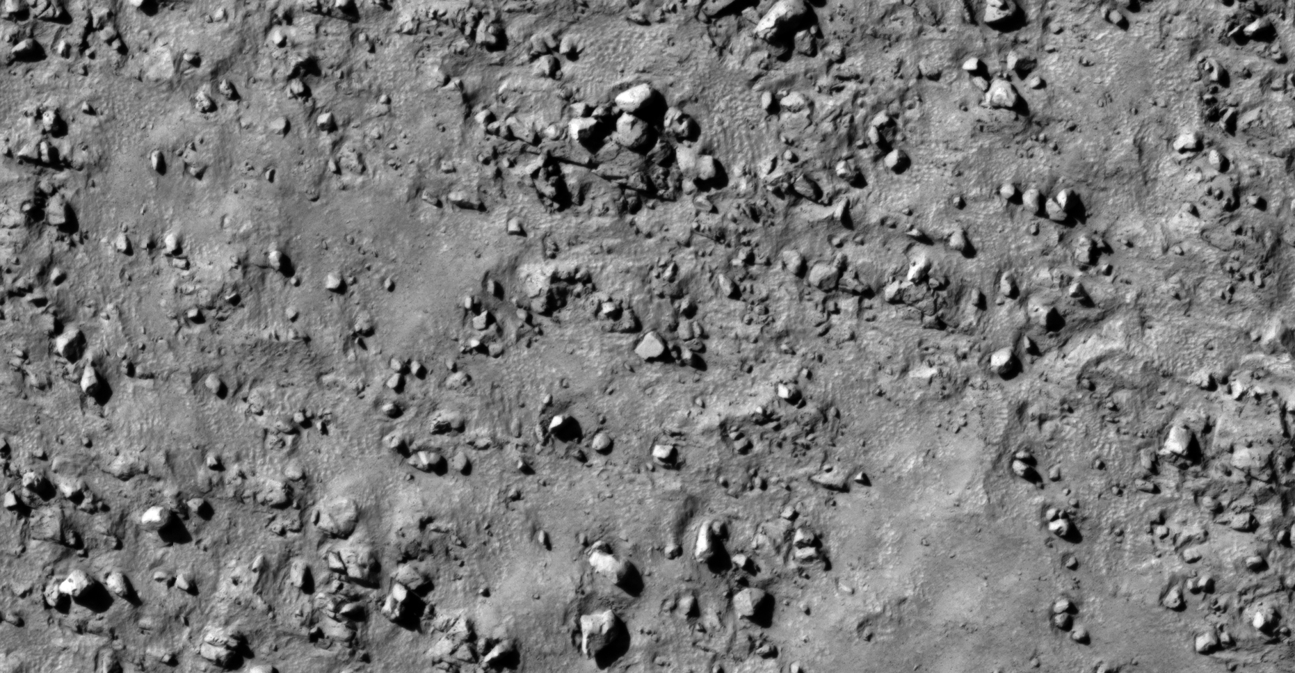
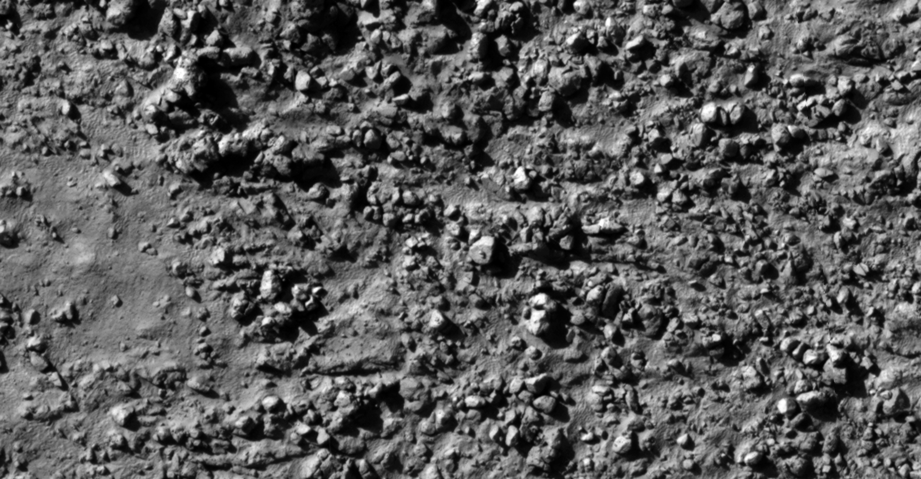
The photograph analyzed here (ESP_032556_1390) was taken by NASA’s Mars Reconnaissance Orbiter on 07 July 2013 and is described as ‘Lobate Debris Apron.’

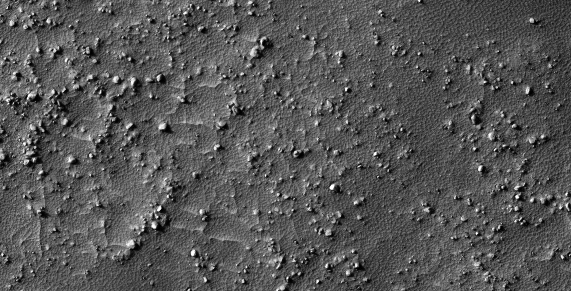
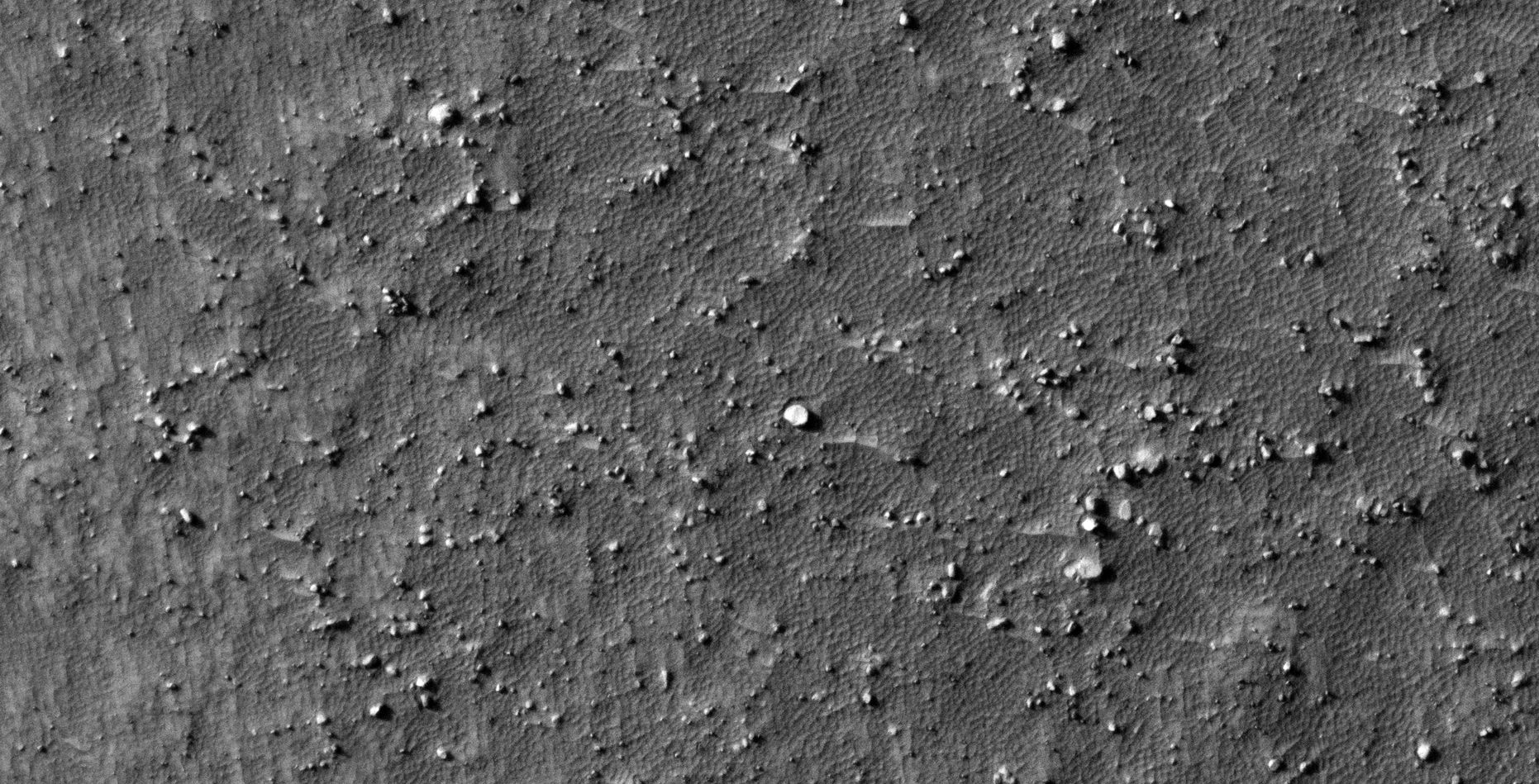
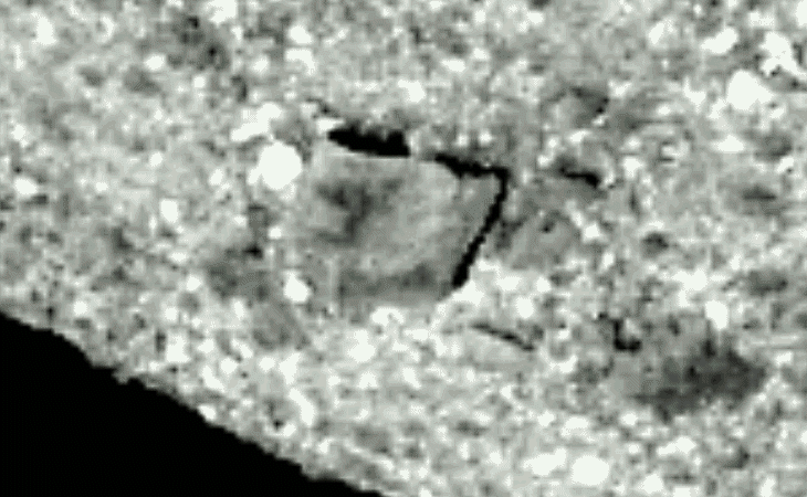
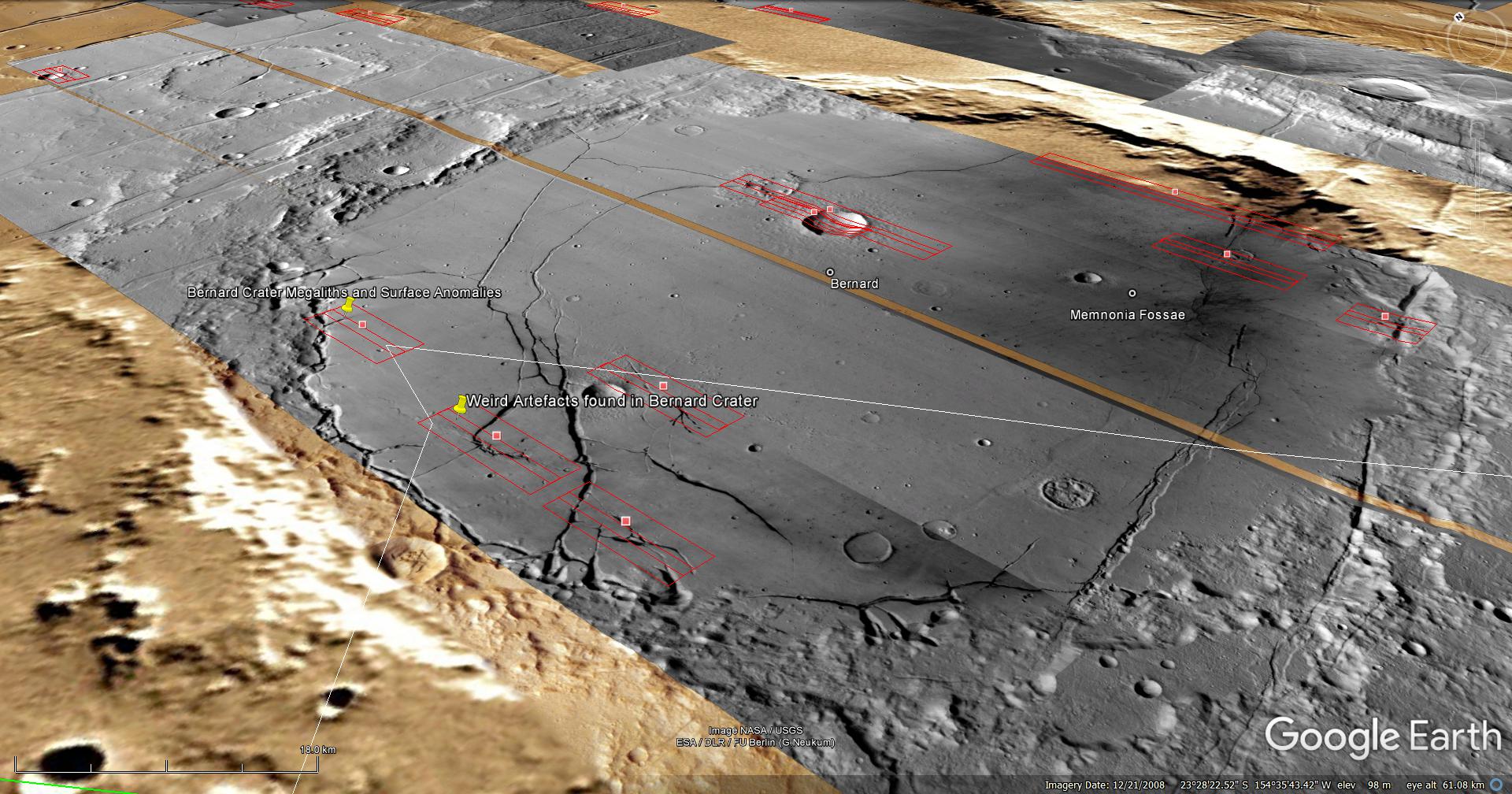
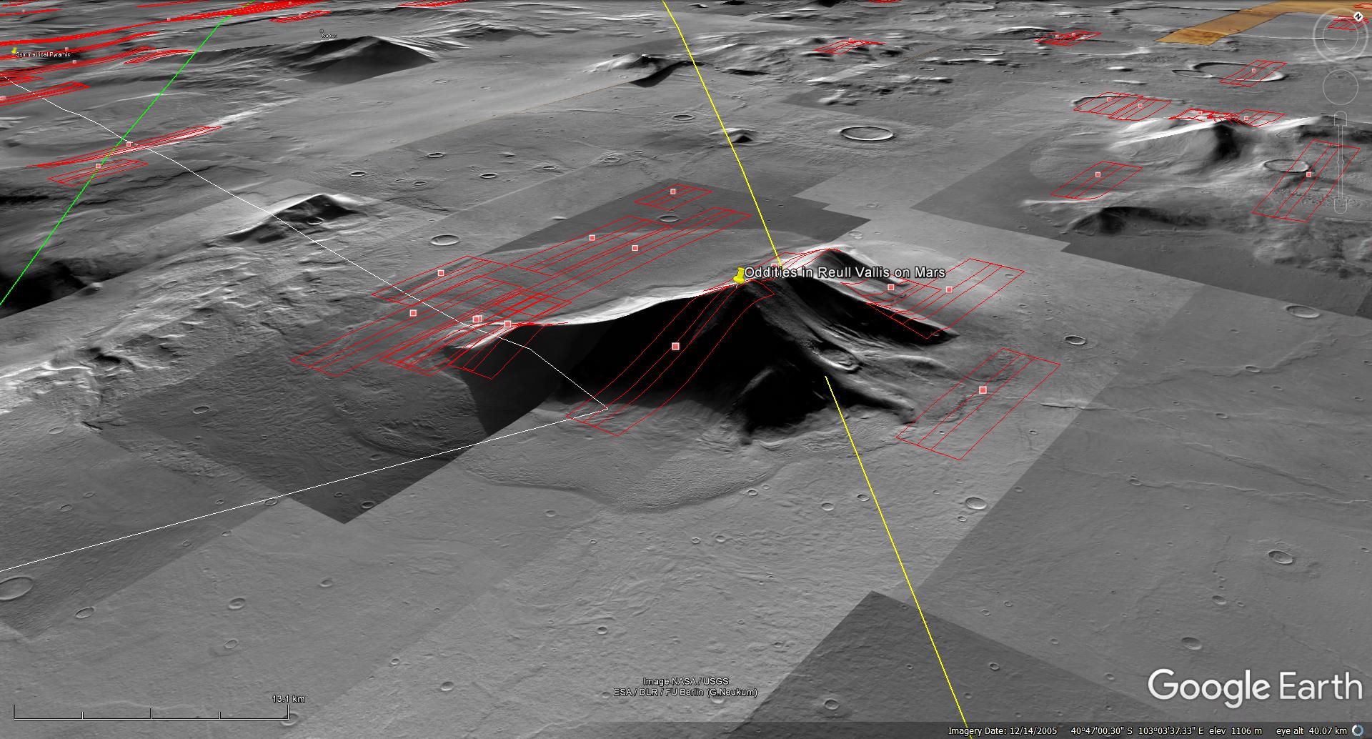
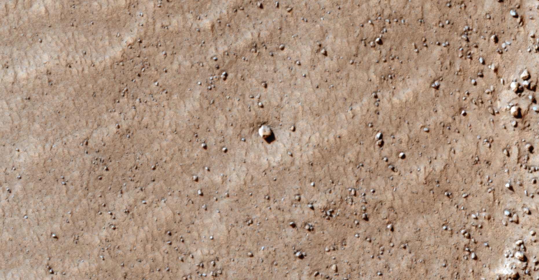
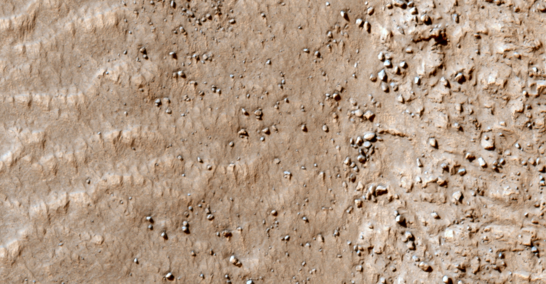
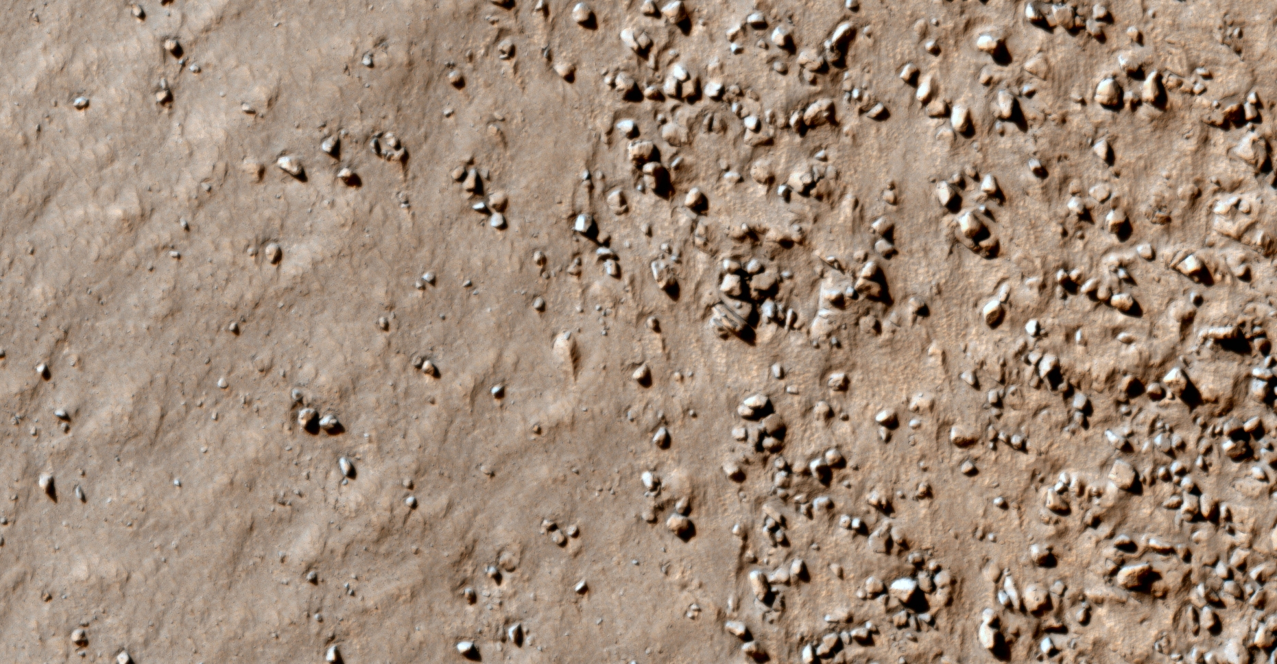
Here I feature huge, perfect sphere’s or balls I discovered on the side of what looks like an ancient eroded pyramid on Mars.

The spheres measure approximately 5 metres in diameter and look exactly like those found on Earth in Easter Island, Costa Rica and other regions.

I speculate the same ancient builder race/s that constructed the megalithic structures of Earth also built those found on Mars, however due to devastating catastrophes on Mars in the distant past we are only seeing the remnants, e.g. megalithic blocks,/slabs, spheres, sculptures and ruins.

An elevated view of this site being analyzed
An elevated view of this site being analyzed (click for larger image)
An elevated view of this site being analyzed
An elevated view of this site being analyzed (click for larger image)
Click for original image at 1:1 scale

Original NASA source:

https://www.uahirise.org/ESP_032556_1390

Other articles featured:

https://www.atlasobscura.com/places/the-navel-of-the-world-easter-island-chile

http://www.science-rumors.com/20-mystery-facts-about-the-stone-spheres-of-costa-rica/

My YouTube video featuring ‘Oddities in Reull Vallis on Mars:’

Subscribe to my YouTube channel and turn on Notifications to receive updates when I upload new video’s.

Links to all my other sites:

https://www.youtube.com/JeanWard (Mars anomalies)

https://mars.raptorzone.co.za (Mars anomalies)

http://www.raptorzone.co.za (my website)

http://wxsat.raptorzone.co.za (weather satellites)

https://twitter.com/raptorzn_ (@RaptorZN_)

https://www.facebook.com/JeanWardMarsAnomalies (Facebook)

http://blog.raptorzone.co.za (social and political issues)

Disclaimer:

Images saved from within HiView or CTX viewer do not include image scale indicators. The image scale indicators I include in images are based on the official resolutions provided by NASA and although I strive to be as accurate as possible there may be slight deviations from the actual scale. Image scale indicators are included as a size approximation tool only.

Geometry lines are mapped as accurately as possible using the limited information, data and mapping tools available at the time, therefore the lines may deviate from target sites by a few kilometres. Revisions may be made in the future as new, more precise information, data and mapping tools become available.

Many or all of the anomalies/artefacts covered in this presentation may be naturally occurring geological features caused by some type of geological processes, however due to the lack of specific information from the source we can only speculate whether these are all natural or some artificial in nature.

In cases where I say an anomaly looks like something I’m attempting to clarify what I see and not specifically that the anomaly is what I say it looks like.

My intention is only to share anomalies I’ve discovered on Mars and not to convince anyone that there is or was a civilization on Mars.

As Will Farrar from WhatsUpInTheSky says: “I see what I see, you see what you see.”

Dome and Other Weird Objects Scattered Across Arkhangelsky Dune Field on Mars

The photograph analyzed here (ESP_019770_1390) was taken by NASA’s Mars Reconnaissance Orbiter on 14 October 2010 and is described as ‘Arkhangelsky Crater Dunes.’

Scattered across this area are what appear to be geometric objects ranging from triangular, saucer-shaped, pyramidal and flat disc-shapes.

I have also discovered similar artefacts in other HiRISE photographs.

An elevated view of this site being analyzed
An elevated view of this site being analyzed (click for larger image)
An elevated view of this site being analyzed
An elevated view of this site being analyzed (click for larger image)
Original image at 1:1 scale (click for larger image)

Original NASA source:

https://www.uahirise.org/ESP_019770_1390

My YouTube video featuring ‘Dome and Other Weird Objects Scattered Across Arkhangelsky Dune Field on Mars:’

Subscribe to my YouTube channel and turn on Notifications to receive updates when I upload new video’s.

Links to all my other sites:

https://www.youtube.com/JeanWard (Mars anomalies)

https://mars.raptorzone.co.za (Mars anomalies)

http://www.raptorzone.co.za (my website)

http://wxsat.raptorzone.co.za (weather satellites)

https://twitter.com/raptorzn_ (@RaptorZN_)

https://www.facebook.com/JeanWardMarsAnomalies (Facebook)

http://blog.raptorzone.co.za (social and political issues)

Disclaimer:

Images saved from within HiView or CTX viewer do not include image scale indicators. The image scale indicators I include in images are based on the official resolutions provided by NASA and although I strive to be as accurate as possible there may be slight deviations from the actual scale. Image scale indicators are included as a size approximation tool only.

Geometry lines are mapped as accurately as possible using the limited information, data and mapping tools available at the time, therefore the lines may deviate from target sites by a few kilometres. Revisions may be made in the future as new, more precise information, data and mapping tools become available.

Many or all of the anomalies/artefacts covered in this presentation may be naturally occurring geological features caused by some type of geological processes, however due to the lack of specific information from the source we can only speculate whether these are all natural or some artificial in nature.

In cases where I say an anomaly looks like something I’m attempting to clarify what I see and not specifically that the anomaly is what I say it looks like.

My intention is only to share anomalies I’ve discovered on Mars and not to convince anyone that there is or was a civilization on Mars.

As Will Farrar from WhatsUpInTheSky says: “I see what I see, you see what you see.”

Wreckage Piles, Structures and Debris South of Kuiper on Mars (Bennu Update)

NOTE: In the video I state North of Kuiper, it should be South of Kuiper. My apology.

The photograph analyzed here (ESP_014118_1210) was taken by NASA’s Mars Reconnaissance Orbiter on 31 July 2009 and is described as ‘Sample Terrain.’

Anomalies found in this photograph very from megalithic to perhaps ancient fossils. There are many artefacts with knobs, domes or spheres in their centers, what might be wreckage and I even speculate ancient shell fossils.

NB: There’s also a massive rectangular container of sorts with a smaller object sticking out of the opening. The first of it’s kind I’ve discovered.

A closer look at the structure on ‘asteroid’ Bennu:

I also cover ‘asteroid’ Bennu, presenting a close-up animation I created of the structure located in the Southern region of the ‘asteroid.’

The structure on Bennu

Wreckage Piles, Structures and Debris South of Kuiper on Mars:

An elevated view of this site being analyzed
An elevated view of this site being analyzed (click for larger image)
An elevated view of this site being analyzed
An elevated view of this site being analyzed (click for larger image)
(click for larger image)

Original NASA source:

https://www.uahirise.org/ESP_014118_1210

Other articles referenced:

https://www.asteroidmission.org/galleries/spacecraft-imagery/

My YouTube video featuring ‘Wreckage Piles, Structures and Debris South of Kuiper on Mars (Bennu Update):’

Subscribe to my YouTube channel and turn on Notifications to receive updates when I upload new video’s.

Links to all my other sites:

https://www.youtube.com/JeanWard (Mars anomalies)

https://mars.raptorzone.co.za (Mars anomalies)

http://www.raptorzone.co.za (my website)

http://wxsat.raptorzone.co.za (weather satellites)

https://twitter.com/raptorzn_ (@RaptorZN_)

https://www.facebook.com/JeanWardMarsAnomalies (Facebook)

http://blog.raptorzone.co.za (social and political issues)

Disclaimer:

Images saved from within HiView or CTX viewer do not include image scale indicators. The image scale indicators I include in images are based on the official resolutions provided by NASA and although I strive to be as accurate as possible there may be slight deviations from the actual scale. Image scale indicators are included as a size approximation tool only.

Geometry lines are mapped as accurately as possible using the limited information, data and mapping tools available at the time, therefore the lines may deviate from target sites by a few kilometres. Revisions may be made in the future as new, more precise information, data and mapping tools become available.

Many or all of the anomalies/artefacts covered in this presentation may be naturally occurring geological features caused by some type of geological processes, however due to the lack of specific information from the source we can only speculate whether these are all natural or some artificial in nature.

In cases where I say an anomaly looks like something I’m attempting to clarify what I see and not specifically that the anomaly is what I say it looks like.

My intention is only to share anomalies I’ve discovered on Mars and not to convince anyone that there is or was a civilization on Mars.

As Will Farrar from WhatsUpInTheSky says: “I see what I see, you see what you see.”

Ancient Wreckage and Structures East of Redi on Mars (Part 2)

The photograph analyzed here (ESP_024117_1185) was taken by NASA’s Mars Reconnaissance Orbiter on 18 September 2011 and is described as ‘Contact between Bouldery and Smooth Terrains’

Anomalies found in this photograph include structures with small domes or knobs in their centers as well as artefacts that appear to be machines and/or wreckage.

An elevated view of this site being analyzed
An elevated view of this site being analyzed (click for larger image)
An elevated view of this site being analyzed
An elevated view of this site being analyzed (click for larger image)
(click for larger image)

Original NASA source:

https://www.uahirise.org/ESP_024117_1185

My YouTube video featuring ‘Ancient Wreckage and Structures East of Redi on Mars (Part 2):’

Subscribe to my YouTube channel and turn on Notifications to receive updates when I upload new video’s.

Links to all my other sites:

https://www.youtube.com/JeanWard (Mars anomalies)

https://mars.raptorzone.co.za (Mars anomalies)

http://www.raptorzone.co.za (my website)

http://wxsat.raptorzone.co.za (weather satellites)

https://twitter.com/raptorzn_ (@RaptorZN_)

https://www.facebook.com/JeanWardMarsAnomalies (Facebook)

http://blog.raptorzone.co.za (social and political issues)

Disclaimer:

Images saved from within HiView or CTX viewer do not include image scale indicators. The image scale indicators I include in images are based on the official resolutions provided by NASA and although I strive to be as accurate as possible there may be slight deviations from the actual scale. Image scale indicators are included as a size approximation tool only.

Geometry lines are mapped as accurately as possible using the limited information, data and mapping tools available at the time, therefore the lines may deviate from target sites by a few kilometres. Revisions may be made in the future as new, more precise information, data and mapping tools become available.

Many or all of the anomalies/artefacts covered in this presentation may be naturally occurring geological features caused by some type of geological processes, however due to the lack of specific information from the source we can only speculate whether these are all natural or some artificial in nature.

In cases where I say an anomaly looks like something I’m attempting to clarify what I see and not specifically that the anomaly is what I say it looks like.

My intention is only to share anomalies I’ve discovered on Mars and not to convince anyone that there is or was a civilization on Mars.

As Will Farrar from WhatsUpInTheSky says: “I see what I see, you see what you see.”

Ancient Wreckage and Structures East of Redi on Mars (Part 1)

The photograph analyzed here (ESP_024117_1185) was taken by NASA’s Mars Reconnaissance Orbiter on 18 September 2011 and is described as ‘Contact between Bouldery and Smooth Terrains’

Anomalies found in this photograph include structures with small domes or knobs in their centers as well as artefacts that appear to be machines and/or wreckage.

An elevated view of this site being analyzed
An elevated view of this site being analyzed (click for larger image)
An elevated view of this site being analyzed
An elevated view of this site being analyzed (click for larger image)
(click for larger image)

Original NASA source:

https://www.uahirise.org/ESP_024117_1185

My YouTube video featuring ‘Ancient Wreckage and Structures East of Redi on Mars (Part 1):’

Subscribe to my YouTube channel and turn on Notifications to receive updates when I upload new video’s.

Links to all my other sites:

https://www.youtube.com/JeanWard (Mars anomalies)

https://mars.raptorzone.co.za (Mars anomalies)

http://www.raptorzone.co.za (my website)

http://wxsat.raptorzone.co.za (weather satellites)

https://twitter.com/raptorzn_ (@RaptorZN_)

https://www.facebook.com/JeanWardMarsAnomalies (Facebook)

http://blog.raptorzone.co.za (social and political issues)

Disclaimer:

Images saved from within HiView or CTX viewer do not include image scale indicators. The image scale indicators I include in images are based on the official resolutions provided by NASA and although I strive to be as accurate as possible there may be slight deviations from the actual scale. Image scale indicators are included as a size approximation tool only.

Geometry lines are mapped as accurately as possible using the limited information, data and mapping tools available at the time, therefore the lines may deviate from target sites by a few kilometres. Revisions may be made in the future as new, more precise information, data and mapping tools become available.

Many or all of the anomalies/artefacts covered in this presentation may be naturally occurring geological features caused by some type of geological processes, however due to the lack of specific information from the source we can only speculate whether these are all natural or some artificial in nature.

In cases where I say an anomaly looks like something I’m attempting to clarify what I see and not specifically that the anomaly is what I say it looks like.

My intention is only to share anomalies I’ve discovered on Mars and not to convince anyone that there is or was a civilization on Mars.

As Will Farrar from WhatsUpInTheSky says: “I see what I see, you see what you see.”

Possible Entranceways to Caves on Mars (Hidden SSP Assets)?

Arsia Mons has been in the news lately with the long elongated cloud photographed by ESA’s Mars Express Orbiter. The so-called cloud has persisted in the same area for months.

Three HiRISE photographs taken of Arsia Mons show huge pits which NASA speculate are entrances to caves. They have been unable to calculate the depth’s of these pits and they estimate the largest one to be greater than 178 metres in depth.

NASA furthermore speculates that these caves will be ideal for human habitation.

Various SSP whistleblowers have testified that humans have been on Mars for decades now. Could these dark pits be hiding SSP bases, equipment and assets?

Could the so-called cloud be an active volcano or could one of these underground SSP assets be terraforming Mars or possibly even have suffered some catastrophe underground and we’re seeing the smoke?

Who knows what may be down in those dark, mysterious depths?

Three HiRISE photographs are analyzed here:

https://www.uahirise.org/PSP_003647_1745

https://www.uahirise.org/PSP_004847_1745

https://www.uahirise.org/PSP_009488_1745

An elevated view of this site being analyzed
An elevated view of this site being analyzed (click for larger image)
(click for larger image)
Zoomed-out, not to scale
Zoomed-out, not to scale (click for larger image)
(click for larger image)
Zoomed-out, not to scale
Zoomed-out, not to scale (click for larger image)
(click for larger image)
Zoomed-out, not to scale
Zoomed-out, not to scale (click for larger image)

My YouTube video featuring ‘Possible Entranceways to Caves on Mars (Hidden SSP Assets)?:’

Subscribe to my YouTube channel and turn on Notifications to receive updates when I upload new video’s.

Links to all my other sites:

https://www.youtube.com/JeanWard (Mars anomalies)

https://mars.raptorzone.co.za (Mars anomalies)

http://www.raptorzone.co.za (my website)

http://wxsat.raptorzone.co.za (weather satellites)

https://twitter.com/raptorzn_ (@RaptorZN_)

https://www.facebook.com/JeanWardMarsAnomalies (Facebook)

http://blog.raptorzone.co.za (social and political issues)

Disclaimer:

Images saved from within HiView or CTX viewer do not include image scale indicators. The image scale indicators I include in images are based on the official resolutions provided by NASA and although I strive to be as accurate as possible there may be slight deviations from the actual scale. Image scale indicators are included as a size approximation tool only.

Geometry lines are mapped as accurately as possible using the limited information, data and mapping tools available at the time, therefore the lines may deviate from target sites by a few kilometres. Revisions may be made in the future as new, more precise information, data and mapping tools become available.

Many or all of the anomalies/artefacts covered in this presentation may be naturally occurring geological features caused by some type of geological processes, however due to the lack of specific information from the source we can only speculate whether these are all natural or some artificial in nature.

In cases where I say an anomaly looks like something I’m attempting to clarify what I see and not specifically that the anomaly is what I say it looks like.

My intention is only to share anomalies I’ve discovered on Mars and not to convince anyone that there is or was a civilization on Mars.

As Will Farrar from WhatsUpInTheSky says: “I see what I see, you see what you see.”

Weird Megalithic-and Other Objects South of Hussey on Mars

The photograph analyzed here (ESP_014130_1210) was taken by NASA’s Mars Reconnaissance Orbiter on 01 August 2009 and is described as ‘Crater Rim Sample.’

Anomalies found in this photograph appear to be megalithic in nature. Some megaliths hive knobs on them while others have circular holes.

There are also a couple of other objects that look like some type of craft, some what flying saucer shaped.

An elevated view of this site being analyzed
An elevated view of this site being analyzed (click for larger image)
An elevated view of this site being analyzed
An elevated view of this site being analyzed (click for larger image)
(click for larger image)

Original NASA source:

https://www.uahirise.org/ESP_014130_1210

My YouTube video featuring ‘Weird Megalithic-and Other Objects South of Hussey on Mars:’

Subscribe to my YouTube channel and turn on Notifications to receive updates when I upload new video’s.

Links to all my other sites:

https://www.youtube.com/JeanWard (Mars anomalies)

https://mars.raptorzone.co.za (Mars anomalies)

http://www.raptorzone.co.za (my website)

http://wxsat.raptorzone.co.za (weather satellites)

https://twitter.com/raptorzn_ (@RaptorZN_)

https://www.facebook.com/JeanWardMarsAnomalies (Facebook)

http://blog.raptorzone.co.za (social and political issues)

Disclaimer:

Images saved from within HiView or CTX viewer do not include image scale indicators. The image scale indicators I include in images are based on the official resolutions provided by NASA and although I strive to be as accurate as possible there may be slight deviations from the actual scale. Image scale indicators are included as a size approximation tool only.

Geometry lines are mapped as accurately as possible using the limited information, data and mapping tools available at the time, therefore the lines may deviate from target sites by a few kilometres. Revisions may be made in the future as new, more precise information, data and mapping tools become available.

Many or all of the anomalies/artefacts covered in this presentation may be naturally occurring geological features caused by some type of geological processes, however due to the lack of specific information from the source we can only speculate whether these are all natural or some artificial in nature.

In cases where I say an anomaly looks like something I’m attempting to clarify what I see and not specifically that the anomaly is what I say it looks like.

My intention is only to share anomalies I’ve discovered on Mars and not to convince anyone that there is or was a civilization on Mars.

As Will Farrar from WhatsUpInTheSky says: “I see what I see, you see what you see.”

Structures, Megaliths and Debris South of Douglass on Mars

The photograph analyzed here (PSP_005597_1250) was taken by NASA’s Mars Reconnaissance Orbiter on 06 October 2007 and is described as ‘Rocky Deposit.’

Anomalies found in this photograph appear to be megalithic in nature, as well as what looks like more debris/ruins and perhaps wreckage from some type of craft or machinery.

An elevated view of this site being analyzed
An elevated view of this site being analyzed (click for larger image)
An elevated view of this site being analyzed
An elevated view of this site being analyzed (click for larger image)
(click for larger image)

Original NASA source:

https://www.uahirise.org/PSP_005597_1250

My YouTube video featuring ‘Structures, Megaliths and Debris South of Douglass on Mars:’

Subscribe to my YouTube channel and turn on Notifications to receive updates when I upload new video’s.

Links to all my other sites:

https://www.youtube.com/JeanWard (Mars anomalies)

https://mars.raptorzone.co.za (Mars anomalies)

http://www.raptorzone.co.za (my website)

http://wxsat.raptorzone.co.za (weather satellites)

https://twitter.com/raptorzn_ (@RaptorZN_)

https://www.facebook.com/JeanWardMarsAnomalies (Facebook)

http://blog.raptorzone.co.za (social and political issues)

Disclaimer:

Images saved from within HiView or CTX viewer do not include image scale indicators. The image scale indicators I include in images are based on the official resolutions provided by NASA and although I strive to be as accurate as possible there may be slight deviations from the actual scale. Image scale indicators are included as a size approximation tool only.

Geometry lines are mapped as accurately as possible using the limited information, data and mapping tools available at the time, therefore the lines may deviate from target sites by a few kilometres. Revisions may be made in the future as new, more precise information, data and mapping tools become available.

Many or all of the anomalies/artefacts covered in this presentation may be naturally occurring geological features caused by some type of geological processes, however due to the lack of specific information from the source we can only speculate whether these are all natural or some artificial in nature.

In cases where I say an anomaly looks like something I’m attempting to clarify what I see and not specifically that the anomaly is what I say it looks like.

My intention is only to share anomalies I’ve discovered on Mars and not to convince anyone that there is or was a civilization on Mars.

As Will Farrar from WhatsUpInTheSky says: “I see what I see, you see what you see.”

Drava Valles Structures, Debris and Wreckage on Mars

The photograph analyzed here (ESP_013249_1270) was taken by NASA’s Mars Reconnaissance Orbiter on 24 May 2009 and is described as ‘Bouldery Deposit on Crater Floor.’

Anomalies found in this photograph appear to be megalithic in nature, as well as what looks like more debris/ruins and perhaps wreckage from some type of craft.

An elevated view of this site being analyzed
An elevated view of this site being analyzed (click for larger image)
An elevated view of this site being analyzed
An elevated view of this site being analyzed (click for larger image)
(click for larger image)

Original NASA source:

https://www.uahirise.org/ESP_013249_1270

My YouTube video featuring ‘Drava Valles Structures, Debris and Wreckage on Mars:’

Subscribe to my YouTube channel and turn on Notifications to receive updates when I upload new video’s.

Links to all my other sites:

https://www.youtube.com/JeanWard (Mars anomalies)

https://mars.raptorzone.co.za (Mars anomalies)

http://www.raptorzone.co.za (my website)

http://wxsat.raptorzone.co.za (weather satellites)

https://twitter.com/raptorzn_ (@RaptorZN_)

https://www.facebook.com/JeanWardMarsAnomalies (Facebook)

http://blog.raptorzone.co.za (social and political issues)

Disclaimer:

Images saved from within HiView or CTX viewer do not include image scale indicators. The image scale indicators I include in images are based on the official resolutions provided by NASA and although I strive to be as accurate as possible there may be slight deviations from the actual scale. Image scale indicators are included as a size approximation tool only.

Geometry lines are mapped as accurately as possible using the limited information, data and mapping tools available at the time, therefore the lines may deviate from target sites by a few kilometres. Revisions may be made in the future as new, more precise information, data and mapping tools become available.

Many or all of the anomalies/artefacts covered in this presentation may be naturally occurring geological features caused by some type of geological processes, however due to the lack of specific information from the source we can only speculate whether these are all natural or some artificial in nature.

In cases where I say an anomaly looks like something I’m attempting to clarify what I see and not specifically that the anomaly is what I say it looks like.

My intention is only to share anomalies I’ve discovered on Mars and not to convince anyone that there is or was a civilization on Mars.

As Will Farrar from WhatsUpInTheSky says: “I see what I see, you see what you see.”

Bernard Crater Megaliths and Surface Anomalies on Mars

The photograph analyzed here (PSP_005956_1570) was taken by NASA’s Mars Reconnaissance Orbiter on 03 November 2007 and is described as ‘Bernard Crater.’

Bernard Crater is actually more of a circular depression, very similar to Asimov (anomalies in Asimov covered in previous video’s).

Anomalies found in Bernard appear to be megalithic in nature and there is what looks like another classic flying saucer type object partially covered in sand.

An elevated view of this site being analyzed
An elevated view of this site being analyzed (click for larger image)
An elevated view of this site being analyzed
An elevated view of this site being analyzed (click for larger image)
(click for larger image)

Original NASA source:

https://www.uahirise.org/PSP_005956_1570

My YouTube video featuring ‘Bernard Crater Megaliths and Surface Anomalies on Mars:’

Subscribe to my YouTube channel and turn on Notifications to receive updates when I upload new video’s.

Links to all my other sites:

https://www.youtube.com/JeanWard (Mars anomalies)

https://mars.raptorzone.co.za (Mars anomalies)

http://www.raptorzone.co.za (my website)

http://wxsat.raptorzone.co.za (weather satellites)

https://twitter.com/raptorzn_ (@RaptorZN_)

https://www.facebook.com/JeanWardMarsAnomalies (Facebook)

http://blog.raptorzone.co.za (social and political issues)

Disclaimer:

Images saved from within HiView or CTX viewer do not include image scale indicators. The image scale indicators I include in images are based on the official resolutions provided by NASA and although I strive to be as accurate as possible there may be slight deviations from the actual scale. Image scale indicators are included as a size approximation tool only.

Geometry lines are mapped as accurately as possible using the limited information, data and mapping tools available at the time, therefore the lines may deviate from target sites by a few kilometres. Revisions may be made in the future as new, more precise information, data and mapping tools become available.

Many or all of the anomalies/artefacts covered in this presentation may be naturally occurring geological features caused by some type of geological processes, however due to the lack of specific information from the source we can only speculate whether these are all natural or some artificial in nature.

In cases where I say an anomaly looks like something I’m attempting to clarify what I see and not specifically that the anomaly is what I say it looks like.

My intention is only to share anomalies I’ve discovered on Mars and not to convince anyone that there is or was a civilization on Mars.

As Will Farrar from WhatsUpInTheSky says: “I see what I see, you see what you see.”