

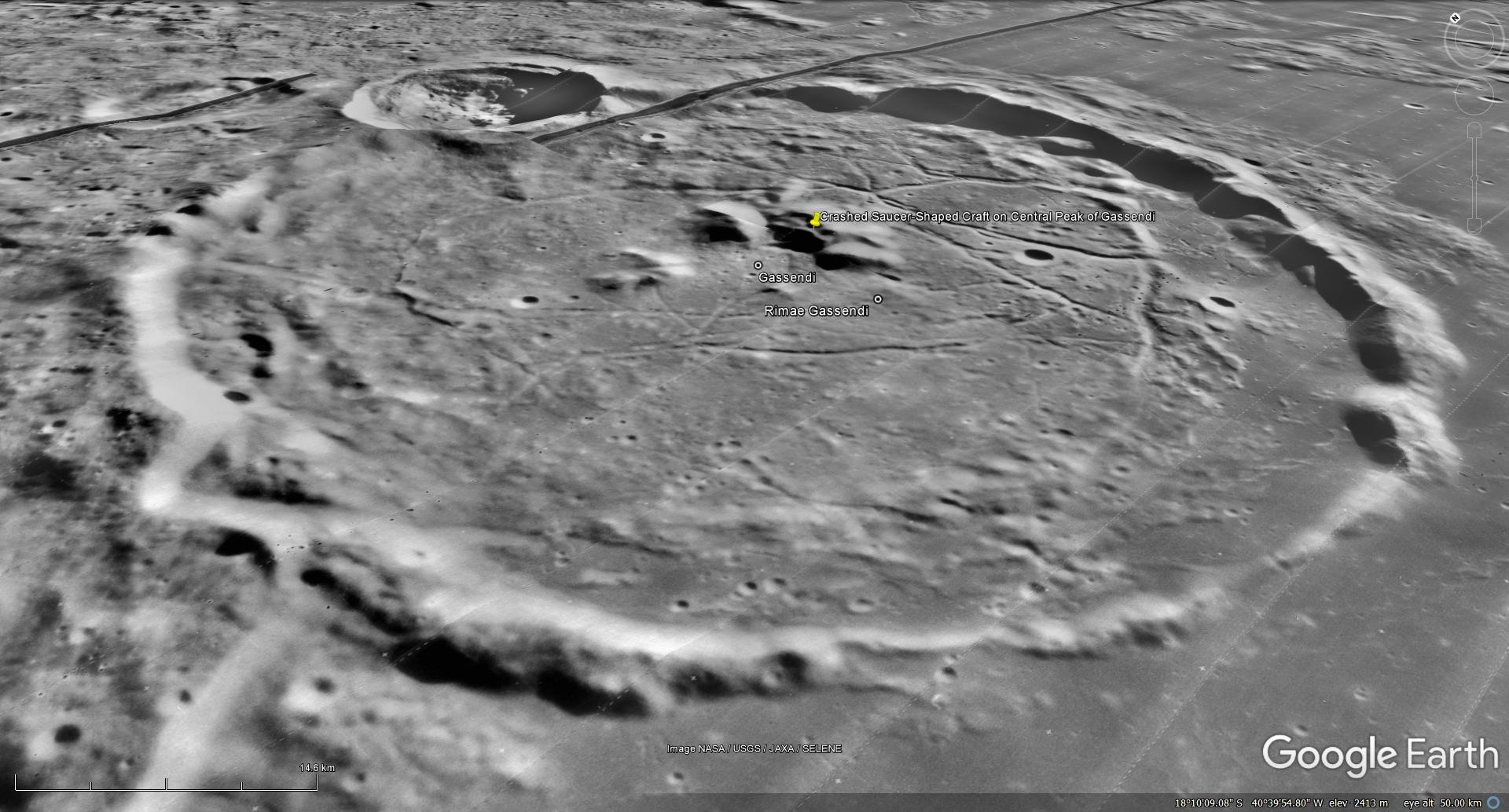
The photograph analyzed here (M109495053RE) was taken by NASA’s Lunar Reconnaissance Orbiter on 2009-10-06 and is described as ‘Gassendi’s Central Peak.’
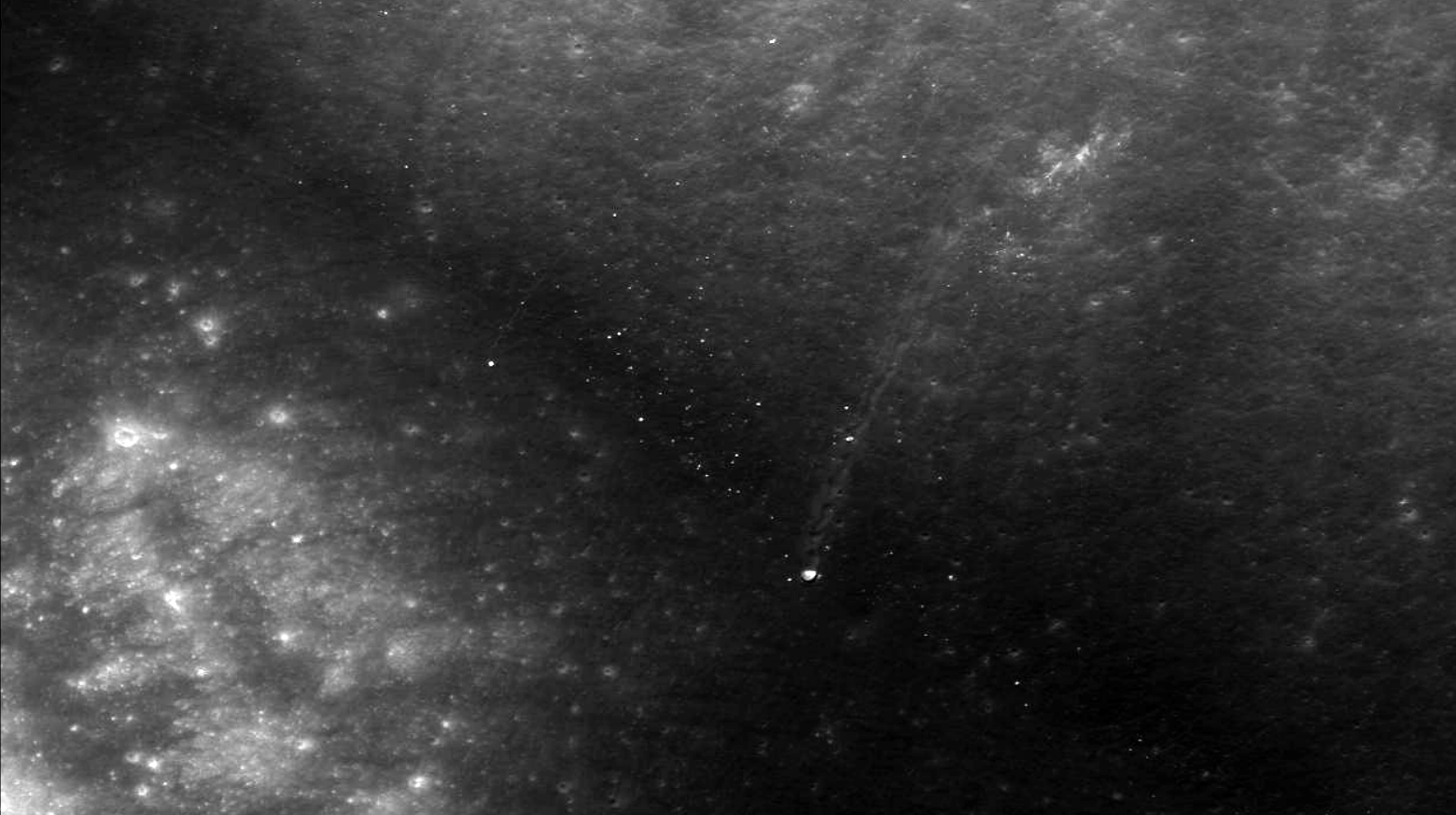
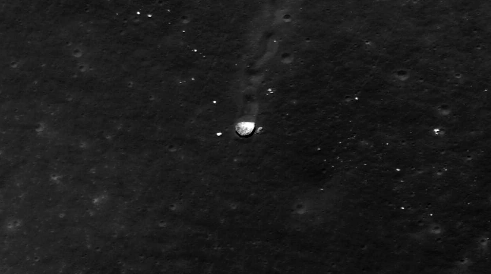
Here I speculate that I may have found a crashed saucer-shaped craft. I don’t think this is a boulder which rolled down from a higher point as there is no sign of a starting point.
Whatever this object is, it seems to have hit the surface at a relatively low angle and speed and gradually left a trench and came to a standstill with it’s front slightly raised above the surface and the back-side covered in regolith.
Original NASA sources:
http://wms.lroc.asu.edu/lroc/view_lroc/LRO-L-LROC-2-EDR-V1.0/M109495053RE
http://lroc.sese.asu.edu/posts/258
My YouTube video featuring ‘Crashed Saucer-Shaped Craft on Central Peak of Gassendi on the Moon?:’
Subscribe to my YouTube channel and turn on Notifications to receive updates when I upload new video’s.
Links to all my other sites:
https://www.youtube.com/JeanWard (Mars anomalies)
https://mars.raptorzone.co.za (Mars anomalies)
http://www.raptorzone.co.za (my website)
http://wxsat.raptorzone.co.za (weather satellites)
https://twitter.com/raptorzn_ (@RaptorZN_)
https://www.facebook.com/JeanWardMarsAnomalies (Facebook)
http://blog.raptorzone.co.za (social and political issues)
Disclaimer:
Geometry lines are mapped as accurately as possible using the limited information, data and mapping tools available at the time, therefore the lines may deviate from target sites by a few kilometres. Revisions may be made in the future as new, more precise information, data and mapping tools become available.
The image scale indicators I include in images are based on the official resolutions provided by NASA and although I strive to be as accurate as possible there may be slight deviations from the actual scale. Image scale indicators are included as a size approximation tool only.
Many or all of the anomalies/artefacts covered in this presentation may be naturally occurring geological features caused by some type of geological processes, however due to the lack of specific information from the source we can only speculate whether these are all natural or some artificial in nature.
In cases where I say an anomaly looks like something I’m attempting to clarify what I see and not specifically that
the anomaly is what I say it looks like.
My intention is only to share anomalies I’ve discovered on the Moon and not to convince anyone that there is or
was a civilization on Mars.
As Will Farrar from WhatsUpInTheSky says: “I see what I see, you see what you see.”