

The photograph analyzed here (ESP_057677_1230) was taken by NASA’s Mars Reconnaissance Orbiter on 15 November 2018 and is described as ‘Scarp in Mid-Latitude Mantle.’
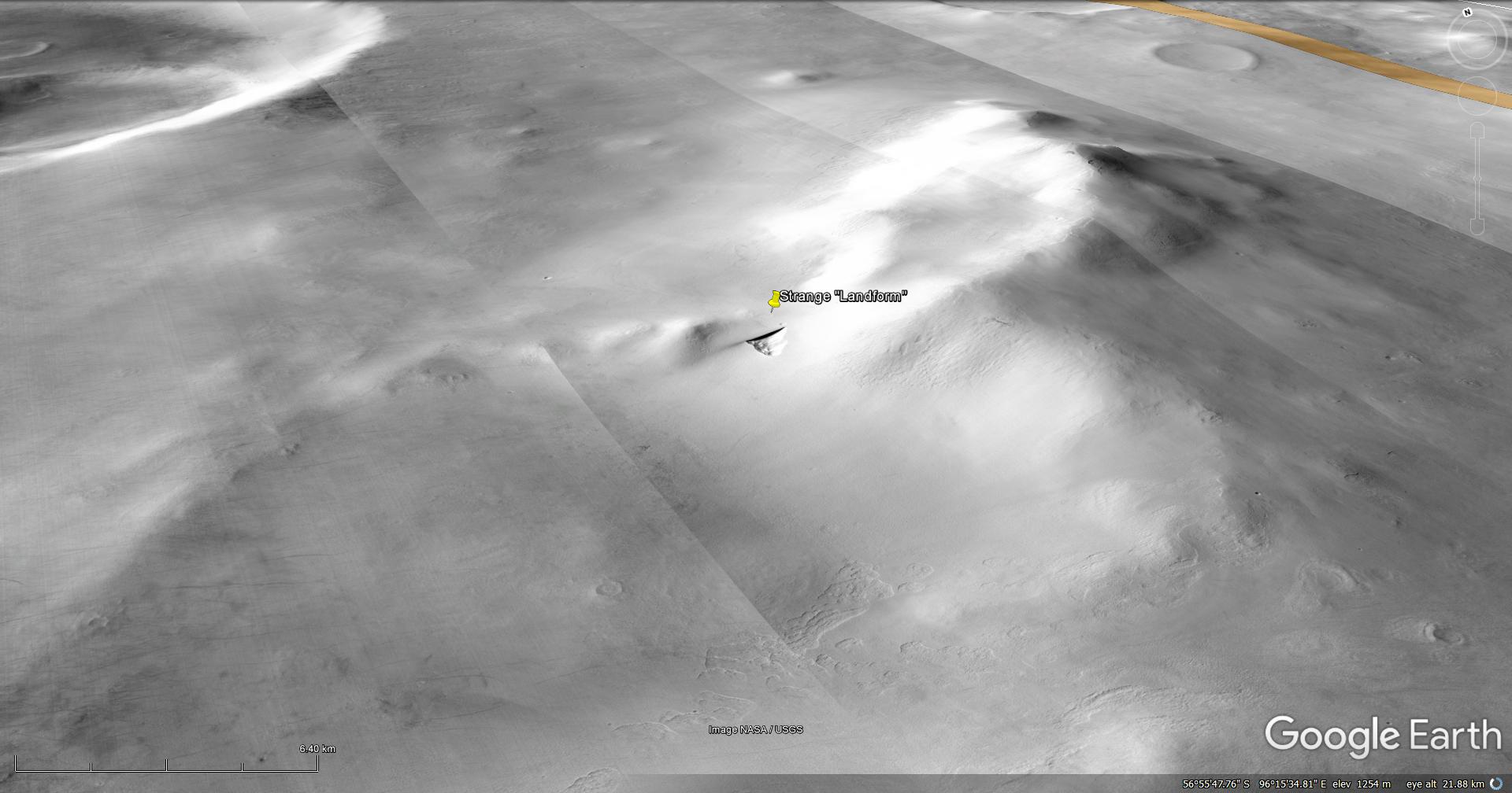
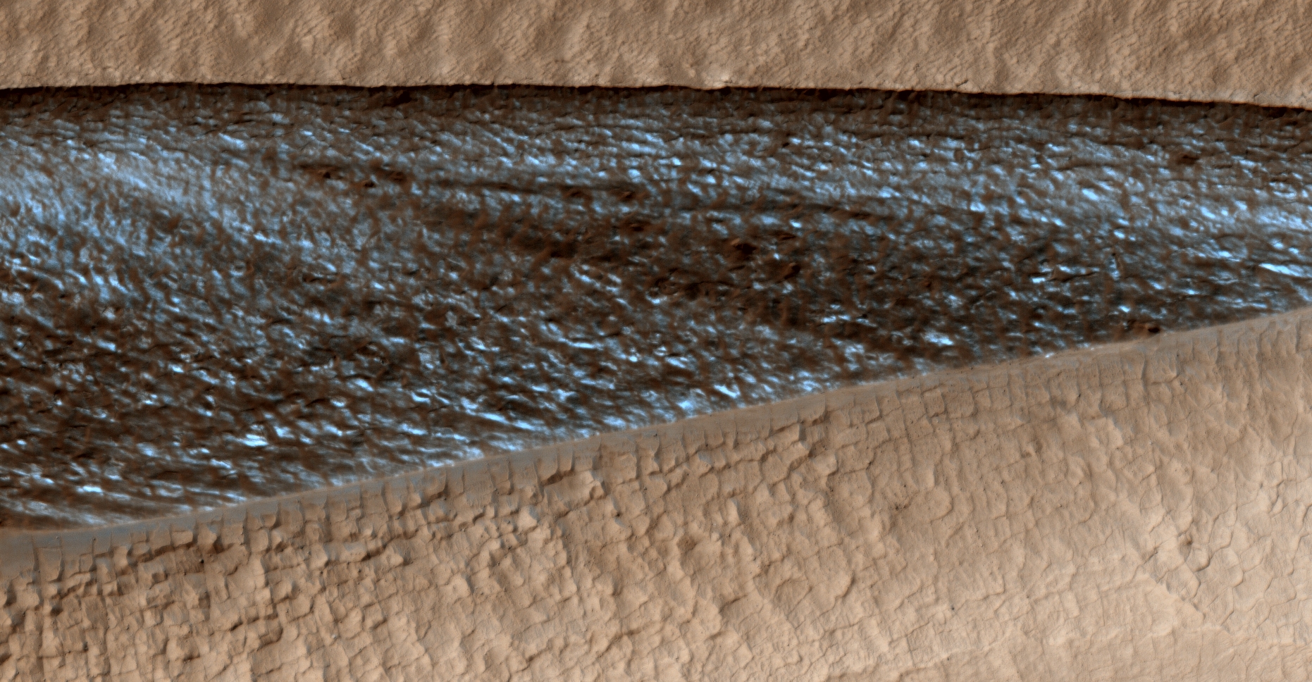
I found yet another of these strange triangular surface anomalies. The previous one I found measure 210 metres per side, this one has a perfectly straight edge which is 1.6 km long.
The surface of this straight edge looks highly unnatural, might is be that this was a type of surface mining operation or could this be a buried structure?
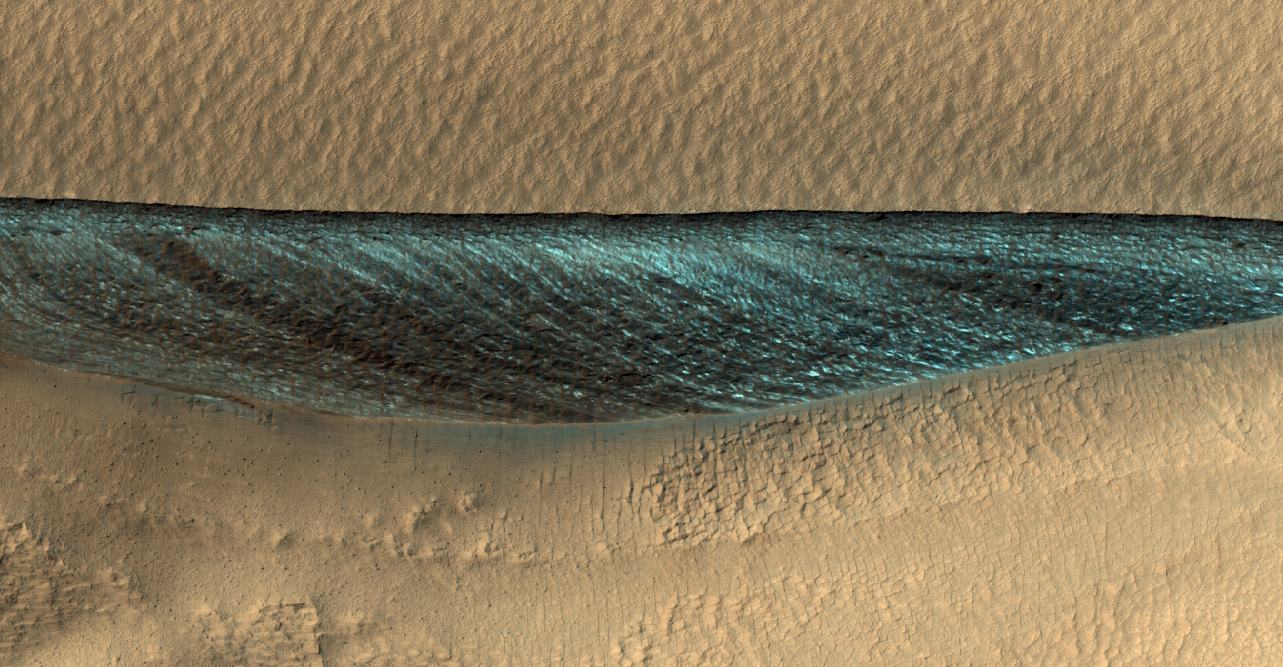
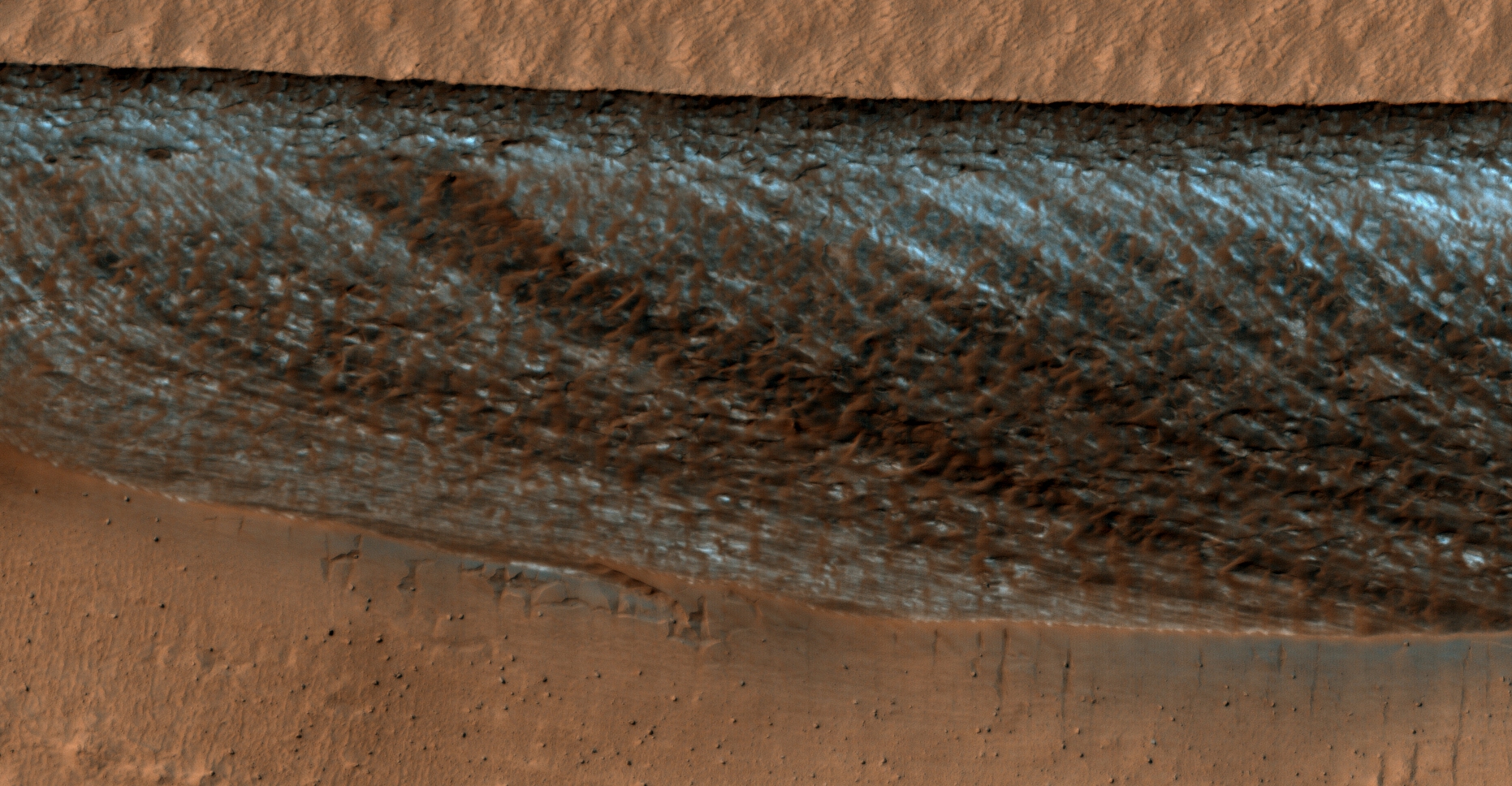
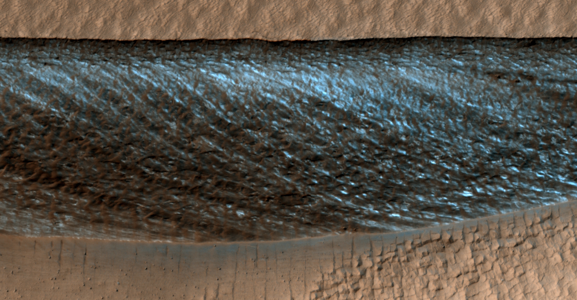
Colour images:
The following images were cropped from the RGB Colour None-Map Projected JP2:
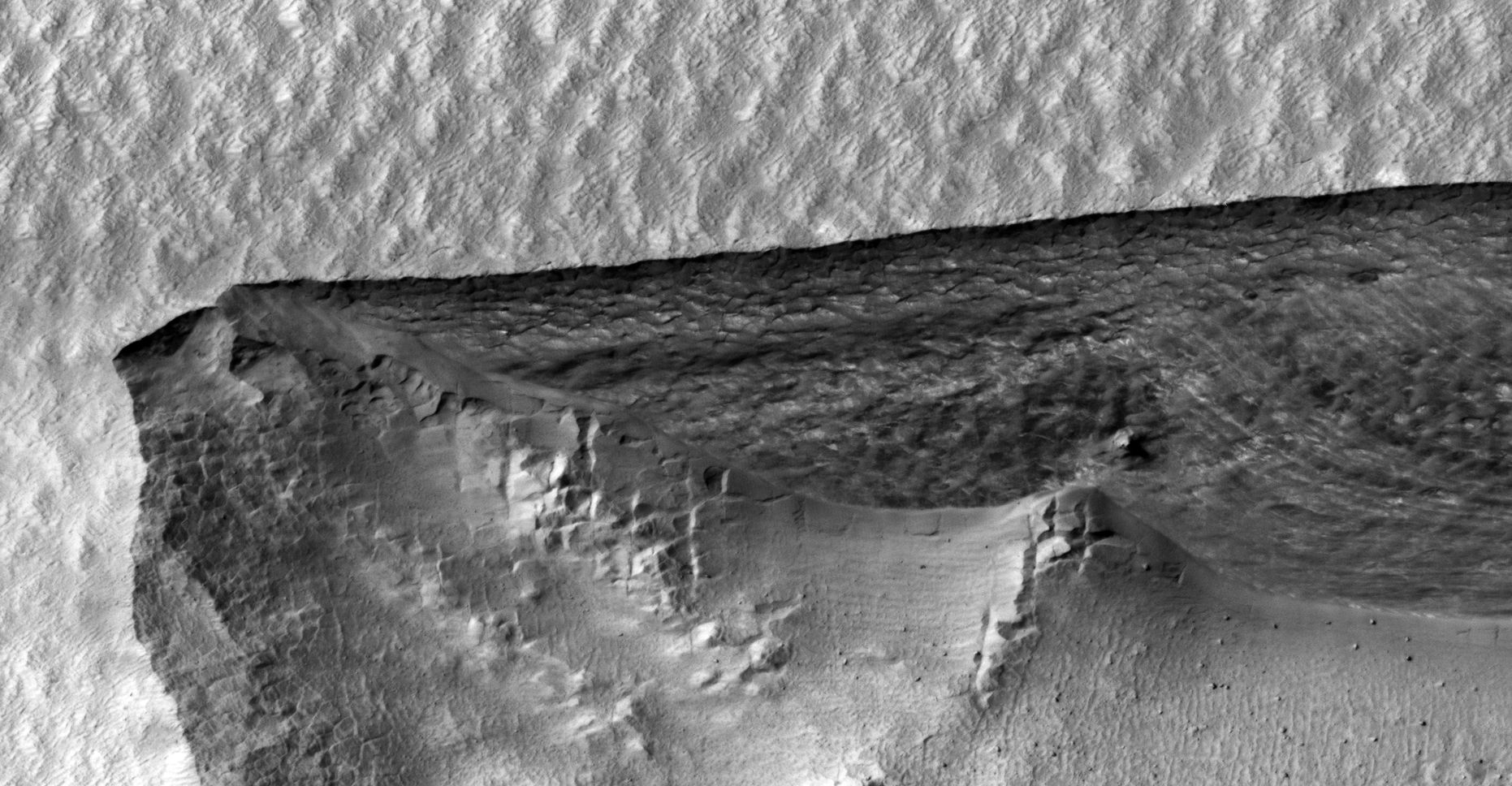
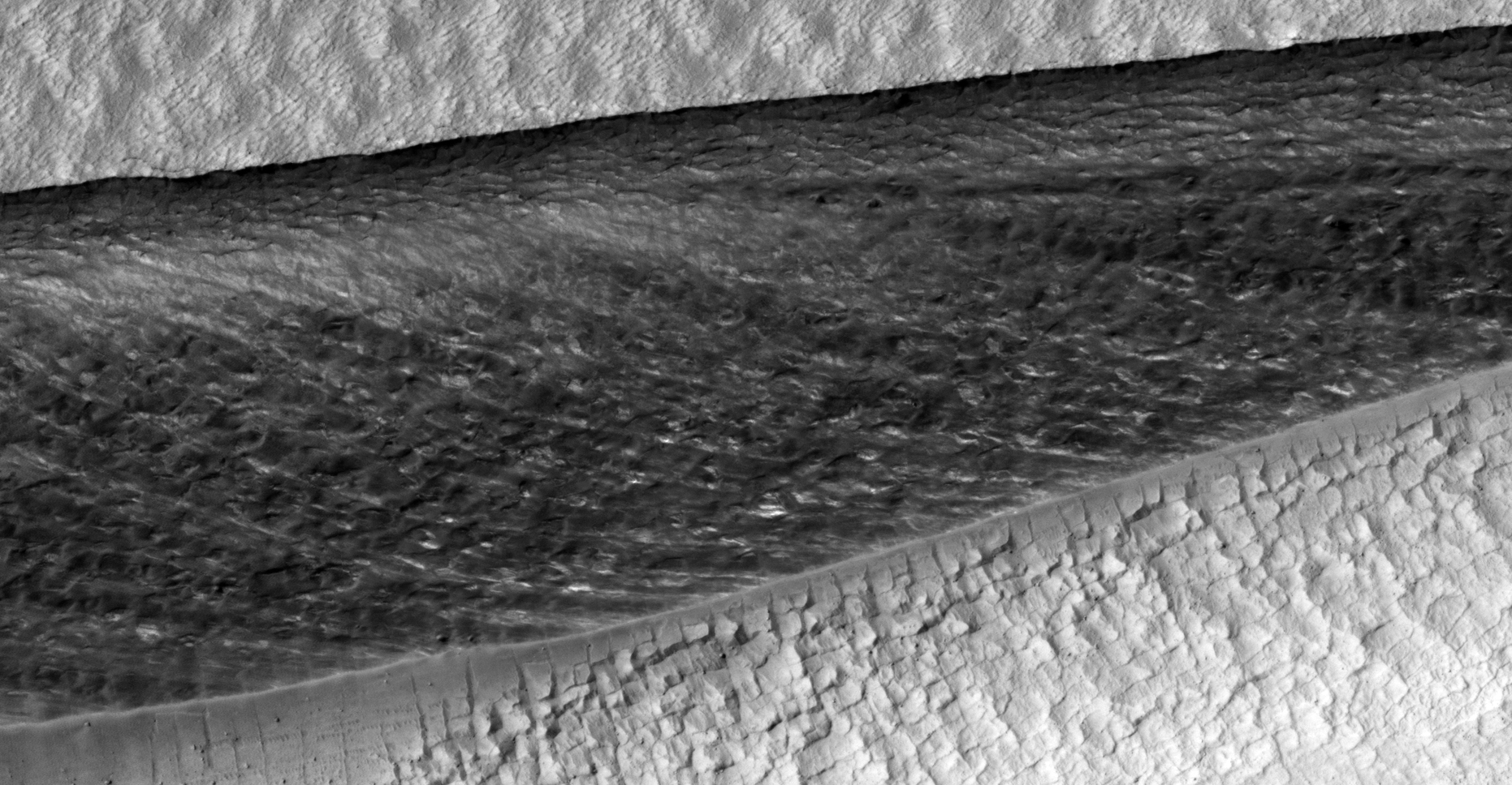
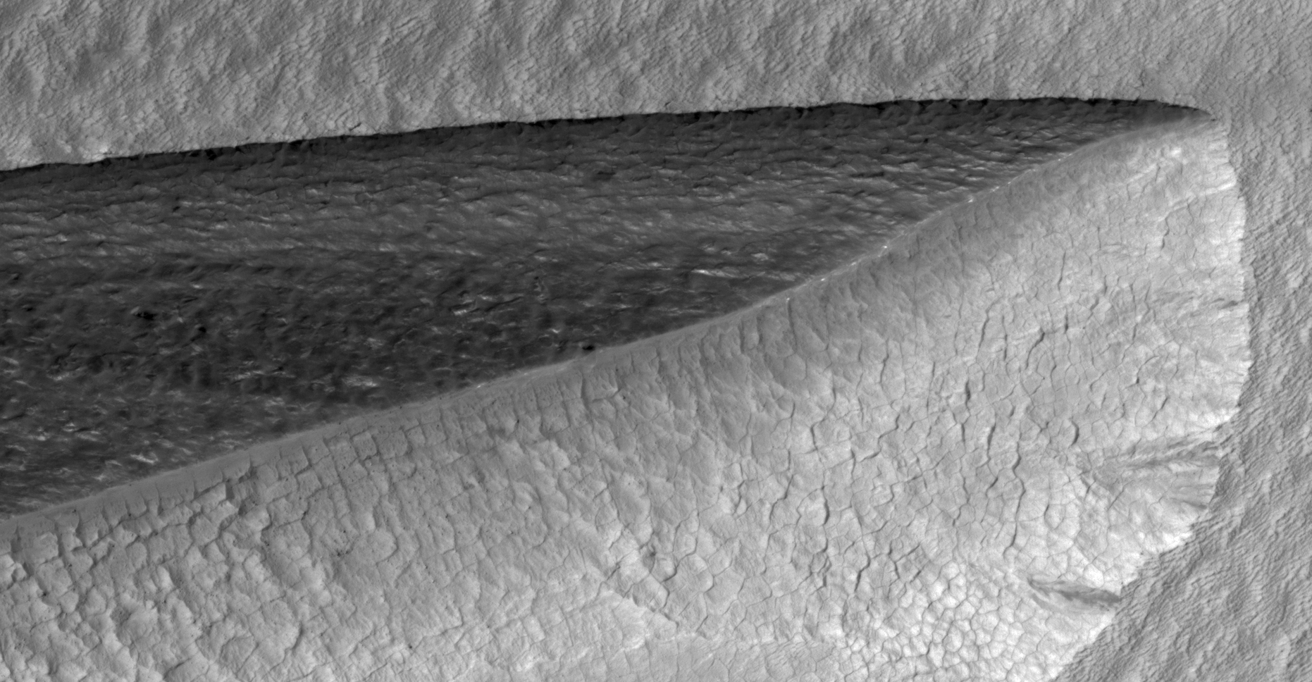
Black and White images:
The following images were cropped from the Black and White Map Projected JP2:


Original NASA source:
https://www.uahirise.org/ESP_057677_1230
My YouTube video featuring ‘Strange “Landform” East of Mad Vallis on Mars:’
Another similar anomaly: ‘Mine or Strange Geometric Shape Carved Into Martian Surface:’
Subscribe to my YouTube channel and turn on Notifications to receive updates when I upload new video’s.
Links to all my other sites:
https://www.youtube.com/JeanWard (Mars anomalies)
https://mars.raptorzone.co.za (Mars anomalies)
http://www.raptorzone.co.za (my website)
http://wxsat.raptorzone.co.za (weather satellites)
https://twitter.com/raptorzn_ (@RaptorZN_)
https://www.facebook.com/JeanWardMarsAnomalies (Facebook)
http://blog.raptorzone.co.za (social and political issues)
Disclaimer:
Images saved from within HiView or CTX viewer do not include image scale indicators. The image scale indicators I include in images are based on the official resolutions provided by NASA and although I strive to be as accurate as possible there may be slight deviations from the actual scale. Image scale indicators are included as a size approximation tool only.
Geometry lines are mapped as accurately as possible using the limited information, data and mapping tools available at the time, therefore the lines may deviate from target sites by a few kilometres. Revisions may be made in the future as new, more precise information, data and mapping tools become available.
Many or all of the anomalies/artefacts covered in this presentation may be naturally occurring geological features caused by some type of geological processes, however due to the lack of specific information from the source we can only speculate whether these are all natural or some artificial in nature.
In cases where I say an anomaly looks like something I’m attempting to clarify what I see and not specifically that the anomaly is what I say it looks like.
My intention is only to share anomalies I’ve discovered on Mars and not to convince anyone that there is or was a civilization on Mars.
As Will Farrar from WhatsUpInTheSky says: “I see what I see, you see what you see.”