

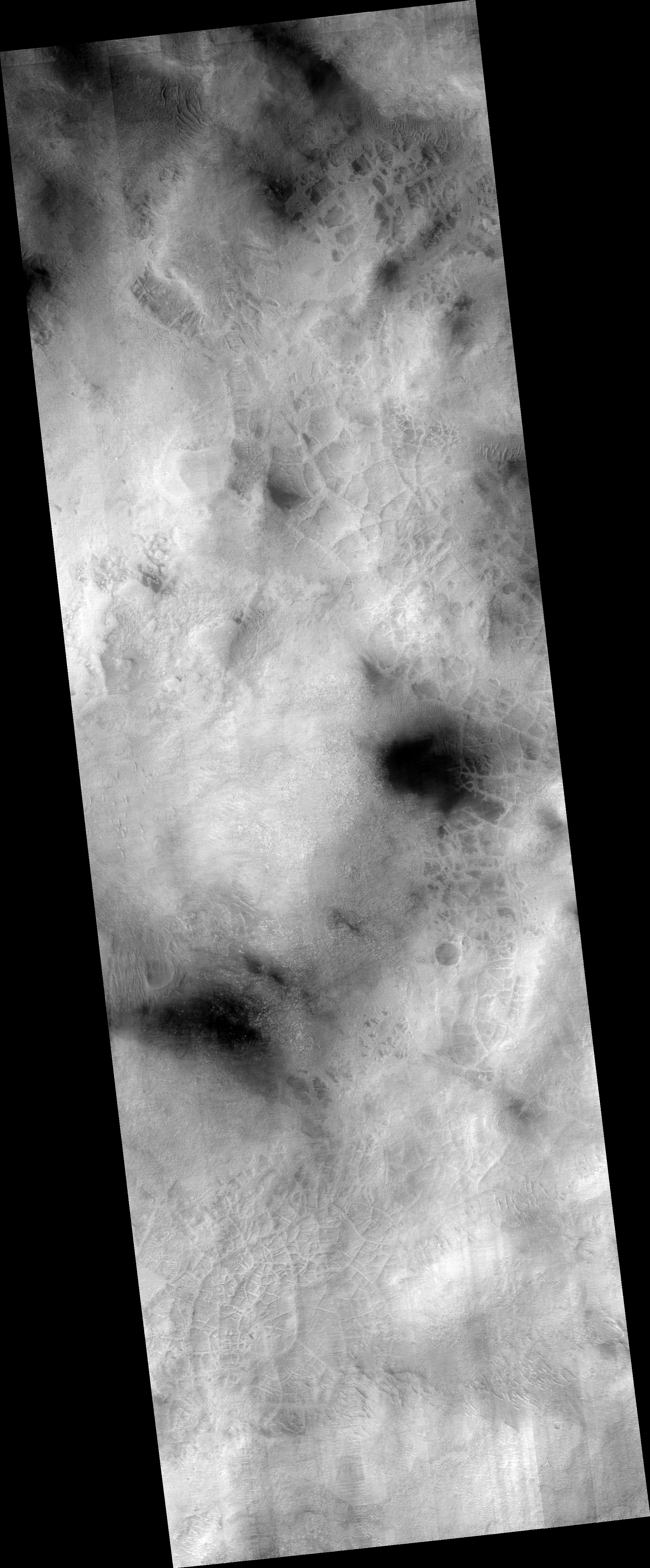
The photographs analyzed here (ESP_026795_1470 and P16_007438_1462_XN_33S297W) were taken by NASA’s Mars Reconnaissance Orbiter on 14 April 2012 and 27 February 2008 respectively. NASA describes the photographs as “Central Structure of an Impact Crater” and “Hellas Planitia” respectively.
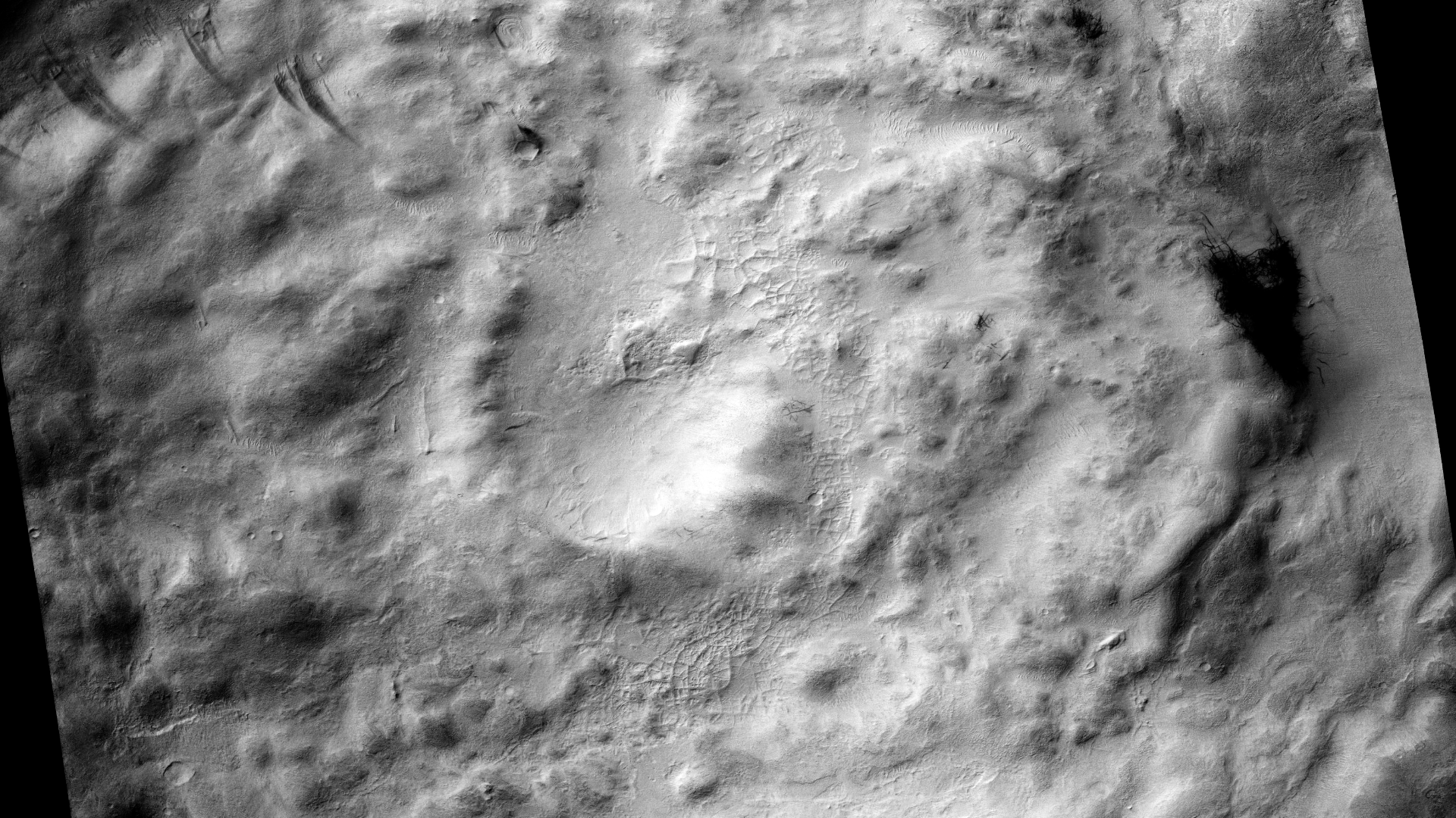
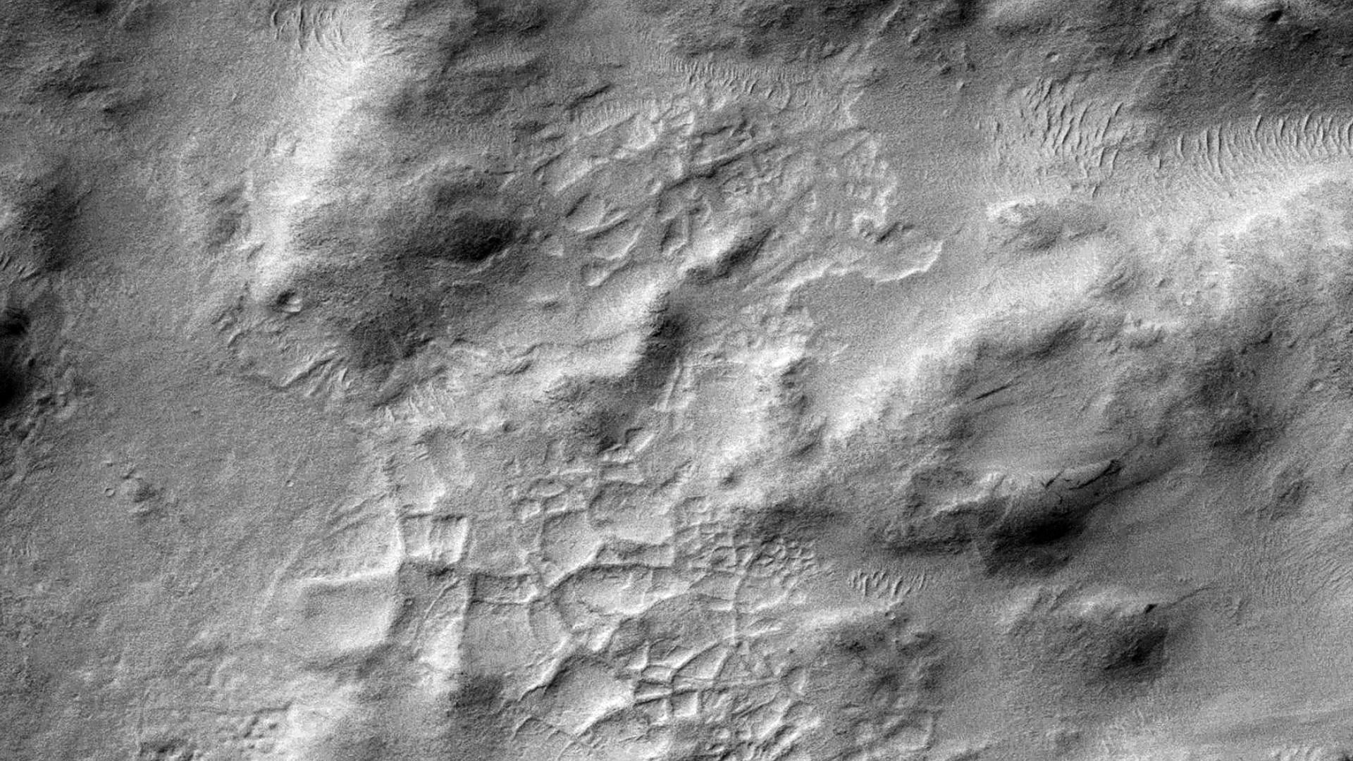
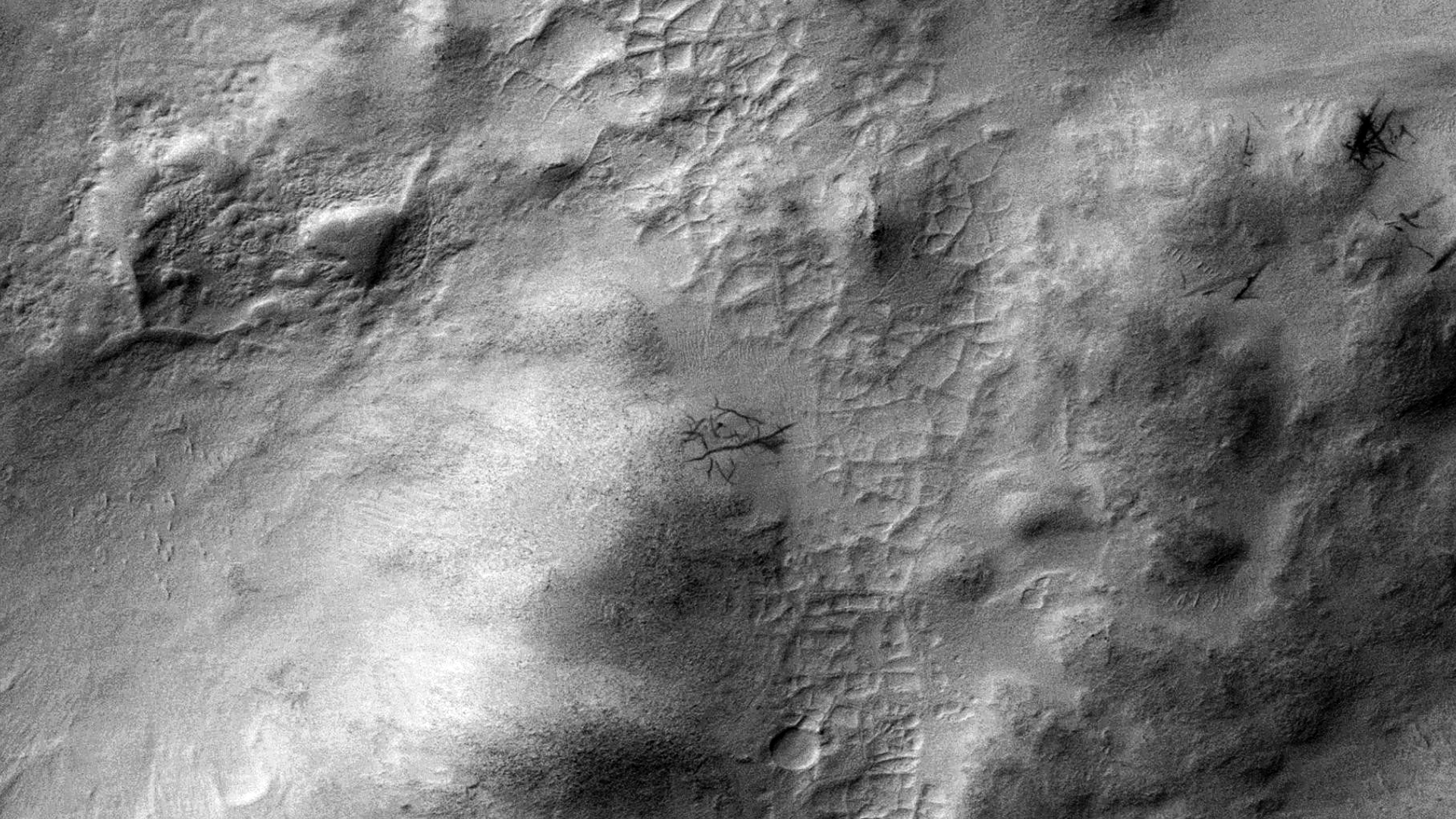
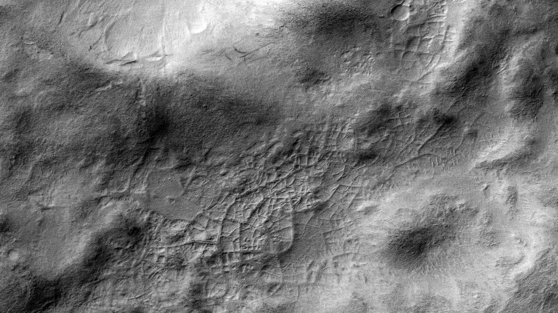
Discovered is what looks like either an abandoned industrial complex and/or mining operation in Badwater Crater. The straight sides of a typical rectangular-shaped surface feature measures on average approximately 200 metres in length.
Could this have been an ancient site where some type of industrial/mining operations were conducted?
This anomaly reminds me of another similar type of structure I discovered in an area (D04_028911_0985_XN_81S064W and ESP_021526_0985) approximately 3687 km to the South, although the structures there are much larger.

Changes over time:
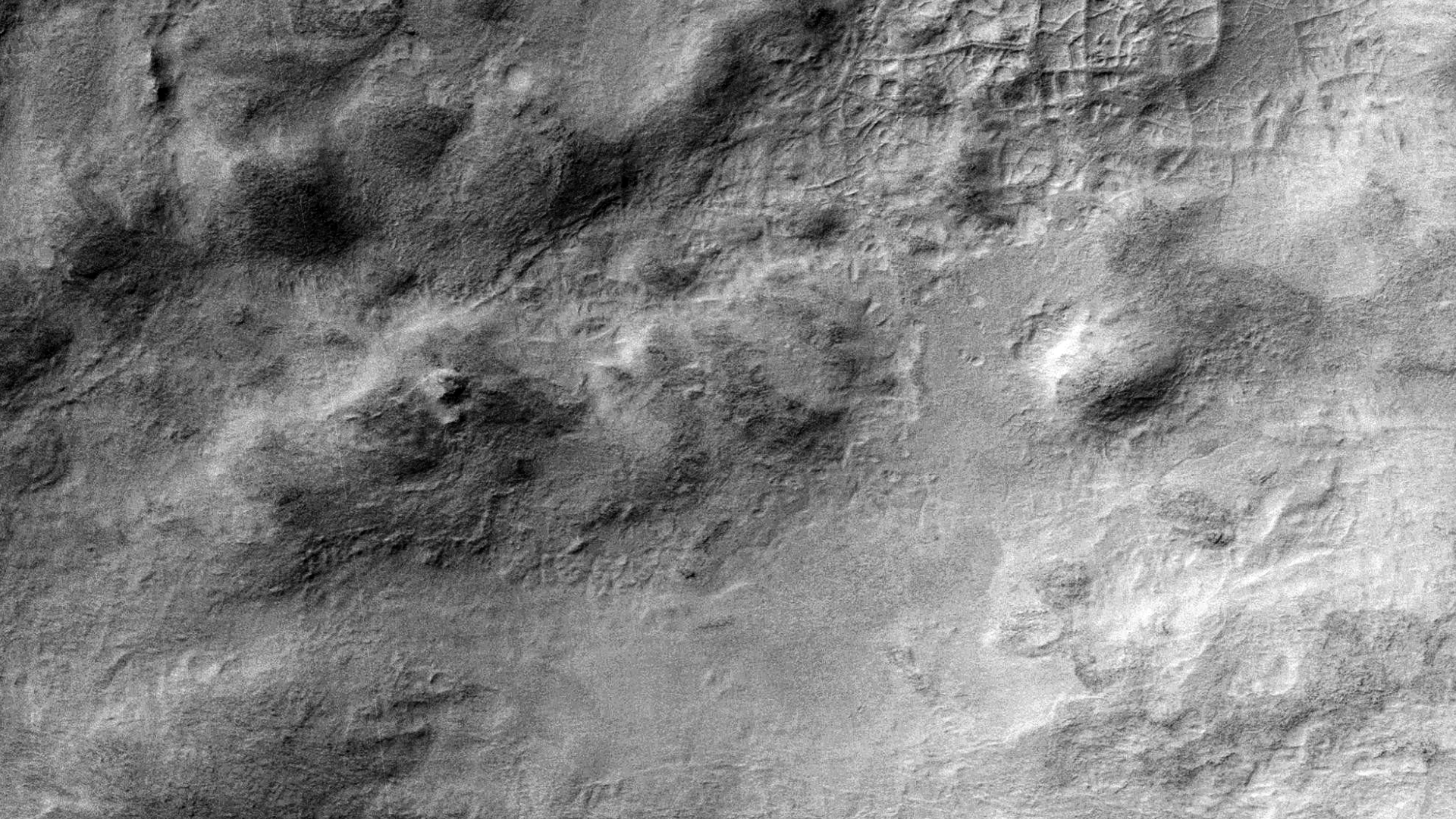
Following are two images cropped from the HiRISE and CTX showing how surface features have changed over time:
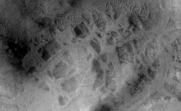
From the HiRISE photograph taken over four years later it appears the ‘carved’ out area’s are somewhat larger, cleaner and more defined.
Original NASA sources:
HiRISE https://www.uahirise.org/ESP_026795_1470
CTX http://viewer.mars.asu.edu/planetview/inst/ctx/P16_007438_1462_XN_33S297W
My YouTube video featuring the ‘Badwater’ Industrial Complex or Mining Operation on Mars:
Additional information:
My previous Blog Post featuring a similar structure: https://mars.raptorzone.co.za/2018/05/25/ancient-inca-type-ruins-retaining-walls-or-farm-found-on-mars/
My previous video featuring featuring a similar structure:
Subscribe to my YouTube channel and turn on notifications to be notified when new videos are uploaded.
Also visit Twitter page @RaptorZN_.
Disclaimer:
Images saved from within HiView or CTX viewer do not include image scale indicators. The image scale indicators I include in images are based on the official resolutions provided by NASA and although I strive to be as accurate as possible there may be slight deviations from the actual scale. Image scale indicators are included as a size approximation tool only.
Ley lines are mapped as accurately as possible using the limited information, data and mapping tools available at the time, therefore the ley lines may deviate from target sites by a few kilometres. Revisions may be made in the future as new, more precise information, data and mapping tools become available.
Many or all of the anomalies/artefacts covered in this presentation may be naturally occurring geological features caused by some type of geological processes, however due to the lack of specific information from the source we can only speculate whether these are all natural or some artificial in nature.
In cases where I say an anomaly looks like something I’m attempting to clarify what I see and not specifically that the anomaly is what I say it looks like.
My intention is only to share anomalies I’ve discovered on Mars and not to convince anyone that there is or was a civilization on Mars.
As Will Farrar from WhatsUpInTheSky says: “I see what I see, you see what you see.”