Water Seeping up through Martian Surface in Maunder Crater?

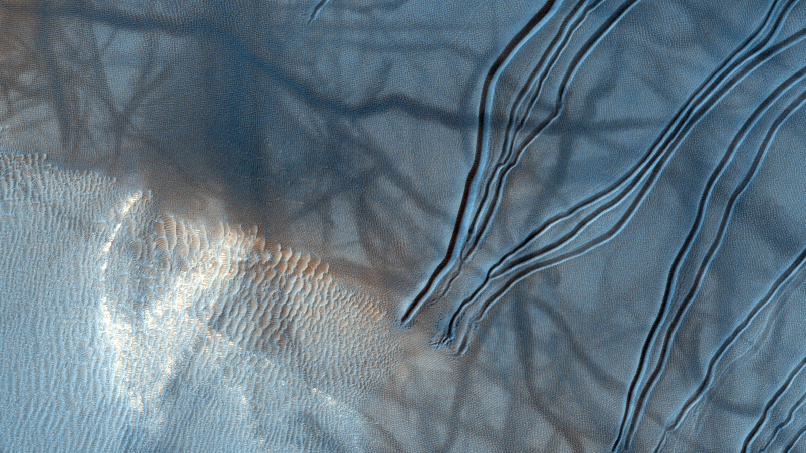
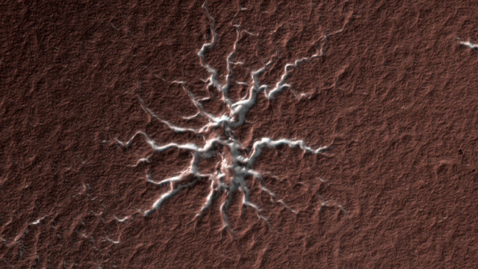
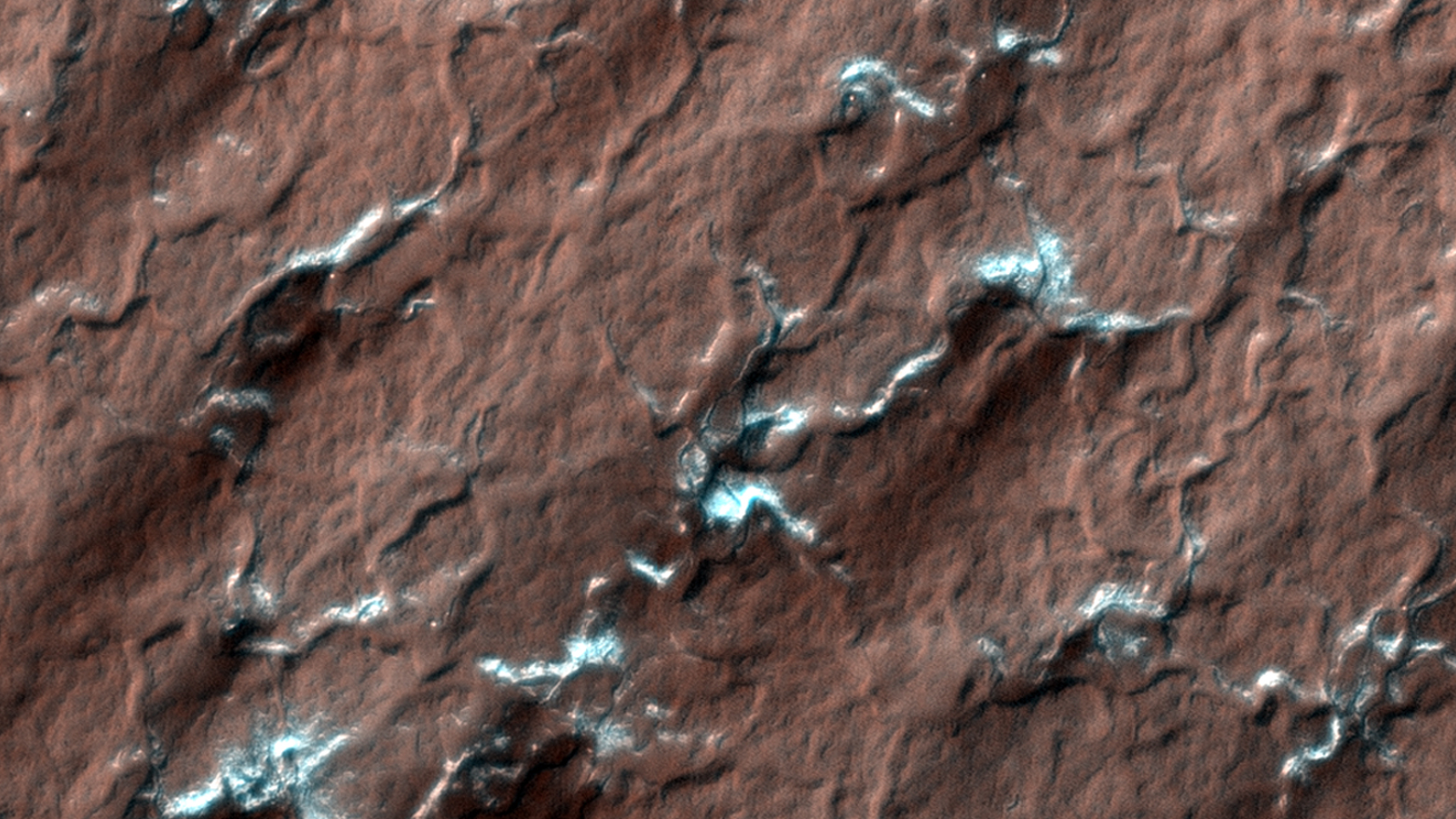
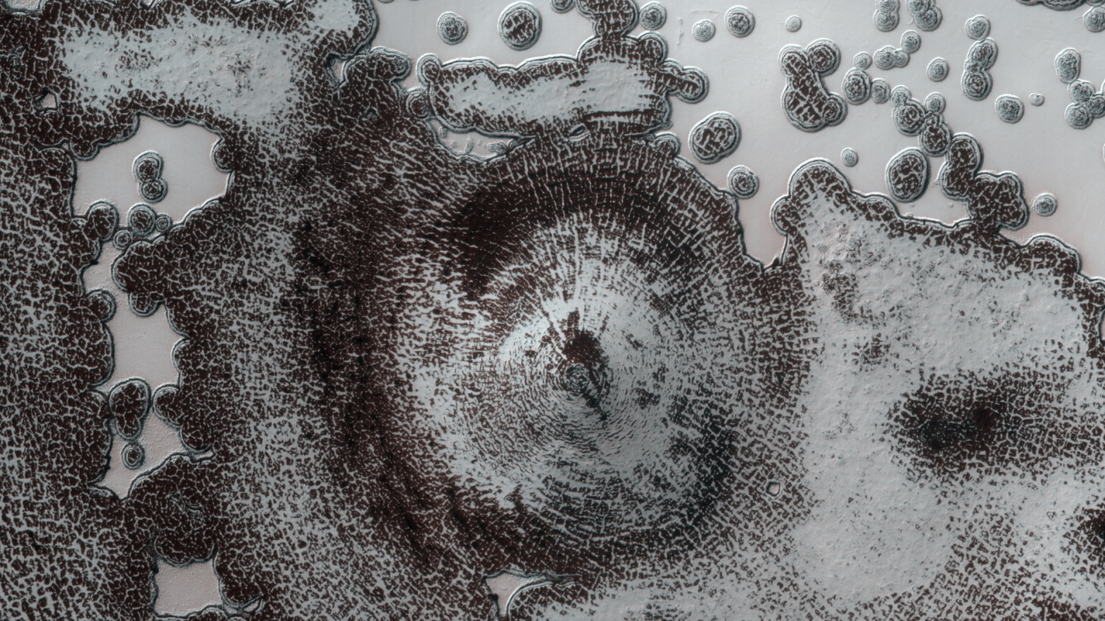
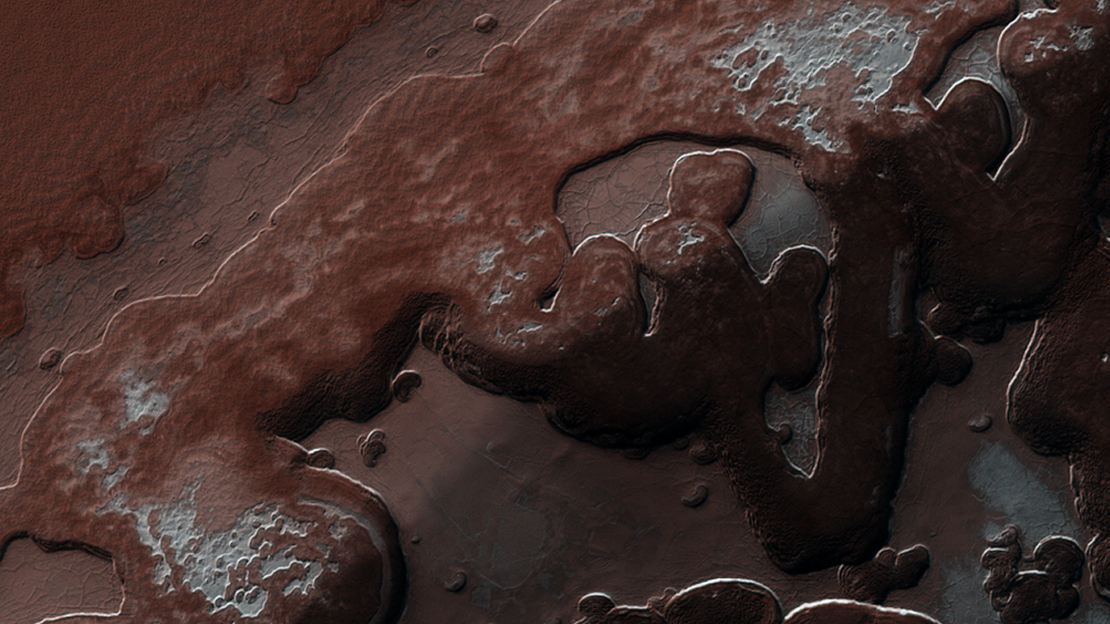
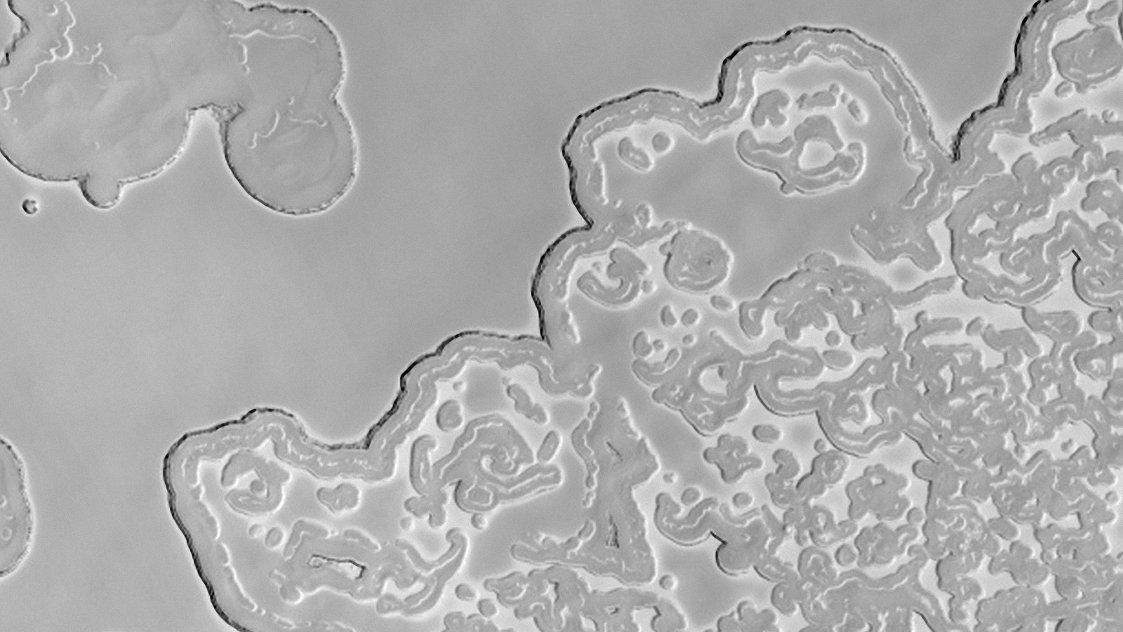
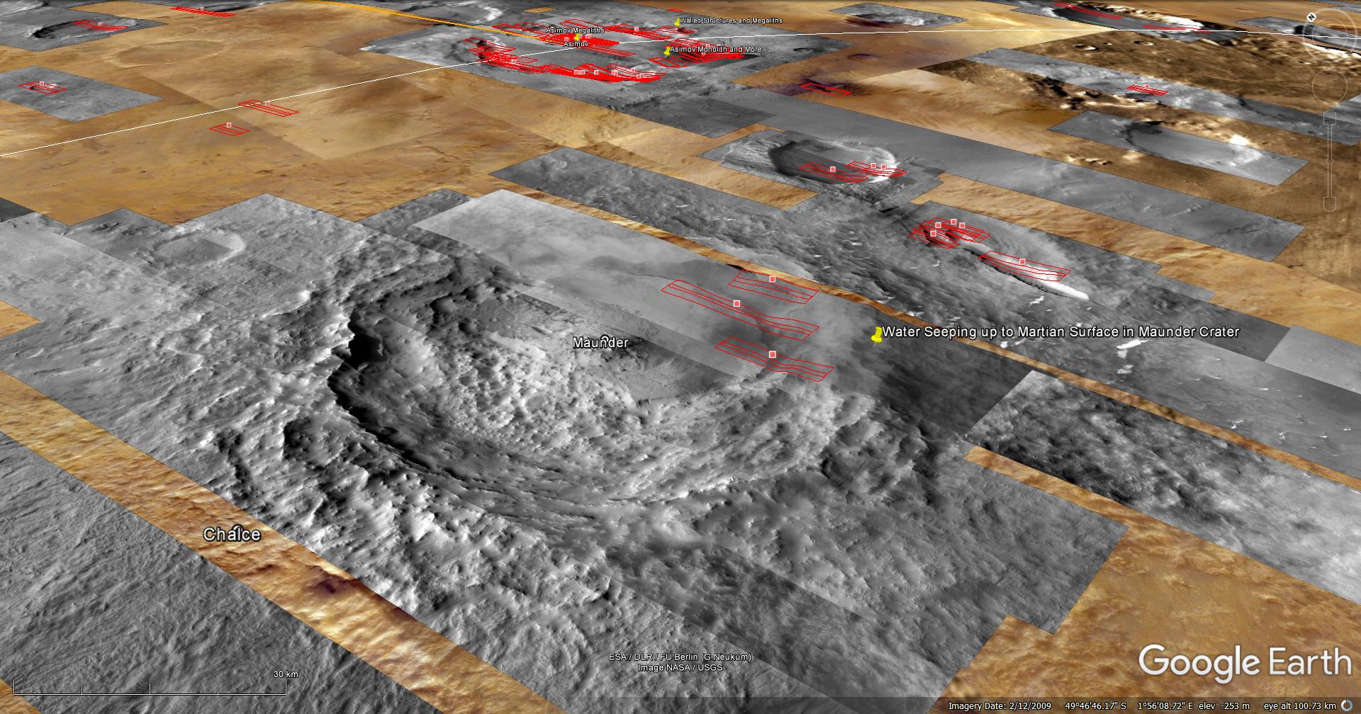
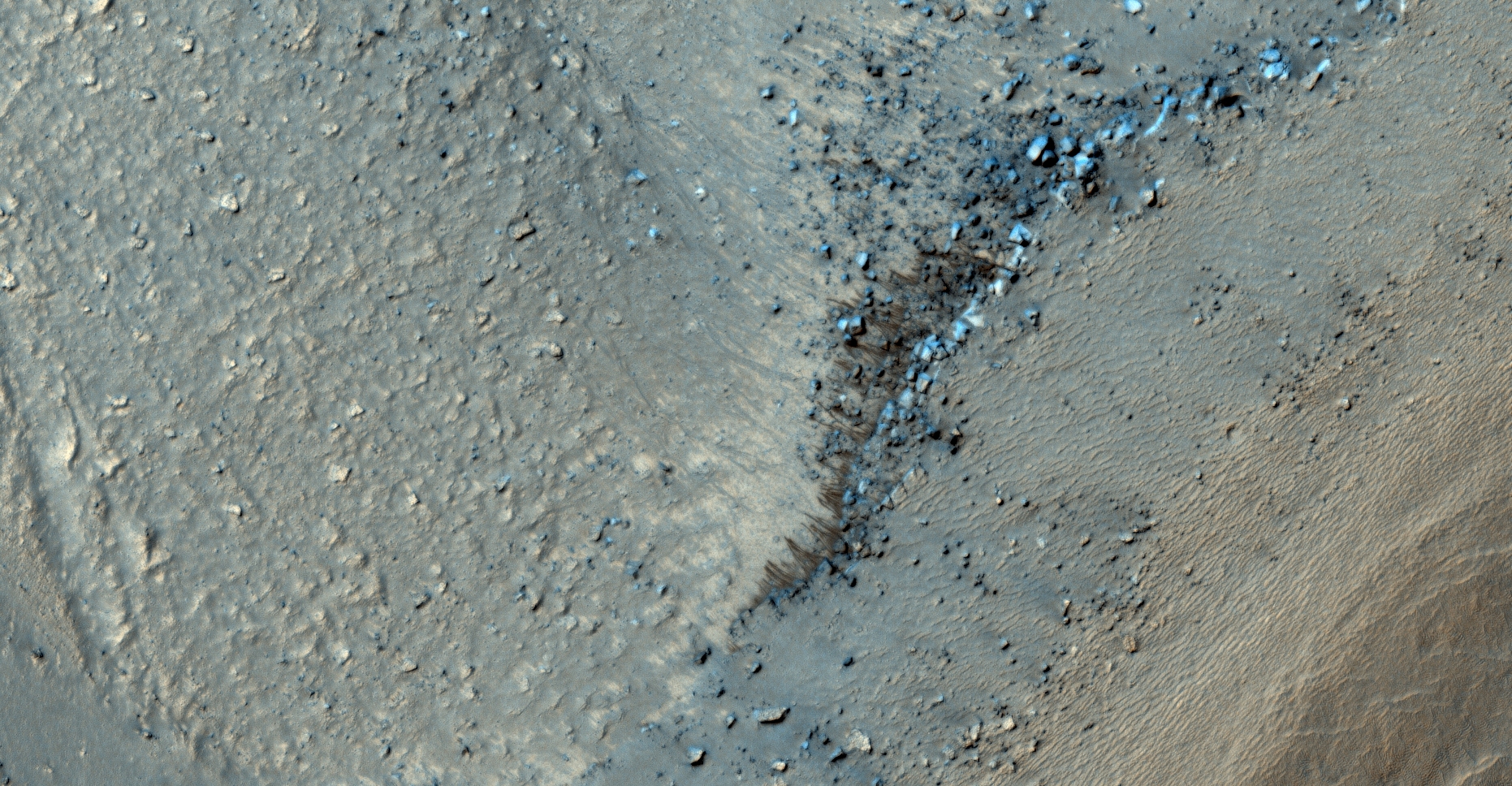
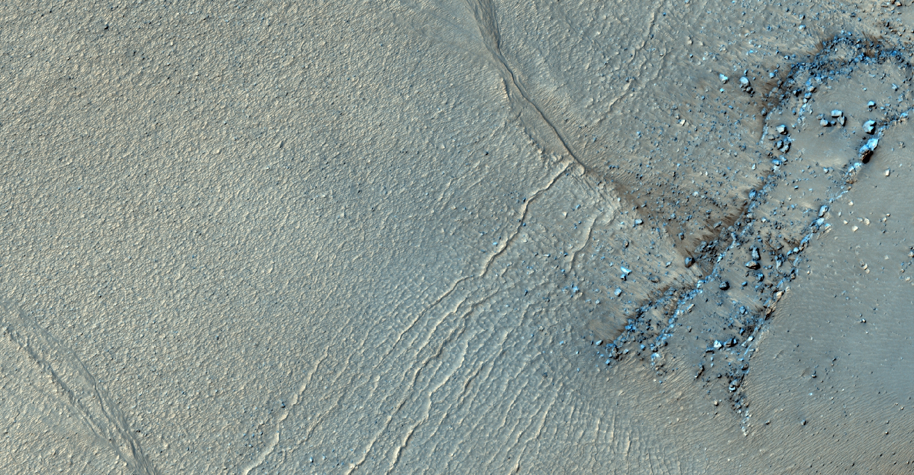
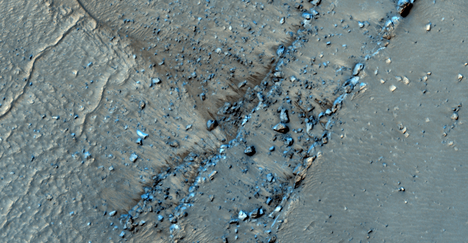
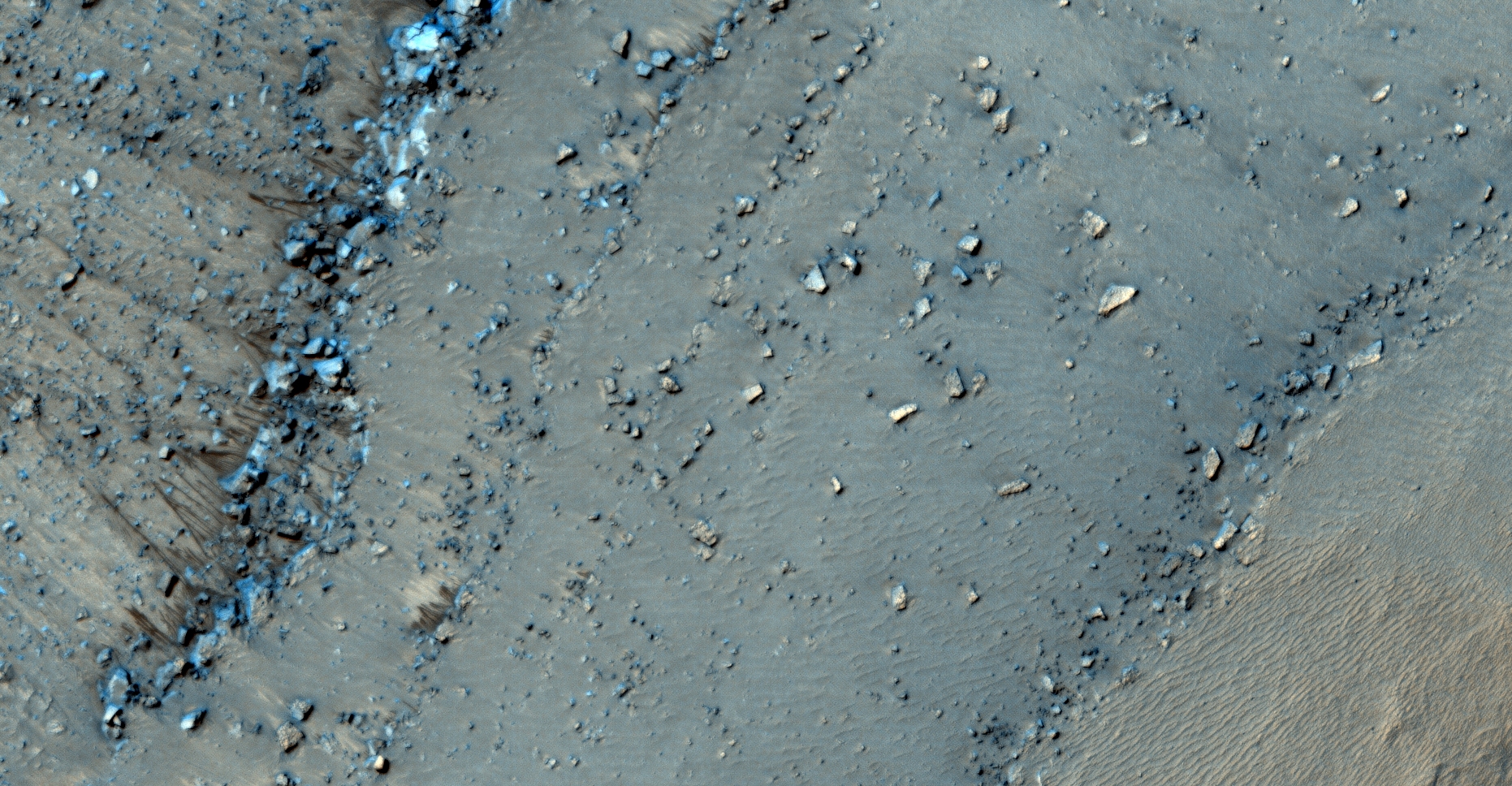
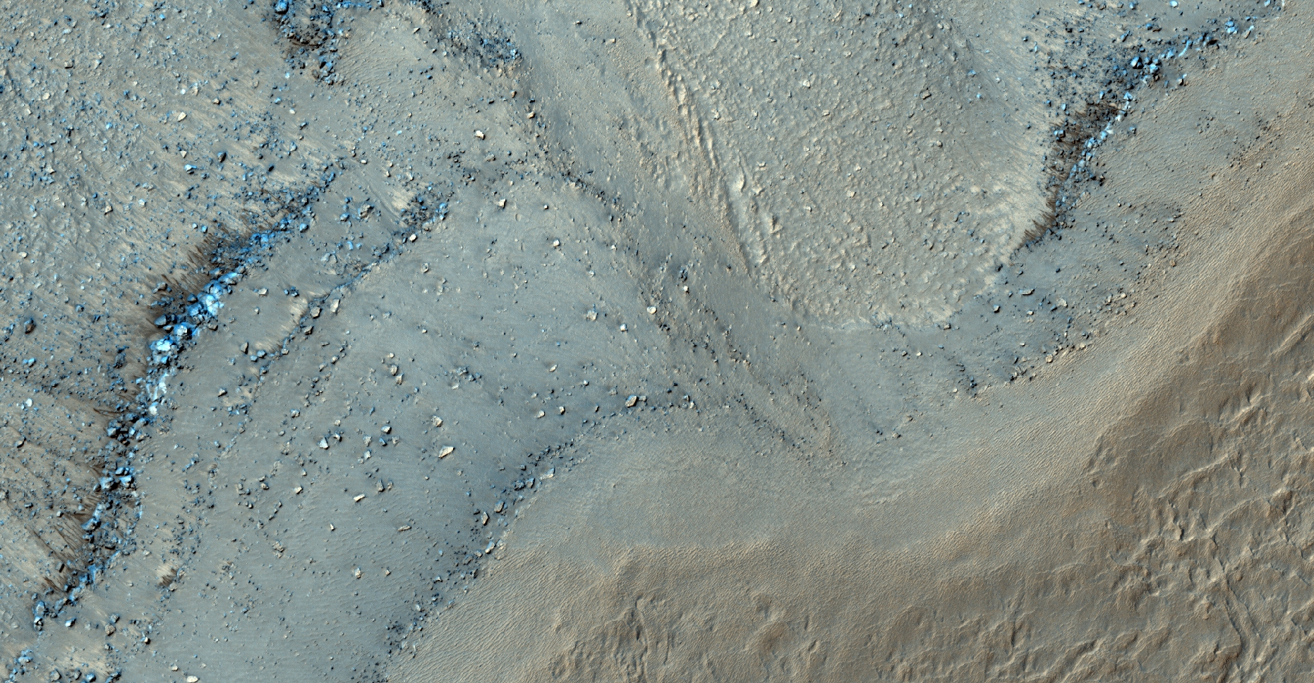
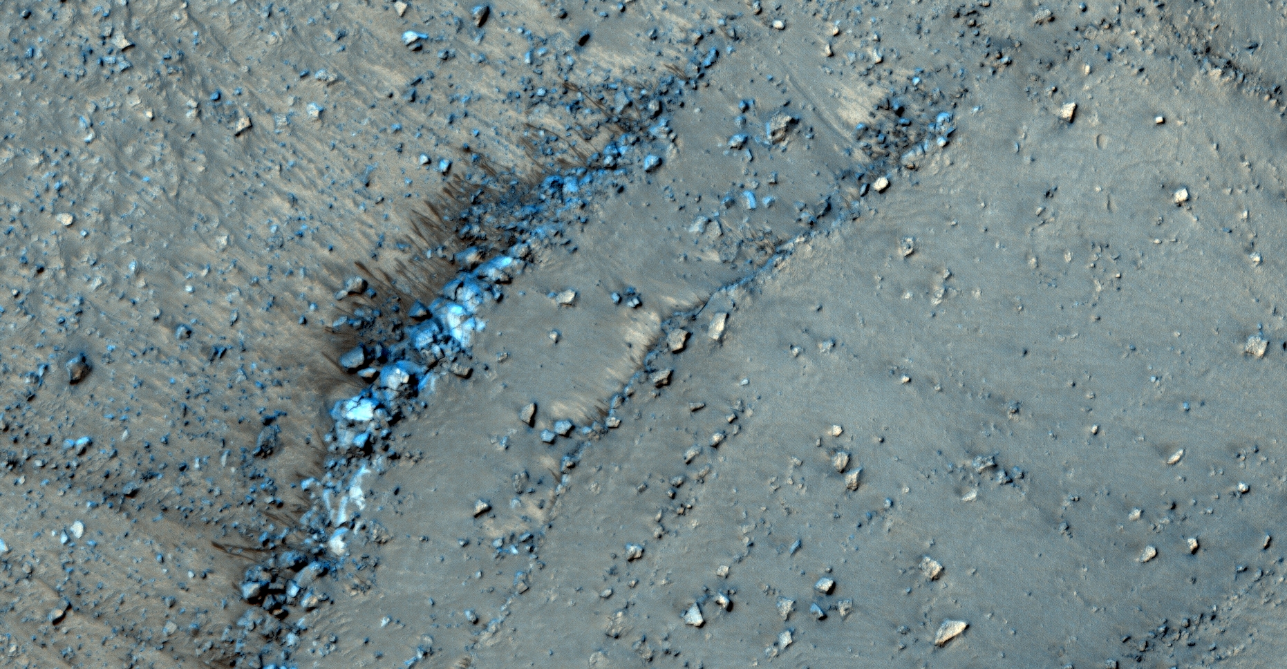
The photograph analyzed here (ESP_057720_1300) was taken by NASA’s Mars Reconnaissance Orbiter on 19 November 2018 and is described as ‘Searching for Slope Features.’

Yet again we discover thin dark streaks emanating from ridge lines and ‘running’ down slopes. These streaks seem to be caused by water/brine seeping up through the Martian surface and running down the slopes leaving the sand moist with a darker colour.

NASA claims these are nothing more than streaks caused by soil moving away leaving darker coloured material below.

I speculate water/brine may be the cause.

An elevated view of this site being analyzed
An elevated view of this site being analyzed (click for larger image)

The following images were cropped from the RGB Colour None-Map Projected JP2:

Original image at 1:1 scale
Original image at 1:1 scale (click for larger image)
Original image zoomed out - Not to scale
Original image zoomed out – Not to scale (click for larger image)
Original image at 1:1 scale
Original image at 1:1 scale (click for larger image)
Original image at 1:1 scale
Original image at 1:1 scale (click for larger image)
Original image at 1:1 scale
Original image at 1:1 scale (click for larger image)
Original image at 1:1 scale
Original image at 1:1 scale (click for larger image)
Original image zoomed out - Not to scale
Original image zoomed out – Not to scale (click for larger image)
Original image at 1:1 scale
Original image at 1:1 scale (click for larger image)

Original NASA source:

https://www.uahirise.org/ESP_057720_1300

My YouTube video featuring ‘Water Seeping up through Martian Surface in Maunder Crater?:’

Subscribe to my YouTube channel and turn on Notifications to receive updates when I upload new video’s.

Links to all my other sites:

https://www.youtube.com/JeanWard (Mars anomalies)

https://mars.raptorzone.co.za (Mars anomalies)

http://www.raptorzone.co.za (my website)

http://wxsat.raptorzone.co.za (weather satellites)

https://twitter.com/raptorzn_ (@RaptorZN_)

https://www.facebook.com/JeanWardMarsAnomalies (Facebook)

http://blog.raptorzone.co.za (social and political issues)

Disclaimer:

Images saved from within HiView or CTX viewer do not include image scale indicators. The image scale indicators I include in images are based on the official resolutions provided by NASA and although I strive to be as accurate as possible there may be slight deviations from the actual scale. Image scale indicators are included as a size approximation tool only.

Geometry lines are mapped as accurately as possible using the limited information, data and mapping tools available at the time, therefore the lines may deviate from target sites by a few kilometres. Revisions may be made in the future as new, more precise information, data and mapping tools become available.

Many or all of the anomalies/artefacts covered in this presentation may be naturally occurring geological features caused by some type of geological processes, however due to the lack of specific information from the source we can only speculate whether these are all natural or some artificial in nature.

In cases where I say an anomaly looks like something I’m attempting to clarify what I see and not specifically that the anomaly is what I say it looks like.

My intention is only to share anomalies I’ve discovered on Mars and not to convince anyone that there is or was a civilization on Mars.

As Will Farrar from WhatsUpInTheSky says: “I see what I see, you see what you see.”

Mars Rebooted

Here I’ll post some of the most awesome colour, high-resolution orbiter images of Mars.

The gallery of images includes links to the original NASA website and Google Earth (Mars) coordinates; to access the coordinate files Google Earth should be pre-installed on your device.

Dust Devils Dancing on Dunes

NASA Description: Dust Devils Dancing on Dunes
Link: NASA source
Link: NASA RAW files
Link: Google Earth (Mars) coordinates

Isolated Araneiform Topography

NASA Description: Isolated Araneiform Topography
Link: NASA source
Link: NASA RAW files
Link: Google Earth (Mars) coordinates

South Polar Spiders
South Polar Spiders

NASA Description: South Polar Spiders
Link: NASA source
Link: NASA RAW files
Link: Google Earth (Mars) coordinates

Circular Feature in South Polar Residual Cap

NASA Description: Circular Feature in South Polar Residual Cap
Link: NASA source
Link: NASA RAW files
Link: Google Earth (Mars) coordinates

South Polar Layered Deposits and Residual Ice Cap

NASA Description: South Polar Layered Deposits and Residual Ice Cap
Link: NASA source
Link: NASA RAW files
Link: Google Earth (Mars) coordinates

Craters on South Polar Layered Deposits

NASA Description: Craters on South Polar Layered Deposits
Link: NASA source
Link: NASA RAW files
Link: Google Earth (Mars) coordinates

South Pole Residual Cap Swiss-Cheese Terrain Monitoring

NASA Description: South Pole Residual Cap Swiss-Cheese Terrain Monitoring
Link: NASA source
Link: NASA RAW files
Link: Google Earth (Mars) coordinates

Download Google Earth (which includes the Moon and Mars): https://www.google.com/earth/desktop/ (for all operating systems)

Download Google Earth (which includes the Moon and Mars): googleearth-win-7.1.8.3036.exe (for Windows XP – local download)

Watch this space …