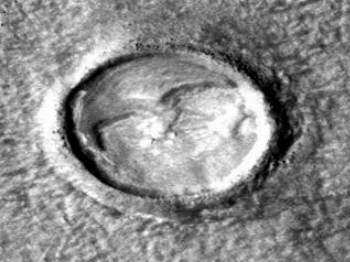
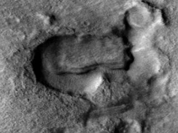
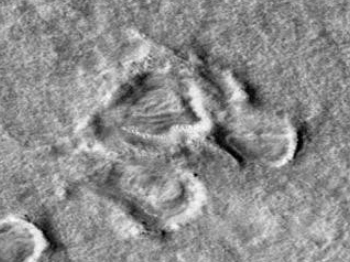
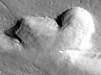
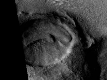
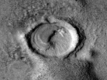
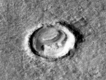
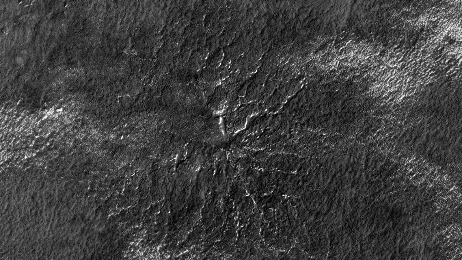
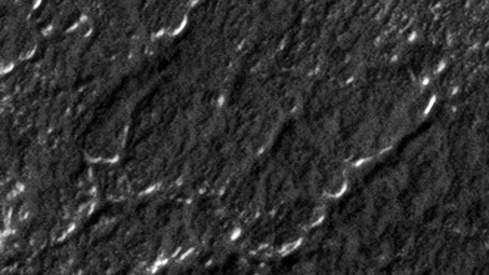
This photograph (ESP_012075_1015) was taken by NASA’s Mars Reconnaissance Orbiter (MRO) HiRISE Camera on 22 February 2009.
NASA describes this photograph as “Possible Hydration.”
In this presentation I present a theory that these dark areas or spots on the surface of Mars might be a form of plant-life covering so-called “Spiders” on the Martian surface.
I speculate that the “plant life” shown might be a type of moss as or a type of very fine leaf plant, perhaps something like a fern.
Mars ‘Spiders’ possibly covered in Plant Life (click for larger image)Mars ‘Spiders’ possibly covered in Plant Life – Zoom I (click for larger image)Mars ‘Spiders’ possibly covered in Plant Life – Zoom II (click for larger image)
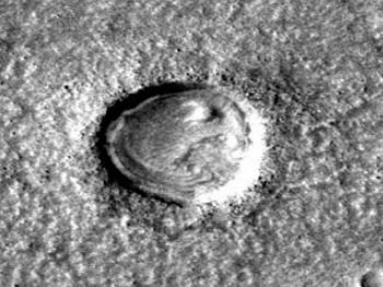
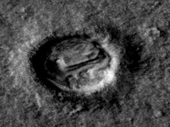
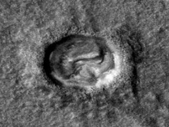
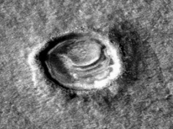
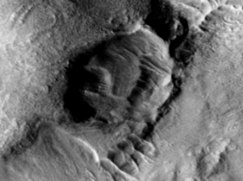
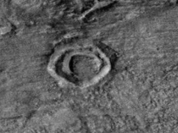
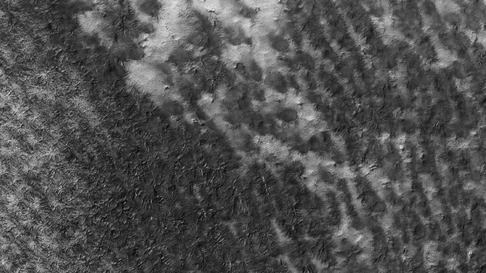
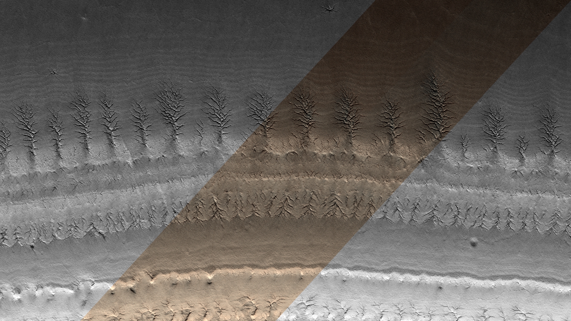
This photograph (ESP_023164_1020) was taken by NASA’s Mars Reconnaissance Orbiter (MRO) HiRISE Camera on 06 July 2011.
NASA describes this photograph as “A Forest of Channels on the South Polar Layered Deposits.”
I discovered what I speculate looks like plant-like life forms on Mars consisting of what may be roots on the surface as well as up above the surface. They don’t look like channels but rather something on top of the surface.
They are uniformly spaced and look like virtual copies of each other. Is there some intelligence behind this phenomena?
There is also a lot of green in the photo, is this natural or did NASA chose that colour?
Is this evidence of plant life on Mars? (click for larger image)
I downloaded the HiRise Merged RGB Map-Projected JP2 file to view these anomalies.
Are these natural geological formations or perhaps evidence of some type of plant life? NASA might have given us a clue by using the word “Forest” in the photo description.
Subscribe to my YouTube channel and turn on notifications to be notified when new videos are uploaded.<
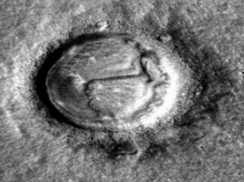
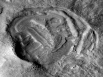
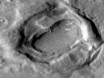
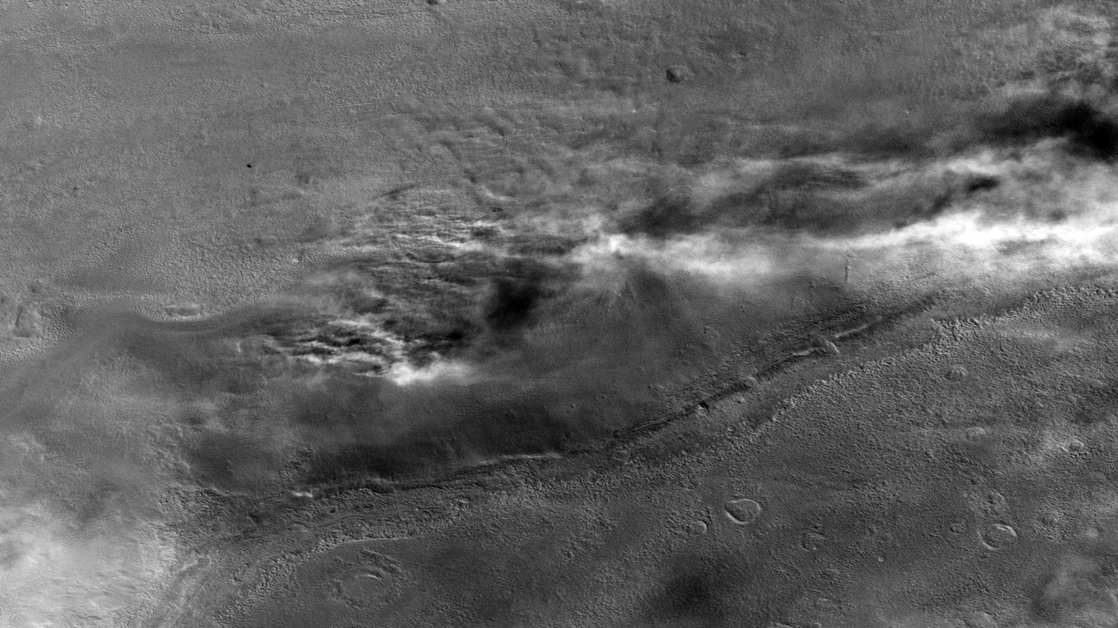
This image was taken by NASA’s Mars Reconnaissance Orbiter (MRO) Context Camera (CTX) on 2007-11-18T10:36:48.041.
NASA describes this image as “Terrain in and near Deuteronilus Colles.”
Is this smoke from burning vegetation, fine dust in the Martian atmosphere or signs of melting ice or snow?
Is this burning vegetation on Mars? (click for larger image)Clumps of vegetation around crater and concentration of vegetation around crater rimPossible similar vegetation on Earth
NASA claims Mars has no plant life. Could this prove they are wrong?
I encourage you to download the NASA photograph, check it out and decide for yourself.
Do we have further evidence pointing to life on Mars? Andrew Basiago, a whistleblower from Project Pegasus, recently testified that he had been to Mars and was exposed to some of the creatures that inhabit the planet.
He presented an image (PIA10214) taken by NASA’S Mars Exploration Rover Spirit in the closing months of 2007 and goes on to explain the life forms contained therein, it includes:
humanoids with bulbous heads and elongated bodies, like those beings described in the UFO literature;
animals still found on Earth, including lizards, frogs, snakes, alligators, and mantises;
animals that once existed on Earth but are now extinct, including the long neck reptile species Plesiosaur.
According to Basiago, the Plesiosaurs are reptile predators and furthermore life-forms on Mars “… consists of essentially 30 or so land species engaging in constant moderate predation against each other.”
Three Plesiosaurs (click for larger image)Plesiosaur kicking up dustHumanoid figure walking
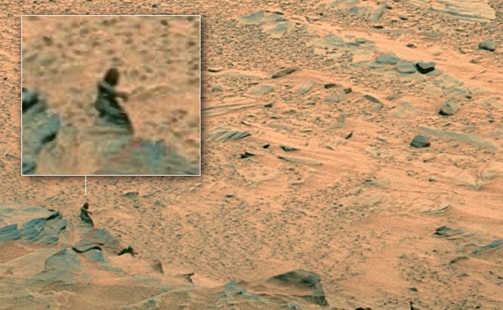
Will Farrar from WhatsUpInTheSky37 recently presented a Mars Curiosity Rover image (0747ML0032190020205903E01_DXXX) on YouTube in which he discusses the discovery of what looks like a strange “pipe” sticking out of the Martian surface; possibly this is a ventilation pipe of an underground base.
However, when comparing the images presented by Basiago and Farrar I came to the conclusion that both these images may contain evidence of the Martian Plesiosaur, i.e. both show, what I think to be, the creatures’ long necks.
Is this just a coincidence or is there something more to these images? Will, you may have come across an image that captured a Martian Plesiosaur, nice find …
As is the case with all anomalies, I am basing this article on pure speculation. It is interesting nonetheless.
Subscribe to my YouTube channel and turn on notifications to be notified when new videos are uploaded.
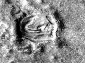
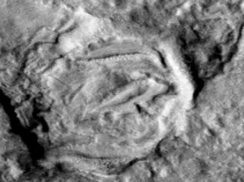
This image was taken by NASA’s Mars Reconnaissance Orbiter (MRO) Context Camera (CTX) on 2007-01-08T00:38:33.833.
NASA describes this as an image as ” Deuteronilus Colles and surrounding landforms.”
I discovered what I think are active mining operations on Mars, for easy viewing I created separate images of each potential mining site.
The following images from P03_002112_2208_XN_40N337W show, what I consider to be, open-pit mining quarry’s with dust clouds in and around the area of each mining site. The mere presence of dust clouds at these particular sites implies that these mines are active.
Open-pit mining quarry’s with dust clouds visible in the Martian atmosphere:
Active mining site oneActive mining site twoActive mining site threeActive mining site fourActive mining site fiveActive mining site six
The following images from P03_002112_2208_XN_40N337W show, what I think to be, the excavation of huge stone monoliths:
Excavating huge stone monoliths:
Huge stone monolith excavation site oneHuge stone monolith excavation site two
The following images from P03_002112_2208_XN_40N337W show other miscellaneous mining sites:
Miscellaneous mining sites:
Miscellaneous mining site oneMiscellaneous mining site twoMiscellaneous mining site threeMiscellaneous mining site fourMiscellaneous mining site fiveMiscellaneous mining site sixMiscellaneous mining site seven
The following images from P03_002112_2208_XN_40N337W show what I think looks like hollowed out shelters or hangers:
Hollowed out shelters or hangers:
Hollowed out shelter or hanger oneHollowed out shelter or hanger twoHollowed out shelter or hanger threeHollowed out shelter or hanger fourHollowed out shelter or hanger five
I’ll add the disc-like craft and triangular craft I discovered in this image, P03_002112_2208_XN_40N337W, to the appropriate Blog entry.
With the presence of water and moderate surface conditions Mars is the focus of much scientific study and the possibility of human colonization.
Various possibilities are under investigation; one of the more popular options is building living quarter’s underground. This would significantly lower colonists’ exposure to radiation.
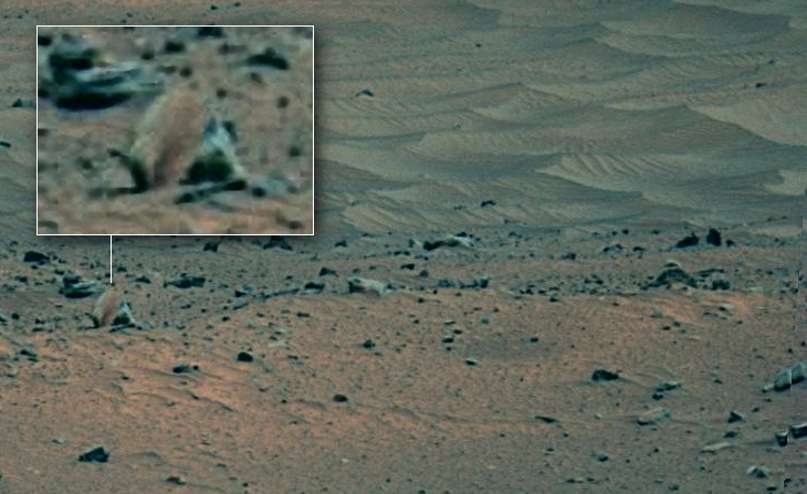
Did Mars Curiosity Rover discover an underground base with a vent cap protruding from the Martian surface?
Underground base ventilation cap on Martian surface (click for larger image)
In this image taken on Sol 721 an object, which appears to be a vent cap similar to an equivalent on Earth, is seen nestled between the rocks.
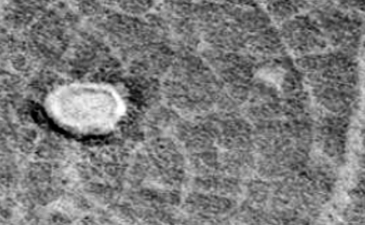
Some anomaly hunters are of the opinion that this oblong anomaly is an object on top of the surface of Mars whereas others are of the opinion that this is a ditch, I tend to agree with the later group.
The sunlit areas of the surrounding craters and the trench are located to the right whereas the shaded areas are located to the left (this is also so for the small crater inside the trench).
Artificial trench found in deep desert region on Mars (click for larger image)
The trench measures 2.2 km long with an average width of 600 m. The deepest point is in the shaded area and the entrance to the trench in the sunlit area.
The edges of the trench are well defined and appear to be perpendicular to the Martian surface. The sand next to the walls at the bottom of the trench probably gathered there due to the walls eroding over time. Excavated sand seems to be spread out next to the trench to the North.
I consider this trench to be artificial in nature due to the fact that it has a geometric shape, has symmetry and the edges and walls are well defined.
The only way to see the object clearly is by using the NASA image viewer located to the left of the web page. Click the “Toggle full page” icon followed by the “Zoom in” icon. Click on “Zoom in” until the maximum image size is displayed. I tried downloading the higher resolution .TIFF image however it does not open once downloaded, perhaps the PDS files will work.
I followed the process described above, combining several screenshots into a large, complete image which you can download here (file size: 8.7 Mbytes).
I tried downloading the original PNG, GIF, JPEG, TIFF and PDF files; however the resolution of each is too low to see the object clearly.
The trench is viewable on Google Earth/Mars at the following coordinates: 13 degrees 20’35.35″N
115 degrees 35’56.27″W.
Whistleblower Corey Goode has testified that we have dug artificial trenches to hide underground bases on other planets using a technique similar to that used in Project Iceworm (machines being adapted to handle sand in this case).
Download Google Earth (which includes the Moon and Mars): googleearth-win-7.1.8.3036.exe (for Windows XP – local download)
Is this perhaps an artificial trench made by Secret Space Program engineers for the purpose of hiding a base there in the future, perhaps the plan was abandoned a long time ago?
Perhaps this is another abandoned open-pit mining quarry on Mars.
Subscribe to my YouTube channel and turn on notifications to be notified when new videos are uploaded.
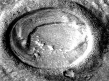
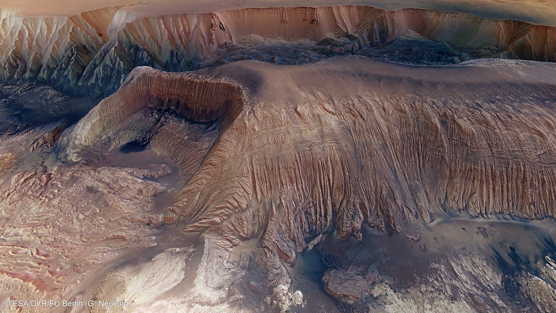
The Mars Express orbiter took this image (Id 297928) of what the European Space Agency (ESA) calls Hebes Chasma mesa, 23 km wide.
This anomaly was first brought to my attention by Thomas Mikey Jensen from the Mars Moon Space TV channel on YouTube.
Abandoned open-pit mining quarry on Mars (click for larger image)
Substantial carbon deposits have been found which may explain the appearance of the black water in the pool at the bottom of the pit.
The devastation to the mountain side is striking, at 23 km wide and 8 km deep this is unlike anything on Earth.
The layers or steps synonymous with similar mining operations on Earth are not seen probably due to the walls of the Quarry being eroded by water over time.
When compared to similar images on Earth one cannot help but wonder if this is an abandoned open-pit quarry on Mars.
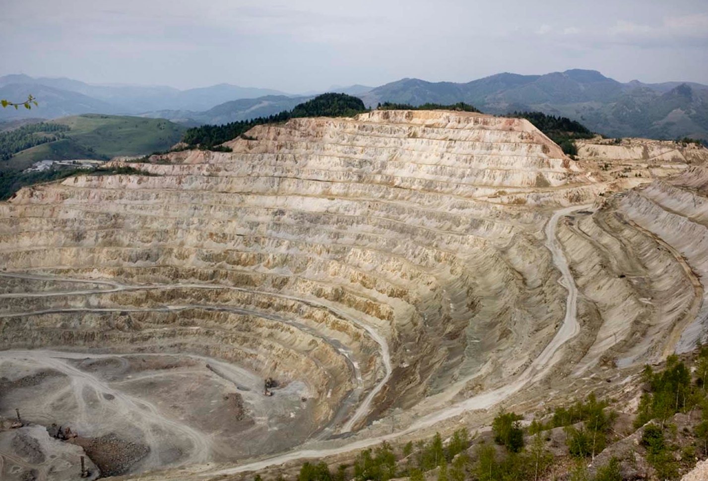
Open pit of Rosia Poieni Montana (click for larger image)


-Large.gif)